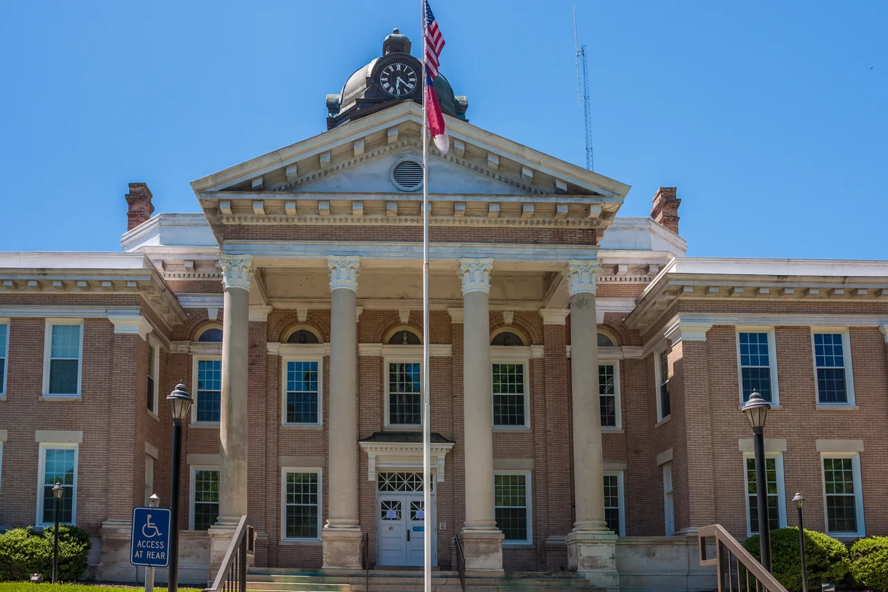

Halifax County, North Carolina
Two and a half months before the Declaration of Independence, before Jefferson had even started drafting it in Philadelphia, eighty-three delegates met in a small courthouse on the Roanoke River and changed the rules. April 12, 1776. The North Carolina Provincial Congress, gathered in the town of Halifax, passed a single resolution - the Halifax Resolves - instructing the colony's delegates at the Continental Congress to vote for separation from Great Britain. It was the first time any colonial government had said the word out loud. The date is sewn into the North Carolina flag to this day. The county that hosts that legacy still sits where it always has: along the bend of the Roanoke, half on the Coastal Plain, half easing up into the Piedmont.
Made by the River
Halifax County was carved out of Edgecombe County on January 1, 1759, taking everything north of Fishing Creek and Rainbow Banks - about 711 square miles of pine and bottomland. The Roanoke River shaped the geography and the economy. Tobacco, naval stores, and grain moved downriver to the trading town of Halifax, which grew prosperous enough to be floated as a candidate for state capital. The railroads ended that story. When tracks crossed the county in the nineteenth century, the river towns lost their reason to exist as ports, and Halifax itself, the county seat, settled into a quieter life as a county-government town.
Halifax Resolves
The Resolves did not appear out of nowhere. They grew out of nearly two decades of friction between settlers in this part of North Carolina and the absentee British proprietors who controlled the land. In January 1759, a Halifax-area mob rode to Edenton, dragged the land agent Francis Corbin out of his bed, and held him at the Enfield jail until he agreed to set his crooked records straight. A second jailbreak that May freed the men who had grabbed Corbin. Distrust of the Crown was already burned into the local political culture. When the Provincial Congress met in Halifax in April 1776, the delegates were not improvising - they were making official a sentiment that had been building in the eastern North Carolina backcountry for a generation. Each year on April 12, Halifax Day brings re-enactors in period dress to the old town to demonstrate the trades and crafts of the colonial era.
Forty Sites on the Register
Halifax County carries forty separate listings on the National Register of Historic Places, an extraordinary density for a rural Southern county. The current towns - Enfield, Hobgood, Littleton, Roanoke Rapids, Scotland Neck, and Weldon - each carry their own stories. Scotland Neck is home to the Sylvan Heights Bird Park, which holds the largest collection of waterfowl species anywhere in the world. The county's land includes Medoc Mountain State Park, Lake Gaston, and Roanoke Rapids Lake. Of the 730 square miles, nearly 196,000 acres are working farmland, and the southern timber belt that crosses the county produces a startling share of the world's pulp and paper. The Haliwa-Saponi Indian Tribe, recognized by the state of North Carolina in 1965, has members concentrated in Halifax and neighboring Warren County and keeps its headquarters in the community of Hollister.
A Black Belt County
The 2020 census counted 48,622 people in Halifax County. About 51 percent are Black or African American, and just under 40 percent are white; the county sits in what geographers and historians call the Black Belt, the band of formerly plantation-economy counties stretching across the American South. The economic legacy of that history is still visible in the data - median household income remains well below the state average, and poverty rates run high. Politically, Halifax has long been a Democratic stronghold; the last Republican to carry the county in a presidential race was Richard Nixon in 1972. It is one of the older counties in North Carolina by founding date and one of the more historically conscious - a place where eighteenth-century courthouse politics still gets a parade every April.
From the Air
Halifax County straddles 36.26 degrees North, 77.66 degrees West, in the northeastern tier of North Carolina. From altitude the Roanoke River cuts a clear east-northeast line forming the county's northern boundary, with the broad expanse of Lake Gaston at the northwest corner and the smaller Roanoke Rapids Lake just below it. Halifax-Northampton Regional Airport (KIXA) lies in the southern portion of the county and offers the closest GA reference. For controlled airspace, Raleigh-Durham (KRDU) is roughly 75 miles southwest, Richmond (KRIC) about 90 miles north-northeast. The town of Halifax itself sits on the river just west of Interstate 95. Recommended viewing altitude is 5,500 to 7,500 feet AGL on clear days.
Nearby Stories
- Cherry Hill Plantation 5.4 km away
- Hertford County, North Carolina 6.9 km away
- Tarboro, North Carolina 15 km away
- Battle of Plymouth (1864) 29 km away
- Fort Christanna 36 km away
- 1837 Suffolk Head-On Collision 38 km away
- Purefoy-Dunn Plantation 45 km away
- Staunton River State Park 59 km away