
Hertford County, North Carolina
In 1706, the Meherrin people moved south from Virginia after years of colonial encroachment and settled on a six-square-mile reservation near Parker's Ferry on the river that already carried their name. They had been pushed across a line drawn by Europeans, onto land abandoned by the Chowanoke who had themselves been pushed off it. The treaty of 1726 confirmed the reservation. It did not keep it. The county that grew up around them, ratified into existence on December 19, 1759, is still home to the Meherrin Indian Tribe, the descendants of that arrival - and to one of the highest concentrations of Democratic voters in North Carolina, a quirk rooted in a longer history that the official maps tend to ignore.
Two Rivers, One Floor
Hertford County sits where the Meherrin and Chowan rivers braid through pine flats and cypress swamp at the western edge of what marketers now call the Inner Banks. Three hundred sixty square miles of mostly low ground, two percent of it open water, the rest forested and farmed. The Chowan Swamp Game Land laps into the county's east. The Ahoskie, Wiccacon, and Potecasi flow off into bigger water. For centuries, those rivers were the road. Tobacco went out on them, slavery-era profits came back, and Murfreesboro's grand antebellum homes were built with the difference. The Chowan Baptist Female Institute opened there in 1841. The 1860 census counted 9,504 people in the county, of whom 47 percent were enslaved and another 12 percent were free people of color - a free Black community unusually large for the antebellum South, and one of the things that makes Hertford's story diverge from the standard plantation-belt narrative.
The Day Winton Burned
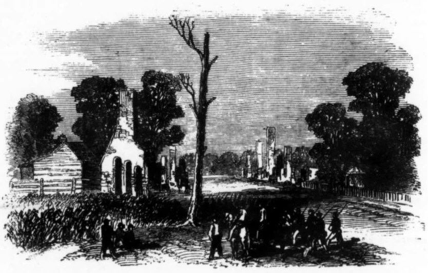
Early in 1862, federal gunboats steamed up the Chowan River, looking to wreck the rail bridges north of Winton. Confederate artillery hidden along the bluffs caught them in an ambush and drove them back downriver. The next day the Federals returned, this time with infantry, landed at Winton, and set most of the town on fire. Winton is generally considered the first town in North Carolina put to the torch during the Civil War. The choice of target was not random: this stretch of river was a crossing point for enslaved people fleeing east toward Union lines and an active corridor for the contraband trade that the slaveholding class along the Chowan had built their wealth on. After the war, the railroad found a new center of gravity at Ahoskie, drawing mills and merchants until it eclipsed the rebuilt Winton as the county's commercial heart - though Winton remains the county seat to this day.
The Free People of Color
Long before emancipation, free Black families farmed, traded, and worshipped in pockets of Hertford County - some descended from Indigenous Meherrin ancestors, some from manumissions, some from people who had simply slipped through the cracks of an institution that depended on absolute categories to function. By 1860 they made up roughly one in eight residents. After Reconstruction, that community helped build Chowan University in next-door Murfreesboro into a regional anchor, and it produced the deep Democratic roots that still register today: as of October 2022, sixty-six percent of registered voters in Hertford County were Democrats - the highest rate of any county in North Carolina. The same data showed Republicans at their lowest registration rate statewide. Today the county is about 60 percent Black or African American. Demographics this distinct are rarely accidental; they are the long shadow of who got to stay, who got to leave, and on whose terms.
Quiet Land, Loud History
Fly over Hertford on a clear morning and what you see is mostly woods. Stands of loblolly pine, brown winter fields broken by cypress sloughs, the dark water of the Chowan curling against the Bertie County line. Ahoskie, the largest town, sprawls in a grid around old rail yards and the WQDK country station tower. Murfreesboro keeps its antebellum brick houses and Chowan University's red roofs in a tight knot near the Meherrin River. Winton, smaller, anchors the southeast end of the county with a courthouse and a private federal prison that took the riverfront's old role as a way station for people from far away. Three hundred fifty-three square miles of land hold about twenty-one thousand people - quiet country, harder history than the quiet suggests.
From the Air
Coordinates 36.36 N, 76.98 W. Recommended viewing altitude 3,000-6,000 feet. The Meherrin and Chowan rivers are the most visible navigation cues, with the Chowan widening to the southeast toward Albemarle Sound. Nearest airfields are Tri-County Airport (KASJ) at Ahoskie and Edenton Northeastern Regional (KEDE) about 25 nm southeast. Tower at KNGU Norfolk Naval Station handles regional traffic 35 nm north. Clear weather typical in fall and winter; summer haze common.
Nearby Stories
- Elizabeth City 5.8 km away
- Chowan River 14 km away
- Battle of Great Bridge 18 km away
- Princeville, North Carolina 23 km away
- 1837 Suffolk Head-On Collision 25 km away
- Halifax County, North Carolina 29 km away
- Fort Christanna 50 km away
- Roanoke Colony 53 km away