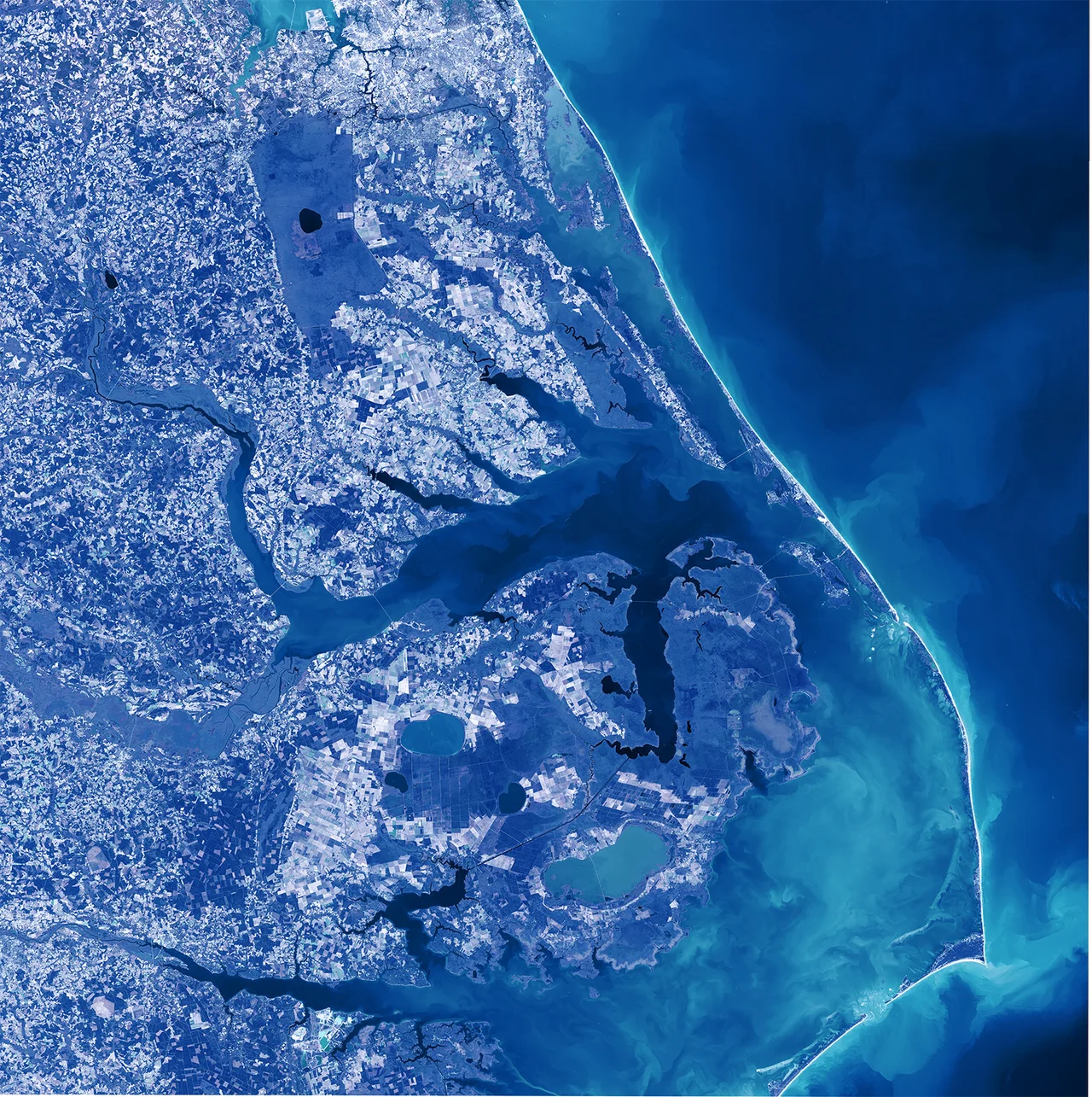

Albemarle Sound
Stand on the Edenton waterfront at sunset and the water you are looking at is not really the ocean. It is not really a river either. Albemarle Sound is a long, mostly fresh estuary - fifty-five miles end to end - hidden behind the Outer Banks like a secret room behind a curtain. The Chowan, Roanoke, Pasquotank, and a dozen smaller rivers empty into it. The Atlantic, on the other side of the Currituck Banks at Kitty Hawk, barely speaks to it. The Pamlico people fished it from dugout canoes for thousands of years before any European saw it. In 1586, English explorers sailed up its length and reported back. Within fifty years, the first permanent English settlements in what would become North Carolina sat along its shores.
The Sound With Many Names
Albemarle is really several sounds wearing one name. The Croatan Sound separates mainland Dare County from Roanoke Island, where the lost colony tried and failed to take root. Roanoke Sound runs east of Roanoke Island to the Outer Banks - confusingly, this was also the historical name for the whole estuary now called Albemarle. The Currituck Sound runs north from the main body to nearly the Virginia line. The whole system makes part of the Atlantic Intracoastal Waterway. In 1663 King Charles II handed the sound, along with the rest of Carolina, to eight Lords Proprietors as a reward for restoring his throne. One of them was George Monck, the first Duke of Albemarle - a soldier who had marched south from Scotland to bring Charles II back from exile. The sound has carried his title ever since.
Coasters and Cargoes
Settlers from Virginia drifted south in the late 1600s and built farms along the Albemarle. Most of them were small operators, planting tobacco for export and corn for survival. They built a maritime economy that ran on coasters - small trading ships that crept between Albemarle ports and the Chesapeake, sometimes pushing as far as the West Indies. The cargo coming home was spices, silk, and sugar. The cargo going out was tobacco, herring, lumber, and a steadily growing volume of human beings sold into a slavery that the Carolina assembly was building, statute by statute, into law. By the colonial period fishing had become its own industry. Enslaved workers were sent into the spring runs of shad, striped bass, and herring with nets that could stretch over a mile long, worked twenty-four hours a day during the season. The herring went into salt for export to Europe. The shad went on ice up the Chowan River to the northern colonies.
Ferries and Bridges
Until 1938, the way you crossed the Albemarle was by ferry. The most famous of them linked Edenton on the north shore with Mackeys to the south - a route that operated continuously from 1734 until the first bridge replaced it after two centuries of service. A longer span, more than three miles, was built in 1990. The crossings matter because the geography of the sound makes everything else difficult. The roads have to skirt the water. The towns - Edenton, Hertford, Elizabeth City, Plymouth, Manteo - are necklaces strung along the shore. The sound is the connector and the divider both, the shortcut and the wall, depending on whether you have a boat.
A Fishery in Decline
Through most of the twentieth century, Albemarle Sound was considered one of the great striped bass fisheries in the world. Tournament fishermen drove down from Virginia and Maryland chasing trophy stripers in the spring run. That world is going. Pollution from upstream agriculture, paper mills, and development along the Roanoke and Chowan has cut the sound's commercial fisheries by an estimated seventy percent in recent decades. The herring runs that fed colonial Europe are a fraction of what they were. The shad have been listed as a species of concern. The water still looks the way it always looked - tea-dark in the river mouths, slate-gray under cloud, glittering brass at sunset. The biology is harder to see from the surface. Restoration efforts at places like the Edenton National Fish Hatchery are part of a slow attempt to put back what four centuries of extraction took out.
From the Air
Coordinates roughly 36.07 N, 76.06 W for the central body, but the sound stretches from roughly 76.00 W to 76.80 W. Recommended viewing altitude 5,000-10,000 feet to read the full 55-mile reach. The Wright Brothers National Memorial at Kitty Hawk sits on the barrier island at the east end. Roanoke Island is at the southeastern corner where the sound joins Pamlico Sound. Nearest airfields: Dare County Regional (KMQI) on Roanoke Island, Elizabeth City CGAS (KECG) on the north shore, Edenton (KEDE) on the west. Weather can change quickly - summer thunderstorms build over the warm shallow water in afternoons.
Nearby Stories
- Bodie Island Lighthouse 5 km away
- Chowan River 12 km away
- Blackwater River (Virginia) 30 km away
- False Cape State Park 30 km away
- Pocosin Lakes National Wildlife Refuge 38 km away
- Beaufort County, North Carolina 46 km away
- Coastal Virginia Offshore Wind 57 km away
- Torpedo Alley 74 km away