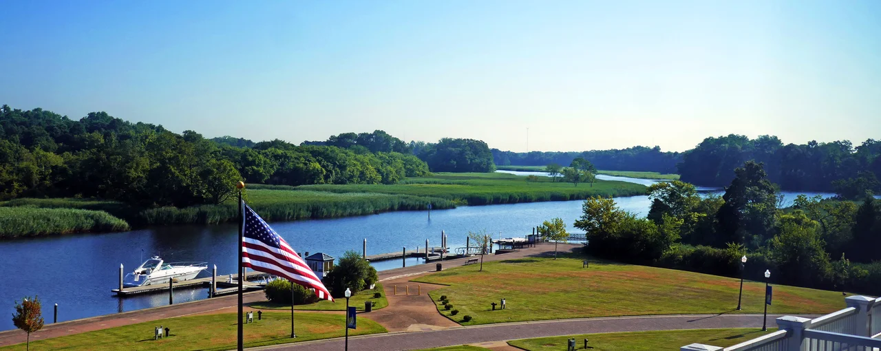

Suffolk, Virginia
Amedeo Obici came to America from a small town called Oderzo in northern Italy. He landed in Wilkes-Barre, Pennsylvania, made a living selling roasted peanuts, and in 1913 brought his Planters Nut and Chocolate Company to Suffolk, Virginia, where the peanut fields stretched in every direction. The mascot he gave to his company - a monocled, top-hatted cartoon legume named Mr. Peanut - was born here in Suffolk. For decades the local AM radio station called itself WLPM, short for the World's Largest Peanut Market. The station is gone, the company has changed hands several times, but Suffolk still throws a Peanut Festival every fall, and Obici's name is on the hospital, the highway, and the sister-city plaque that pairs Suffolk with Oderzo.
From Constant's Warehouse
The town was founded in 1742 on the Nansemond River as a port at the head of navigation. The Nansemond people had lived in this country before colonization, and their name still marks the river and the former county. The English settlement was first called Constant's Warehouse, for John Constant, one of its founders; then renamed Suffolk after the home county of Royal Governor Sir William Gooch in England. Tobacco gave way to mixed farming. In 1750 Suffolk became the seat of Nansemond County; in 1808 it incorporated as a town; in 1910 it became an independent city. In 1974 the city of Suffolk merged with the former county - by then itself the independent city of Nansemond - plus the towns of Holland and Whaleyville, and the result is what Suffolk is today: 429 square miles of land and water, the largest city in Virginia by boundary area, the fourteenth largest in the United States.
The Peanut and the Town
Peanuts shaped the city the way iron shaped Pittsburgh. Planters made Suffolk a processing center for a crop the surrounding fields could grow in volume, and the industry pulled in workers, rail lines, warehouses, and Italian engineers. Obici grew rich and gave a great deal of his money back to the town - the original Louise Obici Memorial Hospital was named for his wife, and when it was replaced by a new Sentara-operated facility in 2002, the name went on the new building too. Planters changed hands - now owned by Hormel after Kraft - but the Mr. Peanut character that Obici's company commissioned in 1916 still carries Suffolk's roots on his lapel. The annual Peanut Festival, running every fall since 1977, draws crowds to a downtown that still leans on its agricultural identity even as defense contractors fill the office parks in the north of the city.
Railroads and Beltways
Two railroads ran through Suffolk before the Civil War - the Portsmouth and Roanoke and the Norfolk and Petersburg - and four more were added afterward. The Seaboard Coast Line station still stands on North Main Street, now the Seaboard Station Railroad Museum, where a model train layout traces the city in miniature. The Norfolk and Western depot at 100 Holladay Street served Amtrak's Mountaineer until 1977. Today three freight railroads still cross the city, and Suffolk sits on a proposed branch of the Southeast High Speed Rail Corridor. The Monitor-Merrimac Memorial Bridge-Tunnel, finished in 1992 at a cost of $400 million, connects Suffolk to Newport News across Hampton Roads, completing the beltway loop with Norfolk and Portsmouth.
The Lighthouse and the Cyber Commands
Lockheed Martin built its Center for Innovation in Suffolk around a freestanding lighthouse and named the campus, with appropriate cheek, The Lighthouse. Raytheon manufactures air-launched decoy jammers here. After the Joint Forces Command disbanded in 2011, the buildings did not stay empty long. The Naval Network Warfare Command, the Global Network Operations Center Detachment, Navy Cyber Defense Operations Command, and Navy Cyber Forces moved into the vacated space, bringing roughly a thousand additional employees and an estimated $88.9 million annual payroll to north Suffolk. Suffolk is no longer just a peanut town; it has become one of the centers of the Navy's cyber operations, sitting quietly behind the more public bases at Norfolk and Oceana.
Two Storms
On April 28, 2008, just after four in the afternoon, an EF3 tornado dropped on Suffolk. It came down more than once, tore a swath north and west of downtown past the Sentara Obici Hospital, and rolled through the Driver neighborhood. More than 120 homes and twelve businesses were seriously damaged; over two hundred people were injured. Governor Tim Kaine declared a state of emergency. The historic structures in Driver took hits, the broadcast antennas in the antenna farm survived, and the city spent the next year putting itself back together. It was a reminder of the kind of weather the Cfa humid-subtropical climate of southeastern Virginia can produce, and of the rural communities that the 1974 consolidation pulled into Suffolk's expanded city limits.
From the Air
Suffolk centers at 36.741N, 76.610W on the Nansemond River, about 18 nm west of downtown Norfolk. The Great Dismal Swamp National Wildlife Refuge occupies much of the southeastern part of the city. From the air, look for the Nansemond River meandering toward its junction with the James, and the broad agricultural fields north and west of downtown. Norfolk International (KORF) is 19 nm east-northeast; the city has its own small airport at Suffolk Executive (KSFQ). Recommended viewing altitude 2,500-5,000 feet AGL.
Nearby Stories
- Thomas Jefferson National Accelerator Facility 1.6 km away
- Cape Charles Lighthouse 4.6 km away
- Dismal Swamp Canal 7.6 km away
- Nat Turner's Rebellion 16 km away
- Chowan University 17 km away
- Flowerdew Hundred Plantation 25 km away
- False Cape State Park 27 km away
- Kitty Hawk: Where Humans First Flew 65 km away