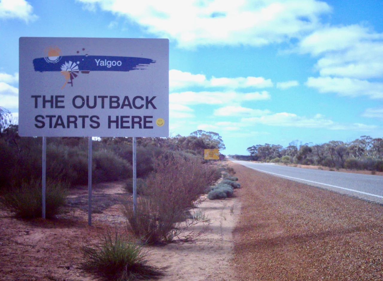

Great Northern Highway
At 3,195 kilometres, it is the longest highway in Australia, and for much of that length it is also one of the loneliest sealed roads on Earth. The Great Northern Highway leaves Midland on the edge of Perth and does not truly relent until it reaches Wyndham, a small port on the far northern coast where, by local tradition, a giant concrete crocodile greets you at the town's entrance. In between lies almost the entire vertical sweep of Western Australia: wheat fields, old goldfields, the iron-red Pilbara, and finally the monsoon country of the Kimberley. People do not drive this road by accident. You commit to it.
A Road Built for War
Before the highway, the north got by on short stretches of dirt linking farms and towns to harbours, where steamers called for goods and passengers. It was a poor way to move freight - and a dangerous way to defend a coastline. When Japanese aircraft began attacking northern Australia during the Second World War, the gap became strategic. From 1944, two highways were pushed north from Perth toward Darwin: the coastal Highway 1, and this inland route. Yet sealing the whole length took decades. The final section was not paved until 16 December 1989, an event that made national news. The all-weather road, passable in any season, was the entire point - and it had been the best part of half a century in the making.
Road Trains and the Whoosh
Trade still rules the highway. Trucks pound its length at every hour, and the largest of them - road trains, a prime mover hauling multiple trailers - are a force of nature on a two-lane road. Drivers learn to read the whoosh: the pressure wave that hits as one passes or overtakes, demanding two firm hands on the wheel. The road crosses pastoral leases, the wheatbelt, and the great iron-mining districts around Newman, where much of the accommodation is block-booked for mine workers cycling through two-week swings. Newman itself sits where the highway crosses the Tropic of Capricorn, the symbolic line into the tropics, though out here the air feels no different - just hot, and getting hotter as the road climbs north.
The Discipline of Distance
This is a road that punishes carelessness. The full route takes about a week with only token stops; tour buses do it in three days by running through the night with relays of fresh drivers, because driver drowsiness is among the deadliest hazards out here. Roadhouses double as petrol stations and rooms, and the rule is simple: never pass one with less than half a tank. Wise travellers carry spare water and spare fuel. Most of all, they avoid driving at dusk and after dark, when cattle and kangaroos drift onto the warm bitumen and their dark eyes throw back no glint of headlight. A collision with a beast at speed can end a journey - or worse - in a heartbeat.
Through Four Worlds
Few roads pass through so many landscapes. South of the iron country, the highway runs through old gold towns and wheat farms. North of Port Hedland - the rust-streaked port where the iron is shipped, and the halfway mark in spirit if not in distance - it bends east and joins Highway 1, threading toward Broome's pearling coast and on into the Kimberley. There the bitumen narrows to single-lane bridges across rivers that swell and flood in the wet, when side roads turn to mud and caravan parks shut for the season. Turn-offs lead to wonders: the red gorges of Karijini, the beehive domes of Purnululu, the Bungle-Bungles. The highway itself stays humble - a thin grey line holding a vast country together.
From the Air
The waypoint here sits at roughly 23.29°S, 119.65°E, near Newman in the Pilbara, where the Great Northern Highway threads between iron-mining country. From the air the highway reads as a thin, ruler-straight line of bitumen across red and ochre terrain, often the only human mark for tens of kilometres, with the occasional roadhouse or rail crossing. The full highway runs 3,195 km from Midland (Perth) to Wyndham. Nearest airport for this stretch is Newman (ICAO YNWN); the route is also served by Port Hedland (YPPD), Broome (YBRM), and Kununurra (YPKU), all with daily Perth connections. Dry-season visibility (May-September) is excellent; the wet season (October-April, strongest in the north) brings storms, dust, and flooding. Recommended viewing altitude 5,000-8,000 ft AGL to follow the road against the surrounding ranges and desert.
Nearby Stories
- Hope Downs Mine 9.5 km away
- Talawana Track 30 km away
- Jigalong 57 km away
- Collier Range National Park 127 km away
- Glikson Crater 144 km away
- Wittenoom, Western Australia 146 km away
- Peak Hill, Western Australia 236 km away
- Parnngurr Community 243 km away