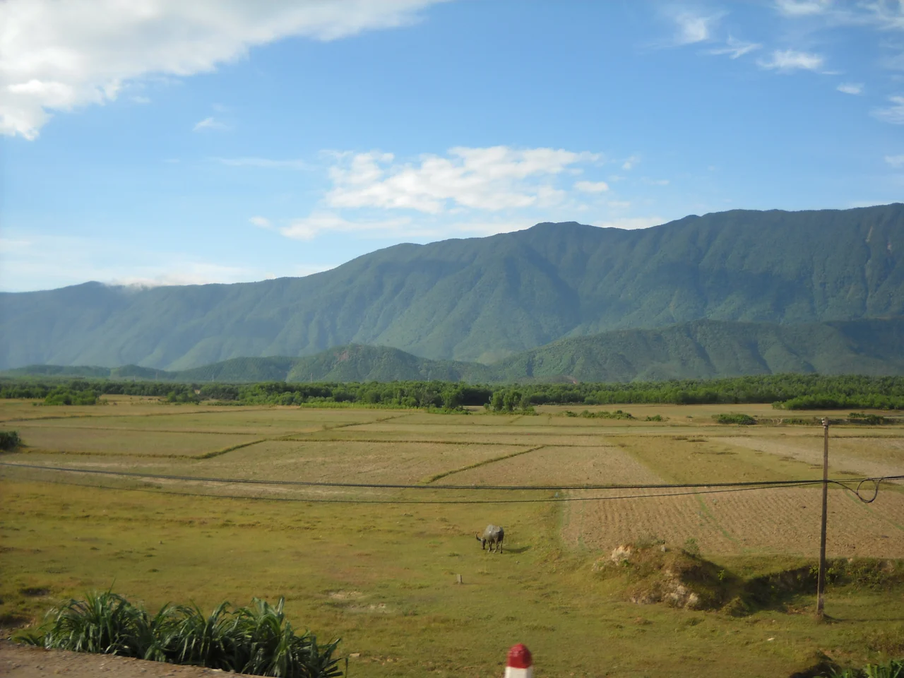

Hoành Sơn Range
Hoành Sơn nhất đái, vạn đại dung thân — one range of the Hoành Sơn, and ten thousand generations may find shelter. Tradition puts the line in the mouth of Nguyễn Bỉnh Khiêm (1491–1585), the scholar the Vietnamese remember as a prophet, answering an envoy sent to ask what a young nobleman named Nguyễn Hoàng should do about the brother-in-law he had good reason to fear. In 1558 Nguyễn Hoàng crossed this ridge and kept going south. His descendants governed everything below it for two centuries, and the dynasty that grew out of them gave Vietnam its last emperors. Whatever you think of prophecy, it was an excellent reading of terrain.
The Sideways Mountain
The Hoành Sơn is not a long range — about fifty kilometres — but it runs the wrong way. The Trường Sơn, the Annamite chain, follows the spine of the peninsula roughly north to south. The Hoành Sơn breaks off it and heads due east, straight into the sea. Hoành means transverse; this is the sideways mountain, and its high point stands at 1,044 metres.
The effect is a wall dropped across the country at its narrowest. North of the ridge is southern Hà Tĩnh, south of it northern Quảng Bình, and the crest between them is a provincial boundary drawn by geology rather than decree. National Route 1 gets across at exactly one place, the Ngang Pass. Before modern tunnelling there was no practical alternative — not for an army, not for a rice merchant, not for a courier carrying an emperor's orders. Everything the country sent between its halves went over that single saddle.
Thirty Kilometres of Stacked Stone
Somebody, at some point, decided a mountain was not wall enough.
Running along the northern slope of the Hoành Sơn, east to west through the communes of Kỳ Anh, is a rampart of stone more than thirty kilometres long. It is built entirely of đá son — a natural rock that grinds down to a red the colour of vermilion — laid dry, with no mortar at all. Over the centuries the stone surfaces have weathered into a substance that binds the courses to each other, so the wall has quietly cemented itself. Where it is best preserved it stands six metres high, five metres thick at the base and three across the top: broad enough to walk along.
Its origins are credited to Champa, with the oldest work traced by some accounts to the kingdom of Lâm Ấp in the fourth century. Between 1656 and 1661 the Trịnh commander Trịnh Toàn rebuilt and reinforced it, in the middle of the long war against the Nguyễn. In 2014 it was recognised as a national heritage site, and a cleared, fenced section now runs through Kỳ Lạc commune.
The Frontier That Kept Moving
For a hundred and thirty years this ridge was an international border. From 938, when Vietnam broke free of a millennium of Chinese rule, until 1069, the Hoành Sơn separated Đại Việt to the north from Champa to the south — two states with different languages, different religions, different gods, and a long habit of raiding one another.
The frontier was administered, not merely asserted. In 992 the Vietnamese court sent Ngô Tử An to cut a road across the range, which tells you the traffic was heavy enough to justify the engineering. Then in 1069 the Lý dynasty annexed Quảng Bình and the border jumped south, past Quảng Trị. The stone wall stayed. The mountain stayed. The pass stayed. Only the line on the map moved, and it would move again, and again, and each time this same fifty kilometres of rock was asked to mean something new.
Ten Thousand Generations
Nguyễn Bỉnh Khiêm's eight words did what the best prophecies do: they described a place so accurately that the prediction became difficult to avoid. South of the Hoành Sơn there is defensible ground, a working coastline, rice country, and precisely one narrow doorway an enemy has to come through. Nguyễn Hoàng went, held, and handed it to his sons. The Nguyễn lords ran Đàng Trong from behind this ridge into the 1770s, and the dynasty founded by their descendant Gia Long in 1802 kept the throne at Huế — latterly under French protection — until 1945.
The range received its formal acknowledgement in bronze. Among the Nine Dynastic Urns cast for the Nguyễn court at Huế, the Hoành Sơn appears in relief on the Huyền đỉnh: a mountain range raised to the status of national emblem, which is more or less what the scholar had proposed in the first place.
From the Air
The Hoành Sơn Range runs roughly east–west near 17.99°N, 106.34°E, from the Trường Sơn cordillera to the coast at the Hà Tĩnh–Quảng Bình line. High ground reaches 1,044 m (3,425 ft), so plan a minimum safe altitude of 5,500 ft MSL for terrain clearance over the interior. From the air the range is easy to identify: a single forested spur cutting perpendicular to the main north–south cordillera and running out to a headland, with National Route 1 threading its one gap at Ngang Pass and the coastline pinched to a narrow strip on either side. A run at 6,000–8,000 ft along the ridge axis shows the whole range end to end. Đồng Hới Airport (VVDH, elevation 18 m) is about 60 km south-southeast; Vinh International (VVVH, elevation 6 m) about 120 km north. Expect mechanical turbulence and lee-side downdrafts in strong onshore wind, and persistent low cloud on the northern slope during the October–January northeast monsoon.
Nearby Stories
- Mụ Giạ Pass 11 km away
- Phong Nha 16 km away
- Hồng Lĩnh Mountains 31 km away
- Hà Tĩnh province 48 km away
- Vũ Quang National Park 53 km away
- Hien Luong Bridge 85 km away
- DMZ (Vietnam) 128 km away
- Bach Long Vi Island 224 km away