.jpg)
Iruya
To reach Iruya you first have to leave it behind. The town sits in Salta Province, but no road from Salta will take you there. Instead you climb out of neighboring Jujuy, grinding up a gravel track from Humahuaca to the Abra del Cóndor, a saddle at 4,000 meters where the wind never quite stops. Then the descent begins, dropping more than a kilometer in a handful of switchbacks until the canyon walls close in and, far below, a cluster of whitewashed houses appears, stacked against a near-vertical slope as if poured there. That is Iruya, population around 1,070, hanging onto the mountainside above the river that gave it its name.
The Road That Almost Isn't
The last forty kilometers are unpaved, a cornice of loose stone where, in places, there is room for only one vehicle and no room at all for error. Drivers ease past one another with inches to spare, the canyon falling away on one side. The Abra del Cóndor is the hinge of the whole journey. It marks the provincial border, but it also divides two worlds: behind you, the rolling brown hills of the Jujuy altiplano; ahead, the sudden, dramatic gorges of Salta. During the summer rains, from December to March, the route can wash out entirely, and travelers have been stranded waiting for the mud to firm up. Isolation is not an accident here. It is the town's defining condition, the reason it looks and feels the way it does.
A Town Built on a Slope
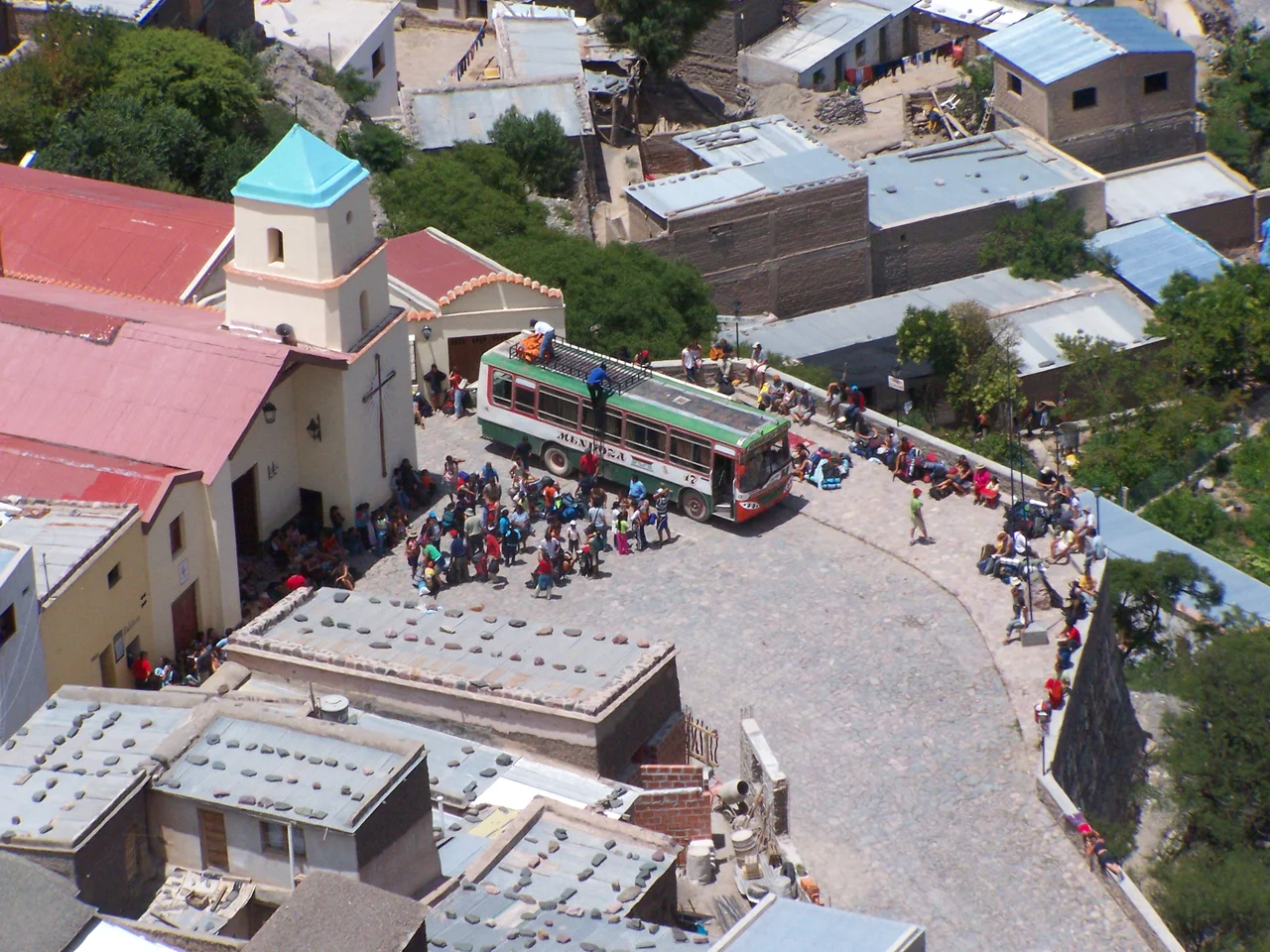
Iruya rests at 2,780 meters, perched where a plateau breaks into the ravine of the Río Grande de Iruya. Its streets are not really streets so much as cobbled ramps, climbing and folding back on themselves between adobe walls. Dogs sleep in the middle of them, untroubled by the occasional truck. At the top stands the church, built in 1690, decades before the town was officially founded in 1753, though families had already been living in the canyon for roughly a century by then. The name comes from Quechua and means, fittingly for these high windswept slopes, an abundance of straw. Look up from the plaza and the Andes rise on every side; look down and the river threads silver through the rock.
Older Than the Spanish
The deepest roots in Iruya belong to the Ocloya, an Indigenous people linked to the Kolla and, beyond them, to the Kollasuyo, the southern quarter of the Inca empire that once stretched across these mountains. Long before any Spanish founding date, this canyon was inhabited, worked, and known. That continuity still shapes daily life. The surrounding hamlets, San Isidro and San Juan to the north, Pueblo Viejo to the south, are reached on foot along trails that have carried people and pack animals for generations. To walk between them is to follow paths older than the town's churches, older than the maps that mark the modern border.
Why People Come
Travelers who make the difficult crossing tend to describe the same thing: a place that feels suspended out of time and almost out of reach. The appeal is partly the setting, that improbable arrangement of houses against stone, and partly the welcome, the unhurried friendliness of a community that does not depend on visitors but receives them warmly. Mornings bring mist into the gorge; afternoons sharpen the light against the cliffs. There is little to do in the conventional sense, which is precisely the point. Iruya rewards the act of simply being somewhere remote and beautiful, a town that asks for effort to reach and repays it in quiet.
From the Air
Iruya lies at 22.79°S, 65.22°W, deep in a canyon of the eastern Andean foothills in Salta Province, northwestern Argentina, at an elevation of 2,780 m. The terrain here is extreme: the surrounding ridges and the Abra del Cóndor pass rise to roughly 4,000 m, so a viewing altitude well above 14,000 ft (around 16,000–18,000 ft) is advisable for terrain clearance. From the air, look for the deeply incised gorge of the Río Grande de Iruya and the tiny grid of the town clinging to its slope; the contrast between the bare altiplano to the west and the green-shadowed canyons to the east is the clearest navigational cue. The nearest major airport is Martín Miguel de Güemes International in Salta (ICAO SASA), about 180 km to the south; San Salvador de Jujuy's Gobernador Horacio Guzmán International (ICAO SASJ) lies somewhat closer to the southwest. Mornings often bring valley mist and afternoon clouds build over the ridges, so clear-air viewing is best earlier in the day.
Nearby Stories
- Baritú National Park 21 km away
- Quebrada de Humahuaca 24 km away
- Salinas Grandes 69 km away
- Cerro Tuzgle 162 km away
- El Rey National Park 186 km away
- Sol de Mañana 207 km away
- Laguna Colorada 266 km away
- Filadelfia 481 km away