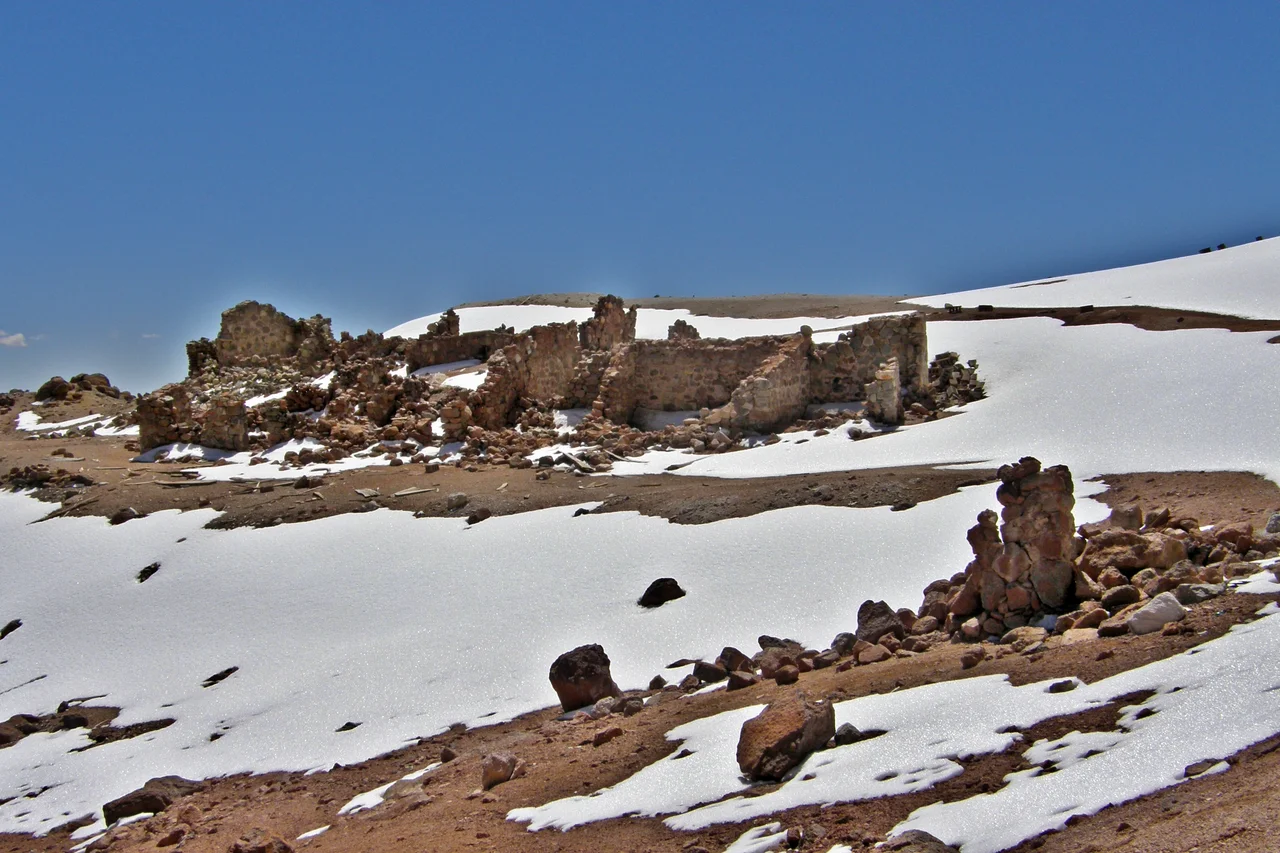

Cerro Tuzgle
Volcanoes are meant to line up. Along the Andes they march in a neat chain above the place where the Nazca Plate dives beneath South America, fed by melt from the descending slab. Cerro Tuzgle ignores the rule. It stands almost 280 kilometers east of that main arc, a solitary cone marooned in the high desert of the back-arc, the largest volcano of its kind in the entire region. Its name comes from the Kunza language of the Atacameño people and means, simply, knoll, a humble word for a mountain that climbs to 5,486 meters and dominates everything around it.
A Mountain Out of Place
Tuzgle owes its odd location to a wound in the Earth's crust. A great fracture called the Calama-Olacapato-El Toro lineament slices across the Andes here, running from the Chilean forearc deep into Argentina, and it marks the boundary between the northern and southern Puna. Magma found a path upward along this fault and built the cone where no volcano had any business being. The same faults that let the magma rise now seem to pinch it off; geologists believe movement along them clamps the conduits shut, which may be why Tuzgle has stayed quiet. Surveys have nonetheless traced a partly molten magma chamber still sitting in the crust beneath the summit.
Deep Time in Layers
The mountain is a stack of eruptions separated by hundreds of thousands of years. The story opens roughly 650,000 years ago with a violent blast of ash and pumice that spread an 80-meter-thick sheet of pale ignimbrite across the plain. Lava domes followed, then flow upon flow of dark andesite that filled an old collapsed crater and built the cone you see today. The youngest flows may be young enough to count as recent in geological terms, lava that hardened while early humans already walked the planet. Frost has since cracked the upper slopes into fields of shattered rock, and a 1926 report described a small lake cupped in the summit crater.
Life Where Almost Nothing Grows
Less than 100 millimeters of rain falls here in a year. Tuzgle sits in the Andean Arid Diagonal, where the Eastern Cordillera wrings the moisture from the wind before it can reach the Puna, so the slopes carry only tough cushion plants like yareta and the resinous shrub called tola. Yet the bleakness is alive. Vicuñas and guanacos graze the thin grass, chinchillas shelter in the rocks, and condors ride the updrafts above flightless rheas the locals call suris. Around the volcano's hot springs, peat bogs hold a thousand-year diary of the climate, written in the slow accumulation of moss that records each wetter or drier century.
Sulfur, Steam, and a Summit Shrine
People have long tried to wring something useful from this mountain. Sulfur was discovered on its flanks in 1924, and miners cut a truck road toward the summit and hauled the yellow rock down by mule to a processing camp grimly named Ojo del Tuzgle, the eye of Tuzgle. The mines stand abandoned now, but the heat that deposited that sulfur still simmers underground, where temperatures exceed 200 degrees Celsius, and engineers have estimated the field might one day yield enough geothermal power to matter. Long before any of them, the Inca climbed all the way to the top. In 1999 the archaeologist Constanza Ceruti documented a ceremonial platform and stone structures on the summit, evidence that this remote peak was once a place of pilgrimage and offering.
From the Air
Cerro Tuzgle stands at about 24.06 degrees south, 66.48 degrees west, rising to 5,486 meters (17,999 feet) on the eastern edge of the Argentine Puna in Jujuy Province. From the air it reads as a remarkably symmetrical, isolated cone, often dusted with snow and streaked by dark finger-like lava flows on its southern and western flanks; the abandoned sulfur mines scar the south-southwestern slope. It is visible from Provincial Route 74, and San Antonio de los Cobres lies 45 km to the southeast. Maintain ample terrain clearance: the summit reaches nearly 18,000 feet and mountain weather brings strong westerly winds, sudden snow, and afternoon convection. Nearest major airport is Martín Miguel de Güemes International (ICAO: SASA) at Salta, about 200 km to the southeast.
Nearby Stories
- Salinas Grandes 23 km away
- Santa Rosa de Tastil 26 km away
- Tolar Grande 45 km away
- Laguna Lejia 61 km away
- Cerro de los Siete Colores 66 km away
- Los Cardones National Park 106 km away
- Atacama Large Millimeter Array 125 km away
- Pucará de Tilcara 125 km away