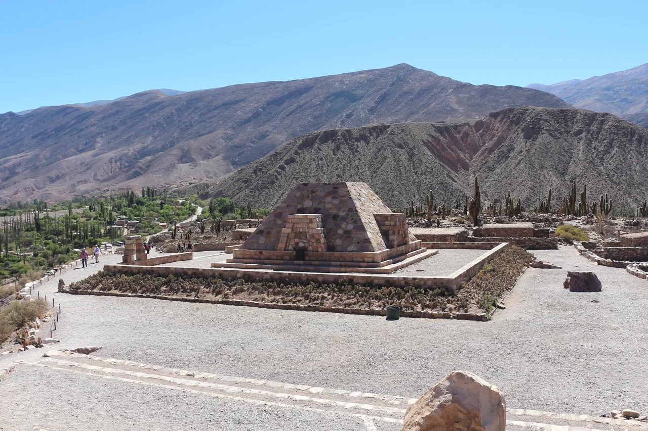

Pucará de Tilcara
Climb fifteen minutes up the hill outside Tilcara and the whole valley opens beneath you. This is exactly why the Omaguaca people built here. From this rocky outcrop they could see far up and down the Quebrada de Humahuaca, watch every traveler approaching, and hold a position almost impossible to take. The low stone walls and narrow doorways scattered across the hilltop are a pucara, a pre-Inca fortified town, and standing among them with the wind off the mountains and the river glittering below, you feel the logic of the place in your bones. People have lived in this valley for more than ten thousand years. Here, for several centuries, they built something meant to last.
A Town on the Heights
The Omaguaca settled this area around the twelfth century, and they were not simple hill people. They were skilled farmers, weavers, and potters, and they were formidable warriors. At its height the pucara sprawled across roughly fifteen acres and held more than two thousand inhabitants, who lived in small square houses of stacked stone with low doorways and no windows, doors built to keep out the cold of the high desert night. Among the dwellings were corrals for animals, spaces for religious ceremony, and burial grounds. This was a working town and a center of power, not merely a refuge to flee to when danger came.
Empires Pass Through
In the late fifteenth century the Inca arrived, sweeping up the valley under Tupac Inca Yupanqui and folding the Quebrada into their vast empire. They put the pucara to use as a military outpost and a node for controlling the silver, zinc, and copper mined nearby. Inca rule here lasted barely half a century. In 1536 the Spanish came, and a way of life that had endured for centuries began to unravel; the conquerors founded the modern town of Tilcara in 1586. The hilltop fell silent, its stone walls slowly tumbling, and for more than three hundred years the fortress that had commanded the valley simply waited.
Rediscovered, and Rebuilt
In 1908 the ethnographer Juan Bautista Ambrosetti of the University of Buenos Aires, working with his student Salvador Debenedetti, brought the site back into the light. In their first three years of excavation they catalogued more than three thousand artifacts, and from 1911 they began clearing the ground and raising fallen walls. Both men died before the work was done; in 1948 Eduardo Casanova took up the project and saw the site open as an archaeological museum in 1968. The reconstruction makes the Pucara de Tilcara the only publicly accessible archaeological site in the Quebrada de Humahuaca, and it was declared a National Monument in 2000. A small botanical garden of native cacti grows beside the ruins.
Whose Ashes, Whose Memory
Yet the rebuilding raised hard questions. In 1935 a stark, European-style monument shaped like a truncated pyramid was raised among the ancient stones to honor Ambrosetti, Debenedetti, and a third archaeologist, Eric Boman — a memorial to the excavators standing atop the homes of the people they studied. The discomfort of that gesture has only grown. A plaque now placed at the site admits as much, noting that for much of the twentieth century Argentina assumed its indigenous peoples had vanished with the Spanish conquest, treating archaeology as the salvage of a dead culture. The voices and struggles of indigenous communities, the plaque says, proved that idea false; in 1994 the national constitution itself recognized the cultural and ethnic pre-existence of Argentina's indigenous peoples. The descendants of the Omaguaca never disappeared. Today the pucara stands not as a tomb for a lost people but as a tool to keep their memory alive.
From the Air
The Pucara de Tilcara sits at roughly 23.59 degrees south, 65.40 degrees west, on a defensible hilltop just outside the town of Tilcara in Jujuy Province, at about 2,400 meters elevation within the Quebrada de Humahuaca. The fortress commands a long north-south stretch of the valley, which itself runs some 155 km and ranges from about 1,600 to 4,500 meters. The nearest airport is Gobernador Horacio Guzman International (ICAO SASJ) near San Salvador de Jujuy; Martin Miguel de Guemes International at Salta (ICAO SASA) lies farther south. From the air the terraced hilltop and its angular stone monument are visible at lower altitudes in clear conditions. Expect high-altitude terrain and changeable mountain weather; mornings are typically clearest.
Nearby Stories
- Calilegua National Park 21 km away
- Uquía 23 km away
- San Salvador de Jujuy 41 km away
- San Antonio de los Cobres 42 km away
- Cerro Tuzgle 60 km away
- El Rey National Park 97 km away
- Baritú National Park 99 km away
- Atacama Large Millimeter Array 174 km away