
Jakobsbakken
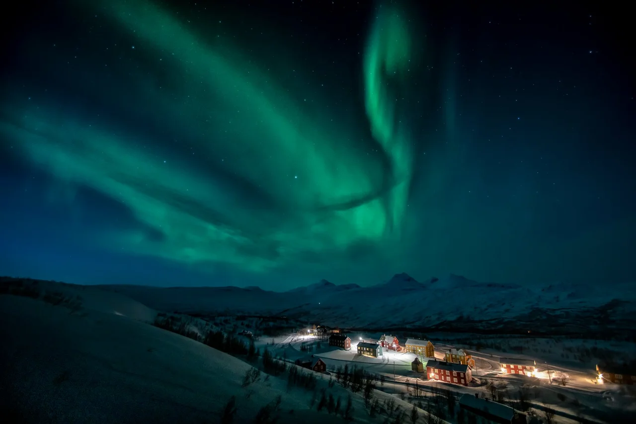
Jakobsbakken had a telephone twenty-two years before it had a post office. That single fact tells you almost everything about the place: a cluster of houses at 600 metres in Arctic Norway, just high enough that the trees give up, where the mining company's need to talk to its shaft bosses mattered far more than anyone's need to send a letter home. More than 350 people lived up here at the peak, with a school, an assembly hall and a shop of their own. Nobody lives here permanently now. The buildings remain, the mine does not, and the road stops where the village starts.
Where the Trees Give Up
The settlement locals simply call Bakken sits about eight kilometres south of Sulitjelma, on high ground above the southern shore of Langvatnet. Six hundred metres is not a great height by alpine standards, but at 67 degrees north it puts you above the birch and into open fell — bare rock, heather, meltwater, and snow that lingers into July. County road 543 climbs to Jakobsbakken and then simply ends. To the east the border massif builds toward Suliskongen at 1,908 metres, and two glaciers, the Sulitjelma icefield and Blåmannsisen, sit within walking distance of anyone determined enough. Winter here is long and genuinely dark. The reason a village existed at all in such a position was the rock underneath it.
The Richest Rock in the Field
Ore was found on this slope in the mid-1870s, though nobody surveyed it properly until 1886. That was the year the Swedish industrialist Nils Persson began acquiring claims across the Sulitjelma area — eight of them in all — and in 1891 the company Sulitjelma Gruber was formed to work them. Jakobsbakken turned out to be the prize. It was by far the richest single deposit in the entire Sulitjelma field, and geologists have since identified at least twenty-three distinct ore minerals in the ground here. The mine ran from 1896 to 1968. Across those seventy-two years it produced 4.47 million tonnes of copper and zinc ore, hauled out by men working a scraping method that the mining museum down in Fagerli still illustrates with a model built in 1932.
Buckets on a Cable
Getting ore off a mountain above the tree line is a problem with no elegant solutions, and the company chose an aerial tramway. Loaded buckets swung down the slope on cables to Sulitjelma, where the smelters and the railway waited, and empty ones came back up the same wire. In summer the line ran over rock and standing water. In winter it ran through weather that could close the footpath for days. Everything else came up the same way or on men's backs: flour, coal, timber, schoolbooks, coffins. The people who worked here were the same mixed Arctic workforce that filled the whole Sulitjelma field — Norwegians, Swedes, Finns, Kven and Sámi — living under a company that owned their houses, their shop and their road, and whose conditions down in the valley were harsh enough to produce Norway's most famous mining strike.
Three Hundred and Fifty Neighbours
For decades this was not an outpost but a proper community, and the details of ordinary life are what make it land. Children walked to a school on the fell. Adults met in an assembly hall. There was a shop, which meant there were arguments about the shop. Families kept animals to stretch what wages would buy. Marriages, births and funerals all happened at 600 metres, in a place where the nearest doctor was a long trip downhill and the nearest town most of a day away. It is worth holding that in mind when looking at the empty houses: they were not a work camp, they were addresses.
Sealed, Bought, Still Used
When the mine closed in 1968, the two halves of Jakobsbakken went separate ways. The industrial half was demolished or walled up, its adits sealed and its headframes taken down. The residential half was bought by the Norwegian Lutheran Mission, which is why the village never rotted into ruins the way abandoned mining settlements usually do. Today it operates as Jakobsbakken Fjellsenter, a mountain and camp centre where children come for a week at a time to the same buildings that once housed shift workers. Cross-country skiers arrive for the annual Kobberløpet — the Copper Race — and hikers use the village as a jumping-off point into the fells and glaciers along the Swedish border. The population figure is still zero. The place is anything but empty.
From the Air
Jakobsbakken lies at 67.095°N, 16.006°E, at roughly 600 m elevation on high open fell south of Langvatnet, about 8 km south of Sulitjelma village. Look for the cluster of white and dark buildings sitting conspicuously above the tree line — at this latitude the boundary between birch and bare rock is sharp, and the village straddles it. Langvatnet's long east-west trench to the north is the primary navigational reference; the Sulitjelma glacier and Blåmannsisen lie east and southeast, with the border ridge reaching 1,908 m at Suliskongen. Recommended viewing altitude 5,000–7,000 ft AGL to hold both the village and the glaciated border range in one frame. Nearest airport is Bodø (ENBO), about 80 km west; Harstad/Narvik Evenes (ENEV) is roughly 155 km north-northeast. Terrain rises steeply on all sides except the descent to Langvatnet, so keep escape routes to the northwest. Snow cover persists late into summer at this elevation, and low cloud commonly sits on the fell even when the valley below is clear.
Nearby Stories
- Blood Road Museum 4.9 km away
- Rago National Park 12 km away
- Vuoggatjålme 29 km away
- Nasa Silver Mine 36 km away
- Laponia 45 km away
- Kungsleden 53 km away
- Iraft 57 km away
- Lofoten Fishery 88 km away