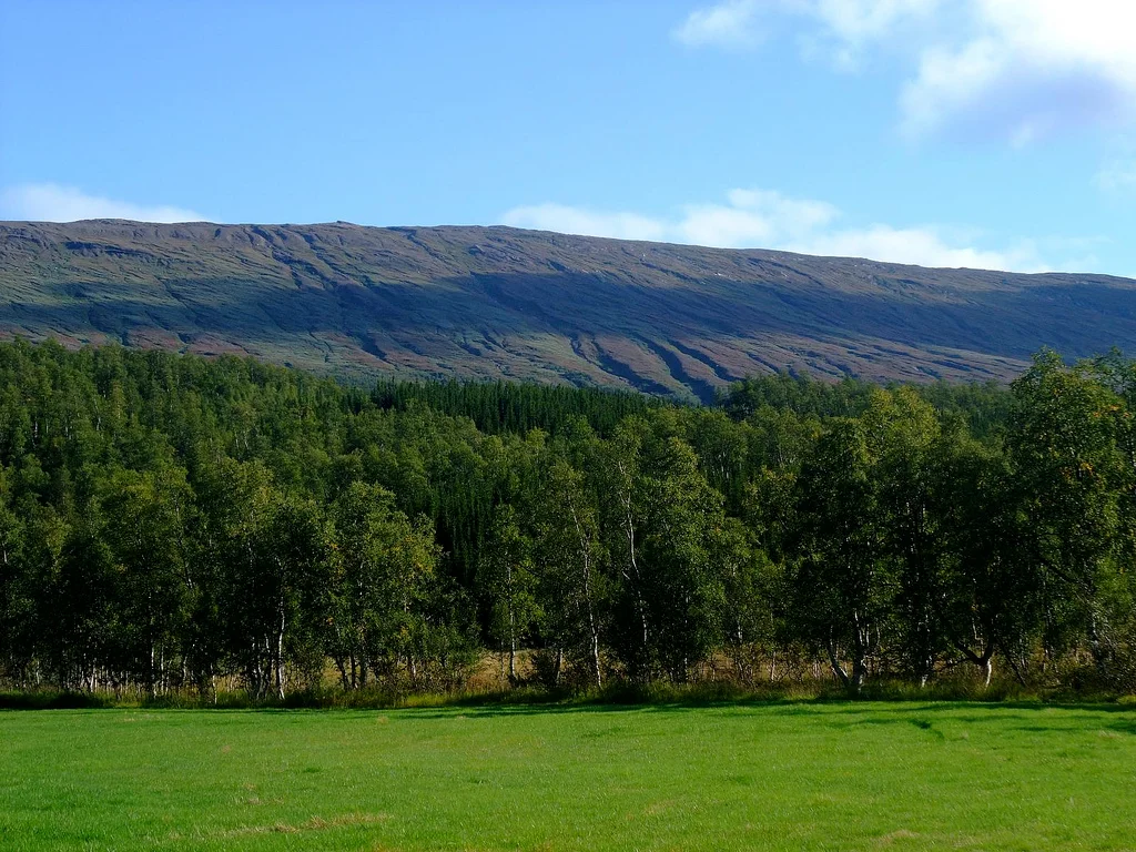

Junkerdal National Park
Somewhere in Junkerdal there is a snow fleabane growing further south than snow fleabane grows anywhere else. So is a bullrush sedge, and so is an alpine arnica. These are Arctic plants, built for ground that spends most of the year frozen, and this valley on the Norwegian side of the Swedish border is where their range gives out. Cross the fells southward and they are simply gone. Junkerdal National Park protects 682 square kilometres of that ground. It was established in 2004, though the botanical case for protecting this valley had been made and won nearly eighty years earlier.
A Botanist's Mountain
The park's fame rests on flora, which is an unusual thing for a Norwegian national park - most of them are sold on glaciers and fjords. Down low, Junkerdal is forested. Higher up, the mountains and plateaus carry an extraordinary density of arctic-alpine species, several of them rare across the whole country. White Arctic mountain heather grows here. So do the Arctic bellflower, upright lousewort and hairy lousewort. Bullrush sedge, snow fleabane and alpine arnica all reach their southernmost limit within the park boundary. Many of these plants are otherwise found only far to the north, or on entirely different continents, which makes walking the ridges here a slightly disorienting experience for anyone who knows their botany: the plants at your feet belong to a latitude several hundred kilometres away.
Junkerdalsura
The park's reputation was built next door. Junkerdalsura is the steep scree slope on the northern side of the gorge where Junkerdalen narrows, and its exceptionally rich plant life was recognised early enough that protection came in stages from 1928 and 1935 - among the first botanical reserves anywhere in Norway, and decades ahead of the national park itself. The reserve borders the park today. Below the gorge the valley is tight and dramatic; above it the ground opens out into terrain gentle enough for farming and forestry, and 57 people still lived in Junkerdalen as of 2022. It is a rare combination in Arctic Norway: a place of serious scientific value that also has neighbours.
Wolverine Country
Three of Norway's four large carnivores are here. Wolverines den in the high country, lynx move through the forest below, and brown bears range across the border - a moose hunt in these mountains occasionally turns into an unplanned encounter with one. Moose and reindeer are both common, and reindeer grazing on this ground is not incidental: Sami herders use the park year-round, and the animals you see are almost certainly somebody's. The birds are the other draw. Gyrfalcons and golden eagles hunt the open fell. Red-throated and Arctic loons nest on the wetlands, along with long-tailed ducks, and the char and trout stocks in the park's lakes are reckoned among the best in this part of Nordland. Balvatnet, the large lake in the middle of the northern plateau, is the centre of gravity for most of it.
The Junker
The name means the young nobleman's valley - junker from a medieval German word for a nobleman's son, dal for valley - and tradition attaches it to a specific man. Preben von Ahnen (1606-1675) was a Danish-Norwegian official who served twenty years as bailiff and district governor in Nordland, and locals called him the Junker. In August 1659 he led a force east through these mountains into Sweden and destroyed the Nasa silver mine, plundering and burning the works and, at Silbojokk on Sädvvájávrre, the church that served the mining community. The mine did not reopen for over a century. Whether the valley really takes its name from him is unprovable at this distance, and there are those who trace the word instead to Sami mythology. What is certain is that a raiding party once came through the gorge, and that the memory stuck to the ground.
Getting In
The park spreads across Saltdal and Fauske municipalities and runs up against the Swedish border, reaching north toward the old mining town of Sulitjelma. National Road 77 turns off the E6 at Storjord and follows Junkerdalen east to Sweden, which makes this one of the more accessible high-Arctic parks in Norway - you can be on marked trails within an hour of leaving the main highway. The Nordland National Park Centre sits at Storjord, at the junction. Nordre Saulo, at 1,755.98 metres the highest point in Saltdal, stands inside the boundary, and Solvågtinden is the peak most people photograph. There are huts in the interior and mountain lodges out on the road at Graddis and Junkerdal. It is still a park you walk into rather than drive through, which is much of the point of it.
From the Air
Junkerdal National Park is centred near 66.883N, 15.80E in Nordland county, Norway, straddling the border with Sweden well north of the Arctic Circle. From the air the defining feature is the Junkerdalen valley running east from the E6 at Storjord toward the frontier, with National Road 77 threading it - a clean linear reference in otherwise complex terrain. The interior is open plateau punctuated by Balvatnet, the large lake near the park's centre, and steep peaks including Solvågtinden and Nordre Saulo (1,755.98 m), the highest ground in Saltdal. Best viewed from 5,000-9,000 feet AGL, high enough to see the plateau and the border fells together. Nearest airports are Bodø (ENBO) roughly 90 km northwest and Mo i Rana Røssvoll (ENRA) to the south. Weather changes fast on the watershed: expect orographic cloud building on the western slopes, strong winds through the valley gap, and snow cover on the high ground from October into June.
Nearby Stories
- Sjønstå 7 km away
- Vuoggatjålme 9.3 km away
- Nasa Silver Mine 20 km away
- Saltstraumen 24 km away
- Dunderland Valley Bus Crash 25 km away
- Sulitjelma Glacier 28 km away
- Operation Musketoon 50 km away
- Laponia 64 km away