
Sjønstå
In December 1956 the Sulitjelma railway was extended down to Finneid, and Sjønstå stopped mattering. Everything the village existed to do — take copper ore off a train, put it on a boat, hand it down the lake toward the sea — could now be done without stopping. The station went, the workshops went, the store and the school went. The post office closed the following year. What is left on the southeastern shore of Øvervatnet, twenty kilometres east of Fauske, is a sandy beach, a river mouth, and about twenty farm buildings that had been standing there for two centuries before the mining boom arrived and are still standing now that it has gone.
Cows in the Shade
The Sjønstå River runs into the lake here, and where it does, glacial moraine left a set of natural terraces above a beach of pale sand — the only decent farmland for some distance in any direction. Somebody claimed it in the seventeenth century. The place first appears in writing in a rent roll of 1665, spelled Süinstad, with a tenant named Baard Pedersøn; it is missing from the land committee's register of 1661 and from the tithe list of 1663–65, which suggests the farm was established more or less exactly when the document was drawn up. The name itself is a puzzle. The philologist Oluf Rygh proposed that it came from skinstøde-å, with å meaning 'river' and the first element naming a place where cattle habitually shelter from the summer heat and the bot flies. Locally people have always said Sjønståg, or Skjønståga, or Sjønstaa. Clerks in distant offices spelled it however they liked.
The Awkward Middle of a Long Journey
Then, from 1891, Swedish and Norwegian capital opened copper and pyrite mines at Sulitjelma, up in the mountains against the Swedish border, and the ore had to get out. The route it took was absurd and unavoidable. Boats carried it the length of Langvatnet from Sulitjelma to Fossen. From Fossen a narrow-gauge railway, built in 1892, ran it down to Sjønstå. At Sjønstå it went back onto the water — down Øvervatnet, then Nedrevatnet — and only at Finneid did it reach a quay on Skjerstad Fjord where a ship could take it. Sjønstå was the hinge in the middle: the place where a trainload became a boatload. That required people, and the right people — locomotive crews, boatmen, mechanics, warehousemen, a station master. A farm of a few families became a junction of a few hundred.
Three Hundred People and a Shooting Club
At its height Sjønstå held about 300 residents, and they did what northern industrial villages did: they founded things. A lodge. A shooting club. A sports club, in 1916, which lasted longer than the reason for its existence. A school opened in 1899 and ran for sixty years. There was a general store, a locomotive shed, and from 1936 a Folkets hus — a people's house, the workers' hall that in Norway usually meant a labour movement had arrived and intended to stay. It is worth remembering how quickly this all came and went. A man who was born on the farm before the mines opened could have watched three hundred neighbours arrive, a railway and a fleet of lake boats appear, and every one of them vanish again, and still not have reached old age.
Twenty Buildings, Unchanged
The farm outlasted the village because nobody ever had reason to modernise it. Sjønstå is a klyngetun, a cluster farm — buildings crowded together in a tight, almost village-like knot rather than spread across the holding. The layout was ordinary in Nordland before 1900 and is now almost entirely gone; Sjønstå is the only one left in Northern Norway. There are about twenty structures, divided between an inner farm of four dwelling houses and four raised granaries, or stabbur, and an outer farm of cowshed, storehouse, barn, woodshed and stall. They have not substantially changed since the 1800s. The Norwegian Directorate for Cultural Heritage gave the site protected status in 2006, citing both the rarity of the layout and its entanglement with the Sulitjelma mines. A foundation set up in 1987 looks after it, and roughly six million kroner went into restoration work between 2003 and 2013. Nobody lives here permanently. In summer the Folkets hus opens as a café, which is a strange and rather good afterlife for a workers' hall.
From the Air
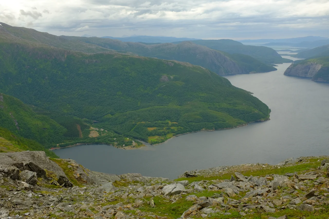
Sjønstå sits at 67.21°N, 15.71°E, on the southeastern shore of Øvervatnet, about 20 kilometres east of Fauske and roughly 55 kilometres east-northeast of Bodø. From 4,000 to 7,000 feet the lake chain reads as a single east–west corridor — Nedrevatnet and Øvervatnet lined up between steep forested walls, with the Sjønstå River entering from the southeast and the pale delta beach marking the settlement. County Road 830, built on the bed of the old Sulitjelma Line, runs the north shore and continues toward Sulitjelma and the glaciers beyond. Nearest airport is Bodø (ENBO); Harstad/Narvik Evenes (ENEV) lies well to the north. The valley funnels wind and holds low cloud; approach with terrain awareness on both sides.
Nearby Stories
- Saltdal Municipality 6.9 km away
- Sulitjelma (mountain) 13 km away
- Saltstraumen 22 km away
- Vuoggatjålme 45 km away
- Operation Musketoon 53 km away
- Lofoten Fishery 63 km away
- Árran Lule Sámi Centre 64 km away
- 2012 Norwegian Air Force C-130 Crash 109 km away