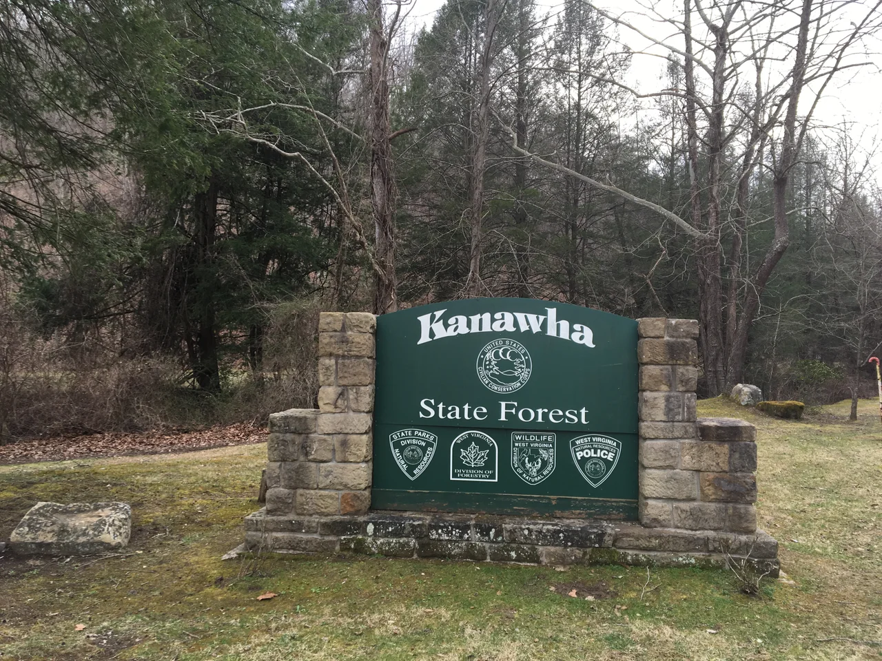

Kanawha State Forest
Seven miles from the capital of West Virginia, the city ends and the forest begins. You drive south out of Charleston, follow Davis Creek Road through a narrow valley past a few last houses, and then you are inside Kanawha State Forest - 9,300 acres of hardwood ridges that stretch into the broken country south of the Kanawha River. It is the kind of geography that surprises first-time visitors. Charleston is a Capitol-dome city of about fifty thousand people, but the topography around it is so creased and folded that wilderness is never more than a few minutes away. Kanawha State Forest is what you get when the state legislature decides to leave one of those folds mostly alone.
A Forest That Acts Like a Park
Technically, Kanawha is a state forest, managed by the West Virginia Department of Natural Resources for a broader mix of timber and recreation than a state park. But in 2018, the West Virginia Legislature directed that the facility be managed as a state park - a hybrid status that keeps the forest designation while delivering park-style amenities. The result is a place that runs as a park in everything but name. There are about 25 miles of multi-use trails - graded for hiking, mountain biking, and in winter, cross-country skiing when conditions cooperate. There is a swimming pool, a playground, picnic shelters, a public shooting range, and overnight camping in a campground that books up fast in summer. Several geocaches are tucked along the trails. The Davis Creek Road entrance is at 38.28133 degrees north, 81.64169 degrees west, which is roughly seven miles by road from downtown Charleston.
What the CCC Built
The central portion of the forest, along with its historic structures, was added to the National Register of Historic Places on March 25, 1993. The honor is for what the Civilian Conservation Corps built here in the 1930s. The CCC was a Depression-era jobs program that put young men to work in forests and parks across the country, and West Virginia received a heavy concentration of the work. Kanawha's stone shelters, footbridges, the original sections of trail, the dam that creates the swimming hole, and many of the surviving cabins all date from that period. The masonry is the giveaway: rough stone fitted by hand, mortar courses that have softened in seventy years of weather, work that was always intended to last. CCC veterans often returned to the forests they had built. Most of those men are now gone. The shelters, however, remain in use most weekends from April to October.
Walking the Ridges
The forest's terrain is classic Appalachian: steep narrow hollows draining off ridge spines, second-growth hardwood that has been recovering for nearly a century since the original timber boom flattened the region. Spring brings ephemerals - trillium, bloodroot, jack-in-the-pulpit - that bloom in the few weeks before the canopy closes. By June the forest is dim and humid; the trails follow contour lines as much as possible, with occasional climbs to the ridge tops for the long views east toward the city and west into wilder country. White-tailed deer are common. The forest also hosts black bear, wild turkey, and a generous assortment of warblers in migration. Mountain biking has grown into one of the forest's signature uses: the trail network includes routes graded for everything from family rides to expert downhills, and the regional mountain-bike community treats the place as a base for weekend trips that fan out into surrounding national forest lands.
Why It Matters That It's Here
Charleston is not a large city, but it is the largest in West Virginia and the population center of the Kanawha Valley. To have 9,300 acres of mostly intact forest within a fifteen-minute drive of the state capitol is a remarkable piece of civic luck. Many American capitals do not have anything comparable that close. The forest absorbs the city's recreation needs and gives visitors a sense of the larger landscape that surrounds Charleston in every direction. Most of West Virginia is hill country, and Kanawha State Forest is one of the most accessible windows into that fact. You park your car, walk a quarter mile, and the highway noise falls away into the sound of water in Davis Creek and wind in the oak crowns. The capital is right behind you. It does not feel that way.
From the Air
Kanawha State Forest sits just south of Charleston, West Virginia at 38.28 degrees north, 81.64 degrees west, in the steep ridge country between the Kanawha River and Boone County. Best viewed at 4,000 to 7,000 feet AGL: look for the dark green forested ridges immediately south of Charleston's residential edge, between U.S. Route 119 and the I-77/I-64 corridor. Yeager Airport (KCRW) is about ten miles north on its distinctive flat-topped ridge. The Kanawha River and the capitol dome in downtown Charleston are reliable orientation landmarks.
Nearby Stories
- Hillbilly Hot Dogs 3.1 km away
- 2013 National Scout Jamboree 7.1 km away
- Gauley River 8 km away
- Beech Fork State Park 11 km away
- Battle of Winfield 14 km away
- Booger Hole, West Virginia 15 km away
- Battle of Blair Mountain 16 km away
- Martin County coal slurry spill 32 km away