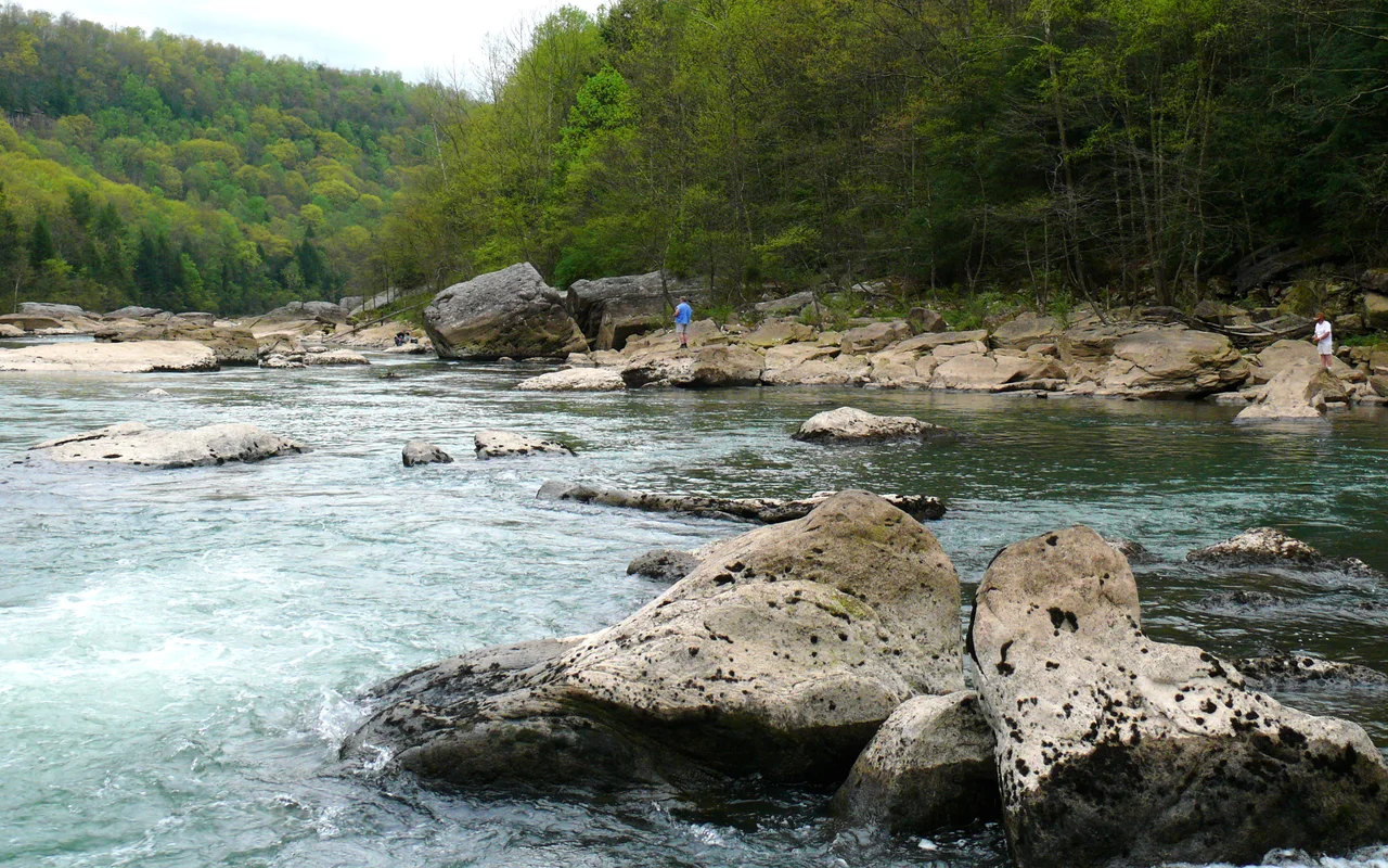

Gauley River
The name is one of the more interesting questions in Appalachian etymology. Most likely it comes from French - Gaul, the historical region of Europe, dating to the brief period in the mid-eighteenth century when this part of what is now West Virginia was claimed by New France, before the French and Indian War shifted the boundary east. The river acquired the name on French maps and kept it after the English took over. Earlier indigenous names have been mostly lost. The river itself rises in the Monongahela National Forest as three small streams - the North, Middle, and South Forks - that converge in Webster County and run for 105 miles west and southwest through some of the most rugged terrain in central Appalachia. At Gauley Bridge in Fayette County, it joins the New River to form the Kanawha, and through the Kanawha and the Ohio, eventually the Mississippi.
Headwaters and Course
The three forks of the Gauley rise on Gauley Mountain in Pocahontas County, in the high country of the Monongahela National Forest where elevations exceed 4,500 feet. They cross the southern edge of Randolph County, converge in Webster County, and the river begins running steadily westward as a single channel. From Webster County, it crosses Nicholas County, passing the small communities of Camden-on-Gauley and Summersville. Through Nicholas it is impounded by Summersville Dam, a US Army Corps of Engineers structure completed in 1966 that creates the 2,790-acre Summersville Lake. Downstream of the dam, the river runs another 25 miles through the steep Gauley Canyon protected as the Gauley River National Recreation Area, and finally joins the New River at the town of Gauley Bridge in Fayette County.
Tributaries from the East
All the Gauley's largest tributaries enter from the east. The Williams River drains a piece of the Monongahela National Forest and joins the Gauley in Webster County - long a favorite of trout anglers. The Cranberry River, also out of Monongahela, joins in Nicholas County. The Cherry River flows through the lumber-era town of Richwood and meets the Gauley near Craigsville. The Meadow River, the longest of the eastern tributaries, runs through the small town of Rainelle and joins the Gauley at the Fayette-Nicholas county border. The result is that the Gauley gathers most of its volume from the Allegheny Plateau as it travels west, picking up the cold, often acidic runoff of high-elevation forests and the warmer water of valley streams in turn.
Gauley Season
Beginning on the Friday after Labor Day each year, the Army Corps of Engineers opens the gates of Summersville Dam in a series of 22 controlled releases scheduled across six weekends - the first five running Friday through Monday, the last a Saturday-Sunday closer. Typical release flows run 2,400 to 2,800 cubic feet per second. The Gauley below the dam becomes one of the great whitewater rivers in the Western Hemisphere. These releases are mandated by an act of the United States Congress - the first federal legislation in American history to specifically require recreational whitewater releases from a dam. The Upper Gauley below the dam features five Class V rapids: Insignificant, Pillow Rock, Lost Paddle, Iron Ring, and Sweet's Falls. Outfitters from across the country host paddlers each weekend; the economic impact of Gauley Season runs into the tens of millions of dollars annually.
Civil War and Modern Life
The Gauley canyon was the setting for one of the early Civil War engagements in western Virginia. On September 10, 1861, Union forces under William S. Rosecrans attacked a Confederate position on the high rim of the Gauley Canyon at Carnifex Ferry. The battle was tactically inconclusive but strategically decisive - Confederate Brigadier General John B. Floyd withdrew across the river that night, and Confederate hopes of reclaiming western Virginia died with the campaign that followed. Today the canyon belongs to the rafters and kayakers in season and to the anglers, hikers, and climbers in the quieter months. Summersville Lake holds another community drowned beneath it: the small towns of Gad and Sparks, purchased and inundated by the Corps in 1966. The Gauley is a working river - a watershed providing flood control, drinking water, recreation, and history - that demands a lot from the country it runs through and gives a lot back.
From the Air
The Gauley River runs from Pocahontas County in the east to its confluence with the New River at Gauley Bridge in Fayette County (38.16 N, 81.20 W). Recommended viewing altitude is 3,000 to 5,000 feet AGL for the lower canyon. The river's steep walled gorge below Summersville Dam is visible from miles away. During Gauley Season (September-October), expect heavy aerial activity over the dam access road. Nearest airports are Summersville Lake Airport (KSXL) for the upper canyon and Yeager (KCRW) for the lower gorge.
Nearby Stories
- New River Gorge National Park and Preserve 4.2 km away
- Greenbrier County, West Virginia 5.5 km away
- End of the World Turn 7.9 km away
- Kanawha State Forest 8.8 km away
- Webster Sycamore 13 km away
- Cranberry Wilderness 16 km away
- Buffalo Creek Flood 21 km away
- Battle of Winfield 29 km away