
End of the World Turn
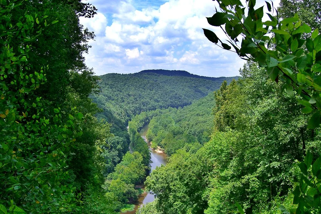
A raftsman coming down the Elk River for the first time, sometime in the early 1800s, would have spent days steering his log raft through the gentle curves of central West Virginia toward Charleston. At a point about 70 miles above the mouth of the Elk, in what is now Clay County, the river makes a sudden left, then bends back right, then bends back left again - a nearly complete half-circle that turns the channel almost a full mile out of its westward course. Beetling cliffs rise sheer from the river to elevations approaching 1,100 feet. From the deck of a raft sweeping into the curve, with the cliffs ahead apparently barring all forward motion, the raftsman would have looked up and concluded the obvious: this was the end of the world. The name stuck. The river still bends. The cliffs still rise.
The Curve of the Elk
About 5.6 miles upstream from the small village of Ivydale, the Elk River encounters a band of resistant sandstone in the surrounding ridges and is forced to follow it. The result is one of the most dramatic meanders in central West Virginia - a sweeping turn just under a mile long, in a graceful semi-circle that the writer W.E.R. Byrne described in his 1940 book Tale of the Elk as the work of impetuous rush turned to placid pool by beetling cliffs. The cliffs reach roughly 1,100 feet above sea level. The Elk River at the base of the cliffs is at about 700 feet, meaning the rock walls rise some 400 feet above the river. Fallen boulders, broken off the cliff faces over geological time, lie in piles along the water's edge. Some of the boulders are the size of houses. The river works around them, falls between them, and emerges at the downstream end into the next valley as though nothing had happened.
The Pioneer Raftsmen
Before railroads reached this part of central West Virginia in the late 1800s, the Elk River was the principal commercial route from the upper valleys to Charleston. Timber from the high country was assembled into rafts at gathering points along the river and floated downstream during seasonal high water. The rafts were enormous - 100 feet or longer, lashed together from squared timbers, steered by long oars at bow and stern. The work required reading the river constantly, knowing every curve, every rock, every fast-water passage. The End of the World Turn was the worst kind of surprise for a first-time pilot. Approaching the curve from upstream, with the cliffs on the outside of the bend rising directly ahead, the river appears to dead-end. By the time the boat is committed to the curve, the current carries it through to the downstream side, but for a few minutes the impression is of having reached a cul-de-sac, the jumping-off place.
View from the Top
There is no developed trail to the top of the End of the World cliffs. Local hunters and a few hikers have worn paths up the back side of the ridge from the surrounding country roads, and visitors who are willing to bushwhack can reach overlooks above the curve. The view down at the river - the green water sweeping through the half-circle, the forest on the inside of the bend, the rooftops of a few river-bottom homes visible in the distance - is one of the more striking unmarked landscape views in central West Virginia. The cliffs themselves are not safe to approach without caution. Some sections drop sheer for 200 feet. Other sections are covered in loose vegetation rooted in shallow soil. The recommended approach is from below, by canoe or kayak on the river, looking up at the cliffs from the water the raftsmen used to see them from.
The Tale of the Elk
W.E.R. Byrne's 1940 book Tale of the Elk is the source of much of what is recorded about the river's history. Byrne was a Braxton County lawyer who practiced in Sutton and spent much of his life fishing and working the Elk River valley; he collected the oral history of the river from the elderly raftsmen and farmers he knew personally. His description of the End of the World, quoted on this page, has become the canonical account of how the curve got its name. The book remains in print in regional reprints and is the kind of resource that makes Appalachian place names like this one feel substantial. The cliffs and the curve appear on USGS maps simply as a contour pattern. The name End of the World Turn is on the maps too, in small letters, a piece of frontier observation that has outlasted everyone who first applied it.
From the Air
The End of the World Turn is centered at 38.54 N, 80.97 W, on the Elk River in Clay County, West Virginia, about 5.6 miles upstream from Ivydale. Recommended viewing altitude is 2,500 to 4,500 feet AGL. The sweeping near-semicircular bend of the Elk River is easy to identify from the air; the cliffs on the outside of the bend rise distinctly above the surrounding ridge. WV Route 4 follows the river through Ivydale. Nearest airports are Yeager (KCRW) in Charleston about 40 miles southwest and Braxton County Airport (K48I) in Sutton about 25 miles east-northeast.
Nearby Stories
- Kanawha State Forest 8.2 km away
- Sarvis Fork Covered Bridge 11 km away
- Stonewall Jackson Lake State Park 11 km away
- Battle of Kessler's Cross Lanes 13 km away
- Webster Sycamore 15 km away
- Cedar Creek State Park 16 km away
- Cranberry Wilderness 16 km away
- Southwest Airlines Flight 2294 23 km away