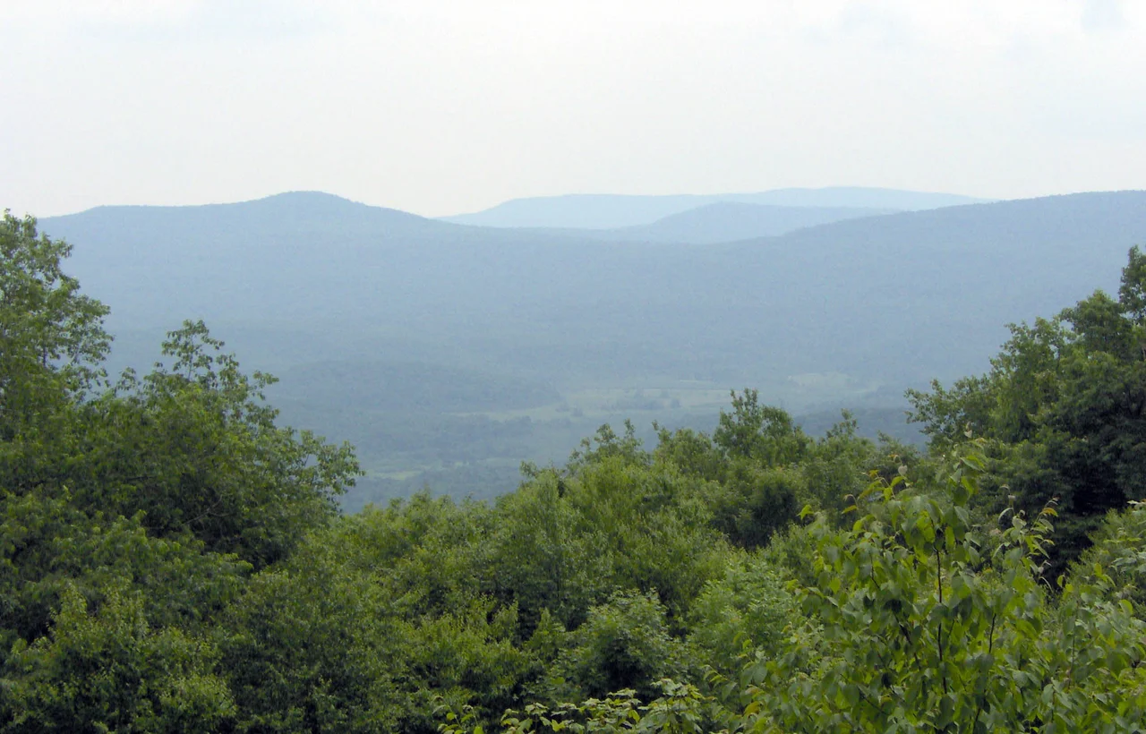

Cranberry Wilderness
Underneath the Cranberry Wilderness, the U.S. Geological Survey has identified roughly 4.18 million metric tons of bituminous coal, of which about 1.68 million tons could be recovered with current mining technology. None of it will be. In 1983, Congress passed H.R. 5161, designating these 47,815 acres - the largest wilderness on the Monongahela National Forest - as off-limits to roads, machines, and extractive industry. The coal stays where it is. So do the trees, the brook trout, and the bears.
The Forest That Came Back
A century ago, this place was bald. The Cherry River Boom and Lumber Company and its peers cut every commercially useful tree off the central Appalachian highlands between roughly 1890 and 1930, hauling out red spruce, hemlock, and northern hardwoods on narrow-gauge logging railroads. What they left behind was slash piles, exposed soil, and fires hot enough to bake the organic layer down to bare rock. The Monongahela National Forest was created in 1920 precisely to repair this damage. A century later, the forest you walk through is the great-grandchild of that destruction - second-growth, in some places now genuinely mature, still missing some of the species that defined the original. Restoration ecologists working in the area have been quietly replanting red spruce for decades.
Two Rivers
The wilderness lies between the Williams River and the Cranberry River, both popular trout streams. Both rise on the high plateau and drop quickly toward the lower country, in the kind of clear cold water that brook trout - the only trout native to these mountains - need to survive. The 2009 expansion of the wilderness added 11,951 acres between the two rivers, an area previously called the Cranberry Backcountry, protecting tributaries that had been logged and roaded under earlier management. The expansion knit the two halves together into a single wild block large enough that you can walk for a full day without crossing a road - rare in the eastern United States and rarer still in West Virginia.
The Trails
About 75 miles of trails wind through the wilderness, with names that read like a topographic poem: Big Beechy, Birch Log, Black Mountain, County Line, District Line, Forks of the Cranberry, North-South, Forks By-Pass, Middle Fork, North Fork, Laurelly Branch, Tumbling Rock, Little Fork, Lick Branch, Rough Run. The North-South Trail, at 14 miles, is the spine. The shorter trails connect to it and to each other in a network that can be combined into multi-day loops. None of the trails are marked or blazed in the manner of state-park trails. Wilderness rules forbid it. You bring a map and a compass and the understanding that wilderness designation is, in part, a deliberate decision to make the visitor work for the experience.
The Gatherings
Twice the Cranberry Wilderness has hosted the national Rainbow Gathering, a loosely organized counterculture event that descends each summer on a different national forest for two weeks of camping, drumming, and communal meals. In 1980 and again in 2005, thousands of Rainbow Family members set up temporary kitchens, latrines, and meditation circles in remote corners of the wilderness. The Forest Service tolerates the gatherings under permits, sometimes uncomfortably. Local residents are similarly divided - some welcoming the trade, others bracing for the disruption. The 2005 gathering left almost no trace within a few seasons. The 1980 gathering is now ancient counterculture history, remembered mostly in mimeographed newsletters and the occasional middle-aged West Virginia hiker who used to be a teenager with bare feet and a guitar.
Why Wilderness
Wilderness designation is the strongest land protection in the American legal toolkit. No timber harvest. No mining. No motorized vehicles. No mechanized equipment, which means even chainsaws are forbidden for trail maintenance - crews use crosscut saws and axes, the way the Civilian Conservation Corps did in the 1930s. The principle, set out by the 1964 Wilderness Act, is that some places should be allowed to run on their own clock, without continuous human management. The Cranberry Wilderness is one of those places. The forest is filling in. The bears, including a healthy population of black bears, have multiplied to the point where the wilderness anchors a regional sanctuary. The coal will keep waiting underground.
From the Air
Located at 38.28 degrees N, 80.33 degrees W in Pocahontas and Webster counties, West Virginia. Cranberry Wilderness covers 47,815 acres of high plateau forest within the Monongahela National Forest. Elevations range from about 2,400 feet along the rivers to over 4,600 feet on the highest ridges. Marlinton Airport (KMRT) is about 14 nm southeast. Elkins-Randolph County Regional Airport (KEKN) is about 35 nm north. Recommended viewing altitude 5,500 to 7,500 feet MSL. Expect mountain wave activity with westerly winds; valley fog common in the river drainages mornings.
Nearby Stories
- Gad, West Virginia 2.3 km away
- Bath County Pumped Storage Station 2.6 km away
- Webster Sycamore 3.2 km away
- Battle of Greenbrier River 5.3 km away
- End of the World Turn 11 km away
- Greenbrier County, West Virginia 11 km away
- New River Gorge National Park and Preserve 20 km away
- Washington and Lee University 38 km away