
Khe Sanh Combat Base
General Lowell E. English was not wrong, exactly. "When you're at Khe Sanh, you're not really anywhere," the 3rd Marine Division's assistant commander declared in 1966, when asked why Marines should garrison a remote plateau in the northwest corner of Quảng Trị Province. "It's far away from everything. You could lose it and you really haven't lost a damn thing." Two years later, six thousand U.S. Marines held Khe Sanh under one of the most intense sieges of the entire Vietnam War, and every television network in America was broadcasting maps of a place that was, according to a general, nowhere.
Where the French Left Off
The plateau above Route 9 had been occupied before the Marines arrived. French forces built a light-duty airstrip here in 1949, carved into the red laterite clay of the Xom Cham Plateau, and the bones of their presence — an abandoned fort, overgrown tracks, the remnants of colonial infrastructure — still marked the landscape when U.S. Army Special Forces Detachment A-101 arrived in August 1962.
The Special Forces built their first camp at the old French fort, about two kilometers east of the village of Khe Sanh, using it as an outpost of the Civilian Irregular Defense Group program. Their mission was straightforward: watch the border, monitor People's Army of Vietnam (PAVN) infiltration, and protect the local population from a conflict that was already reaching into these mountains. In November 1964 they moved to the airstrip site itself, drawn by its tactical advantages — level ground, good drainage, clear fields of fire in every direction, and the stable rock of what would become known as the Rock Quarry. Bunkers went up. A perimeter took shape. What had been a French colonial convenience became an American military installation.
The Logic of an Impossible Position
The debate over Khe Sanh's value never really ended. General William Westmoreland wanted Marines there to block a potential PAVN push through the northwest corridor — a route that could allow North Vietnamese forces to bypass Marine defenses further east and cut into the heart of Quảng Trị Province. Marine commanders pushed back, repeatedly. The terrain was remote. Resupply was difficult. The base sat within range of artillery in neutral Laos, making it perpetually vulnerable.
In late September 1966, the argument was settled by intelligence: a PAVN troop concentration had been identified just 14 kilometers from the base. Lieutenant Colonel Peter A. Wickwire's 1st Battalion, 3rd Marines arrived by KC-130 transport and began patrolling. Contact with PAVN forces was scarce at first — 15 North Vietnamese soldiers killed in months of patrolling — but the intelligence picture was clear. Three regiments of the PAVN 325C Division were operating in the tri-border region. Whatever Khe Sanh was or wasn't, it was now in their way.
Seventy-Seven Days
The siege began on January 21, 1968, when PAVN artillery opened on the combat base at the same moment North Vietnamese forces were sweeping toward Tet Offensive targets across South Vietnam. For the 6,000 Marines, soldiers, and South Vietnamese Rangers holding the base and its surrounding hilltop outposts — Hills 881S, 861, 558, and 950 — the next 77 days were defined by artillery barrages, ground probes, and the constant roar of American aircraft overhead flying Operation Niagara, the most concentrated aerial bombardment of the war up to that point.
The siege commanded international attention in a way few Vietnam battles had. Journalists and cameras were present; President Johnson kept a sand-table model of Khe Sanh in the Situation Room. The fear, never quite spoken aloud, was Dien Bien Phu — the 1954 French defeat at a similarly isolated outpost that had ended French rule in Indochina. The comparison was argued over, disputed, and ultimately rejected. Operation Pegasus, a ground relief operation launched on April 1, broke the siege. On July 5, 1968, the base was abandoned — its military value, in the end, deemed insufficient to justify holding it.
What the Land Remembers
The plateau was reactivated briefly in 1971 to support Operation Lam Son 719, the South Vietnamese incursion into Laos, and then abandoned again. A PAVN sapper attack in March 1971 killed three Americans and destroyed ammunition dumps and aircraft. The base was formally closed in April of that year. By 1973, PAVN engineers had rebuilt the airstrip and were using it for their own purposes.
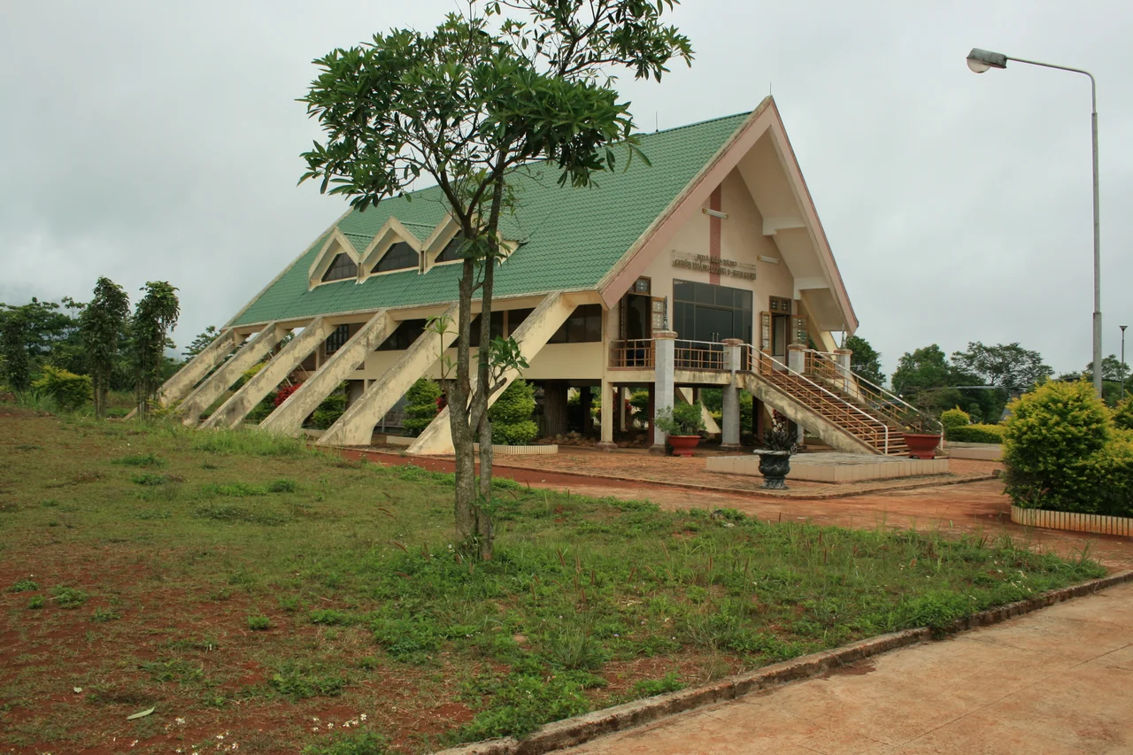
Today most of what was once the combat base has been reclaimed by the landscape — by jungle undergrowth, and by the coffee and banana plants that local farmers cultivate across the old laterite plateau. A small museum on the site holds photographs, weapons, and the thick visitors' impression books that Vietnamese battlefield museums keep as a kind of ongoing testimony. Outside, a C-130 transport aircraft, a CH-47 Chinook helicopter, a UH-1 Huey, artillery pieces, and restored bunkers stand as static exhibits under the open sky.
Tours from Huế make the trip daily. Visitors walk the same ground where Marines once measured their world in meters of cleared wire, where young men from both sides died in an argument about territory that a general had once dismissed as nowhere. The coffee here is very good.
From the Air
Khe Sanh Combat Base sits at 16.654°N, 106.731°E on the Xom Cham Plateau in northwest Quảng Trị Province, roughly 65km west of the coast. At 5,000–8,000 feet, the old airstrip — now partially restored — is clearly visible as a cleared strip running roughly east-west across the plateau, with the surrounding hills (881S to the northwest, 861 to the north) rising above it. The Rao Quan River valley is visible to the south. Nearest airport is Dong Hoi (VDH), approximately 75km to the northeast. On clear days, the Laotian border terrain is visible to the west. Morning fog frequently fills the valley below; the plateau itself is typically clear by mid-morning.
Nearby Stories
- Battle of Signal Hill (Vietnam) 5.4 km away
- DMZ Campaign (1969–1971) 7.5 km away
- Southern Laos 22 km away
- Hien Luong Bridge 40 km away
- Battle of Hamburger Hill 52 km away
- National Route 9 (Vietnam) 54 km away
- Tú Làn Caves System 99 km away
- Bach Long Vi Island 366 km away