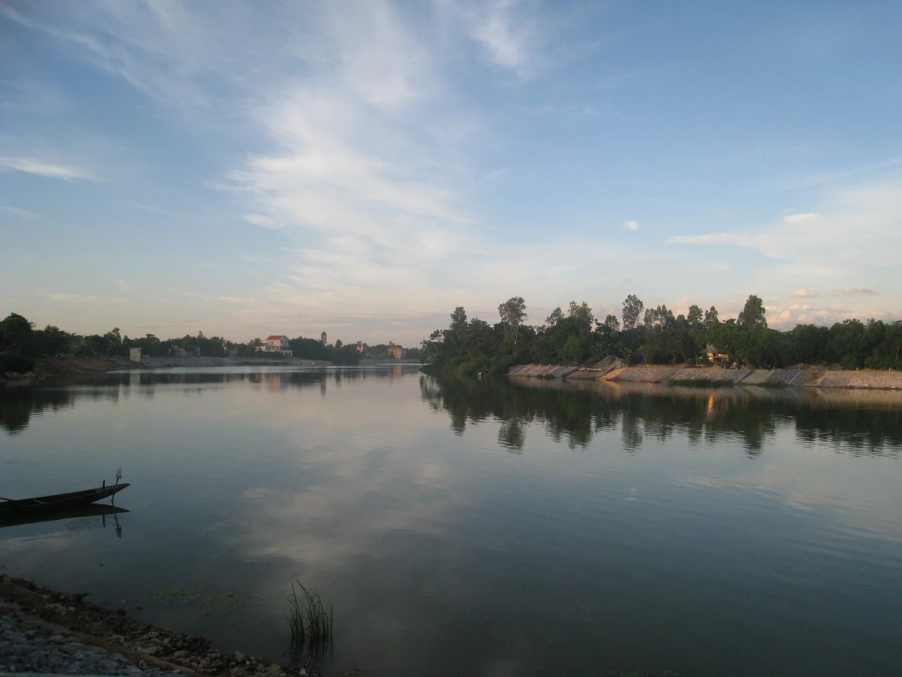

Kiến Giang River
Every 2 September, while the rest of Vietnam marks National Day with parades and speeches, Lệ Thủy goes down to the water instead. Long wooden boats line up on the Kiến Giang, crews braced along the gunwales, and both banks fill before the first gun. The rowing festival is old enough that nobody local treats it as a tourist event; in 2019 the Ministry of Culture, Sports and Tourism added it to the national register of intangible cultural heritage, which amounted less to a promotion than to an official acknowledgement of what the district had been doing anyway.
The Contrary River
Vietnamese writers call the Kiến Giang a nghịch hà — a river that goes against the grain. Nearly every waterway in the country drains east or southeast off the Annamite Range and into the sea by the shortest route available. The Kiến Giang gathers itself in those same mountains, in the Trường Sơn west of Lệ Thủy, and then turns stubbornly northeast, running parallel to the coast for most of its 58 kilometres before it finds an outlet. Eight tributaries feed it across a basin of roughly 2,600 square kilometres. The water they deliver is strikingly clear, as central Vietnamese rivers tend to be, carrying almost no silt — which is why the Kiến Giang has never built the fat, fertile delta that rivers of its length usually leave behind. What it has instead is a thin ribbon of good ground, and at Trần Xá it gives that water up to the Long Đại, and the two together become the Nhật Lệ.
When the Mountains Empty
The trouble with a short river fed by steep country is that everything arrives at once. Autumn rain falls on the Trường Sơn and comes down the upper Kiến Giang fast and hard, and the lowlands of Lệ Thủy — flat, close to sea level, with nowhere to put the surplus — take the whole of it. Flood here has never been an anomaly. It is a season, budgeted for, built around, an annual rearrangement of the household. The An Mã dam upstream now holds back a good part of the surge, buying the villages downstream the thing they never used to have, which is time. Between floods the river is placid to the point of stillness, a flat green lane through the rice, and the disconnect between the two versions of the same water is the first thing that strikes anyone who arrives in the wrong month.
The Riverbank's Long Memory
For a modest provincial river, the Kiến Giang has produced a remarkable share of Vietnamese history. Nguyễn Hữu Cảnh was born nearby, in what is now Quảng Ninh district, in 1650 and rose to become a senior general under Lord Nguyễn Phúc Chu, who sent him south in 1698 to organise the frontier. What he founded there — the Gia Định garrison, its roads, canals and markets — is the administrative seed of Saigon. He died two years later at Rạch Gầm, and Vietnam has honoured him ever since as the man who gave the south its shape. Two and a half centuries on, on 25 August 1911, Võ Nguyên Giáp was born in the same district to a family that farmed and rented out what it could not work. He commanded at Điện Biên Phủ, outlasted two empires and most of his contemporaries, died in 2013, and was brought back to be buried in his home province.
Mỹ Trạch, November 1947
Where the North–South railway crosses the Kiến Giang stands a bridge, and beside it the village of Mỹ Trạch. On 29 November 1947, during the war against the French, soldiers arrived at midday and did not leave until two the following morning. When they had gone, more than 420 villagers were dead — 170 women, 157 children, 94 elderly people, close to half of everyone who lived there. Women were raped before they were killed. Three hundred and twenty-six houses were destroyed. These were farming families a few hundred metres from their own paddies, and the arithmetic of the dead says plainly enough who was and was not at home in the middle of a working day. The site is now a recognised national historical monument, and the memorial stands within sight of the water.
Two Songs and a New Address
The Kiến Giang has been sung about more than most rivers its size. "Đưa em về Kiến Giang" and "Quảng Bình quê ta ơi" both belong to the standard repertoire of the region, and both do the same quiet work of fixing a place in the national ear. The province those songs named has since changed: on 12 June 2025, Quảng Bình was dissolved and merged into an enlarged Quảng Trị, so Lệ Thủy now files its paperwork under a different heading. The river is unbothered. Come the second of September, the boats will be on it again, the banks will fill, and the crews will row a stretch of water that has been carrying grain, soldiers, refugees and racing hulls in whichever direction it pleases for as long as anyone has been counting.
From the Air
Coordinates 17.349°N, 106.643°E, in the Lệ Thủy lowlands of central Vietnam. Best viewed from 3,000–6,000 ft, where the river's contrary northeast course reads clearly against the general east–west grain of the drainage. Navigation cues: the Trường Sơn (Annamite Range) wall to the west, the coastal dune belt and South China Sea to the east, and the North–South railway and National Route 1 running parallel to the river. Follow the water northeast to the Trần Xá confluence with the Long Đại, where the Nhật Lệ begins and runs to the sea at Đồng Hới. Nearest airport is Đồng Hới (VVDH), roughly 20 km north. Clearest flying is March through August; the autumn monsoon brings low cloud, heavy rain and widespread flooding across this basin.
Nearby Stories
- Battle of the Gianh River (1643) 1.4 km away
- Grès supérieurs Formation 19 km away
- Tú Làn Caves System 21 km away
- Phong Nha – Kẻ Bàng National Park 24 km away
- Mutter's Ridge 29 km away
- DMZ Campaign (1969–1971) 47 km away
- Battle of the Mỹ Chánh Line 76 km away
- Bach Long Vi Island 289 km away