The Kimberley, Western Australia
The Kimberley symbolises remoteness. But here is the paradox: this vast, largely uninhabited region — bordered by the Timor Sea to the north, the Indian Ocean to the northwest, and desert on every other side — was the first part of Australia settled by humans. Some 65,000 years ago, people arrived and stayed. They evolved 50 to 60 languages across four linguistic families, invented the boomerang, grew yams in managed gardens, and covered the rock faces with art. The emptiness Europeans see when they look at the Kimberley is not emptiness at all. It is the layered residue of one of the longest continuous human occupations on Earth.
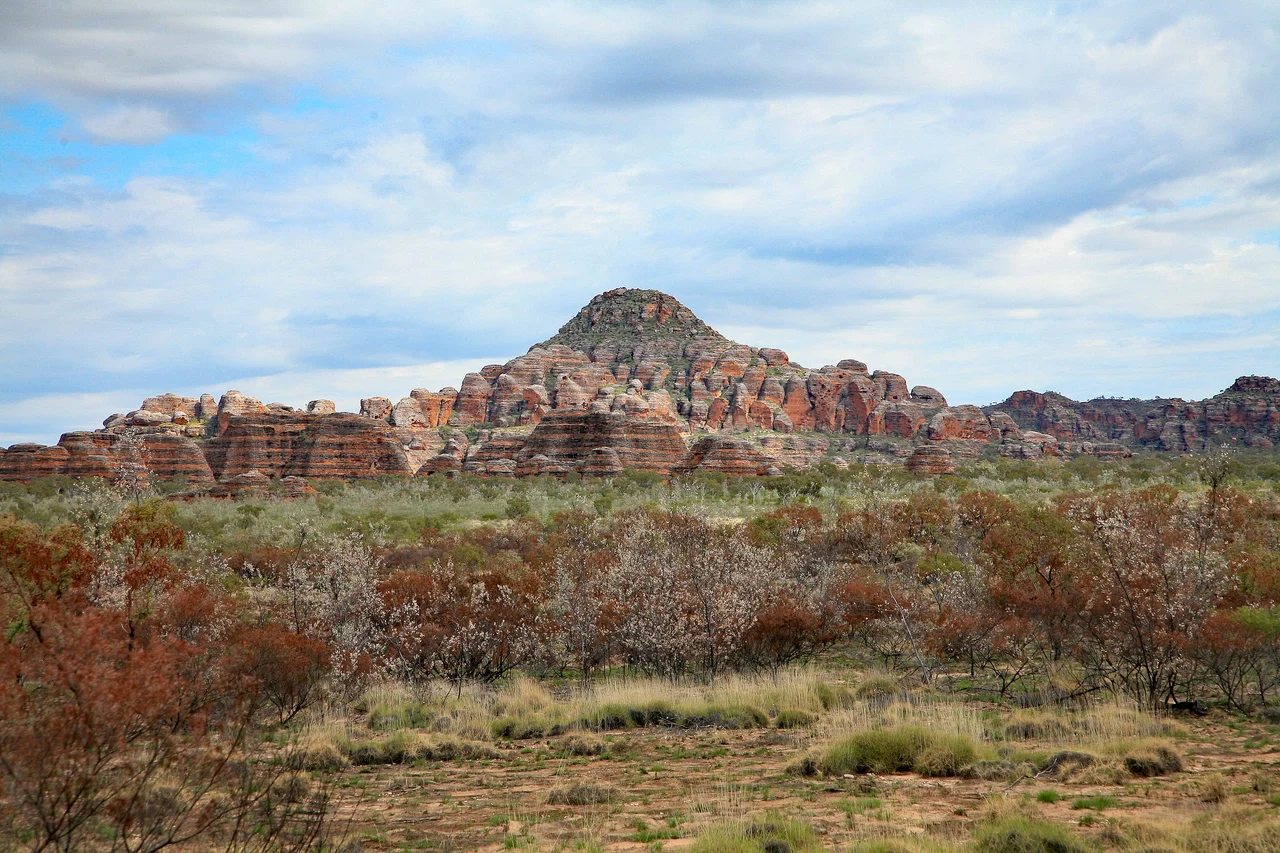
Rock That Remembers Everything
To understand the Kimberley's landscape, you need geological time. From 2.5 billion years ago the Kimberley craton — a raft of ancient crust that somehow survived unbroken — collided with a larger mass to the south. The collision took a billion years and raised mountains. The ground then subsided, seas moved in, and sandstone and limestone built up in layers that were subsequently heaved back into a plateau. Later episodes of erosion cut down through that plateau, carving the fantastically weathered gorges that define the region's character today: Bell Gorge, Windjana Gorge, Echidna Chasm, and dozens more, each one a vertical cross-section through deep time. The result is a landscape of vast ochre savannah plains interrupted by sudden, steep lines of ancient rock.
Three Seasons That Dictate Everything
The Kimberley runs on monsoon time. The Wet, from December to April, is when the rain comes — and it comes hard, turning unsealed roads into rivers and creeks into churning torrents. Many facilities close. Cyclones become possible. The Buildup in October and November is the most punishing season: 40-degree heat, stifling humidity, and spectacular lightning storms that build into enormous thunderheads each afternoon without delivering meaningful rain. Then comes the Dry, April through September: six months of blue skies, days at 30 degrees and nights at 15, roads open, wildlife concentrated around waterholes. This is when to visit — though you will pay for it, and so will the 40,000 people who live here year-round, mostly clustered in four towns scattered across a territory the size of Germany.
The Art in the Rock
The most extraordinary inheritance of the Kimberley's Aboriginal cultures is its rock art. Thousands of paintings and etchings cover surfaces across the region, ranging from small intimate panels to vast gallery walls. The best known are on the Mitchell Plateau: the Gwion Gwion figures — also called Bradshaw Figures — elegant and enigmatic, show human forms in postures that suggest ceremony and movement. The Wandjina figures, with their enormous eyes and halo-like headdresses, remain sacred to the Wunambal Gaambera people and are still ritually repainted by traditional custodians. Some art has been removed to museums, some has been stolen or defaced. The in-situ examples sit in remote country guarded by the people whose ancestors made them.
Getting There and Getting Around
The distances in the Kimberley are formidable and the roads demand respect. From Perth to Broome is 2,360 kilometres along the coast, or 2,050 kilometres inland. Once inside the region, the Great Northern Highway runs sealed from Broome through Fitzroy Crossing, Halls Creek, and Kununurra to Wyndham — just over 1,000 kilometres of reliable all-weather road. Gibb River Road, the legendary track from Derby to Wyndham, looks like a shortcut on the map. In the dry season with a high-clearance 4WD it takes most of a week. In the wet, attempting it could cost far more than time. Beyond the sealed highways, filling stations and mobile phone coverage both disappear. This is country that still requires preparation, experience, and a willingness to be genuinely alone.
From the Air
Coordinates: 16.00°S, 126.00°E — central Kimberley. The region spans roughly from Broome (17.96°S, 122.23°E) in the west to Kununurra (15.78°S, 128.73°E) in the east, covering an enormous swath of northern Western Australia. Principal airports: Broome International (YBRM), Kununurra (YPKU), Derby (YDBY). Scenic flights operate out of Kununurra over the Bungle Bungles and Purnululu, and out of Broome over Horizontal Falls. Flying over the Gibb River Road corridor reveals a procession of gorge systems and rock formations best appreciated from altitude.
Nearby Stories
- Charnley River–Artesian Range Wildlife Sanctuary 41 km away
- Spider Crater 44 km away
- Drysdale River National Park 77 km away
- Axis Naval Activity in Australian Waters 77 km away
- The Speewah 109 km away
- Mitchell Falls 117 km away
- Montgomery Reef 136 km away
- Argyle Diamond Mine 200 km away