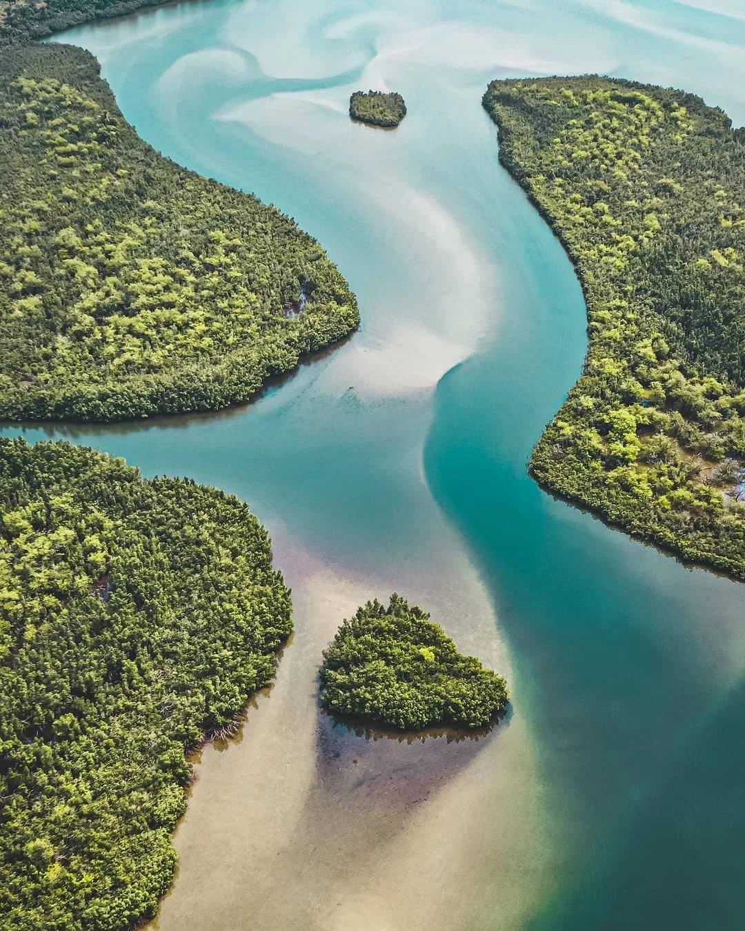

Lake Piso
The name means "pigeon's hole." Long before it appeared on any nautical chart, the Vai people watched flocks of pigeons descend on this brackish water to drink, and they named the lagoon for the birds. Today it is called Lake Piso - also Lake Pisu, also simply Fisherman's Lake - and it spreads across western Liberia as the country's largest lagoon, an oblong sheet of water pressed between green hills and the open Atlantic. The pigeons gave it a name. The fishermen gave it a livelihood. And the world, eventually, gave it a designation: a wetland of international importance.
Where River Meets Tide
Lake Piso is not quite freshwater and not quite sea. It is brackish - a mingling of the two - because a single narrow inlet links the lagoon to the Atlantic, letting the ocean's tides breathe in and out across its surface. Rivers feed it from the land side: Mole Creek, the Mafa, and others draining the hills of Grand Cape Mount County empty their freshwater into the salt. The lagoon hugs the Cape Mount peninsula, the spit of land that carries the town of Robertsport on its seaward edge. The result is a shifting, in-between place, rich enough in life to support fishing villages along its shores and, beneath the rivers that feed it, something far harder than water - high-quality diamonds, washed down from igneous rock and trapped in the riverbeds.
Seaplanes and Pigeons
During the Second World War, the quiet lagoon found an unlikely role. Its broad, sheltered surface made an ideal landing strip for aircraft that needed no runway, and Lake Piso became a base for Allied seaplanes - flying boats setting down on water that had known only fishing canoes. The war moved on, the seaplanes left, and the lagoon returned to the birds. In 1999 a nature reserve was established here, and in 2003 the Lake Piso wetlands - some 76,000 hectares of water, marsh, and mangrove - had become Liberia's first and only Ramsar site, a wetland recognized worldwide for the life it shelters. It remains an Important Bird Area, the pigeons of its name joined by countless other species drawn to the meeting of river and sea.
The Lake That Took the Mourners
Water this useful is also water that can turn. On the nights of December 13 and 14, 2002, an overcrowded wooden ferry named the Papa Friends 2000 was crossing the lagoon near the mouth of the Mafa River. Aboard were roughly 200 people, most of them returning from the funeral of a local footballer - a community gathered in grief and now gathered, by terrible chance, in one fragile boat. The ferry capsized in the dark. Only 15 people were pulled from the water alive. The rest drowned. The lagoon that fed the villages and welcomed the seaplanes had, in a single night, swallowed a town's worth of mourners on their way home from saying goodbye to one of their own.
Homeland of the Vai
The land around Lake Piso is Vai country, and has been for generations. The Vai are remembered far beyond Liberia for an extraordinary achievement: in the early nineteenth century, one of them, Momolu Duwalu Bukele, developed a writing system - a syllabary of their own design, one of the few indigenous scripts created in Africa in modern times. To live beside Lake Piso is to live in a place layered with meaning: a lagoon named by people who read the sky for pigeons, who built their own letters, and who still cast their nets where the rivers run into the tide. The water keeps its rhythm, in and out with the Atlantic, indifferent and essential, the heart of a corner of Liberia that the wider world rarely sees.
From the Air
Lake Piso sits at roughly 6.74 degrees north, 11.25 degrees west, in Grand Cape Mount County, western Liberia, just inland of the town of Robertsport. From the air the lagoon reads as a long, oblong sheet of water hugging the Cape Mount peninsula, separated from the Atlantic by a thin coastal spit and connected by a single narrow inlet - a striking contrast of dark lagoon, white surf, and green hills. The nearest major airport is Roberts International (GLRB) near Monrovia, about 70 km southeast. Conditions follow a tropical monsoon pattern: clear, hazy dry-season skies from January to March, and heavy overcast with intense rain through the long wet season.
Nearby Stories
- Hotel Africa 15 km away
- Mount Coffee Hydropower Project 40 km away
- Tiwai Island 58 km away
- Mattru Jong 68 km away
- Ducor Hotel: Africa's Five-Star Ruin 71 km away
- Bonthe District 101 km away
- The Niger River: The Boomerang That Built Empires 231 km away
- Rocas Atoll 2686 km away