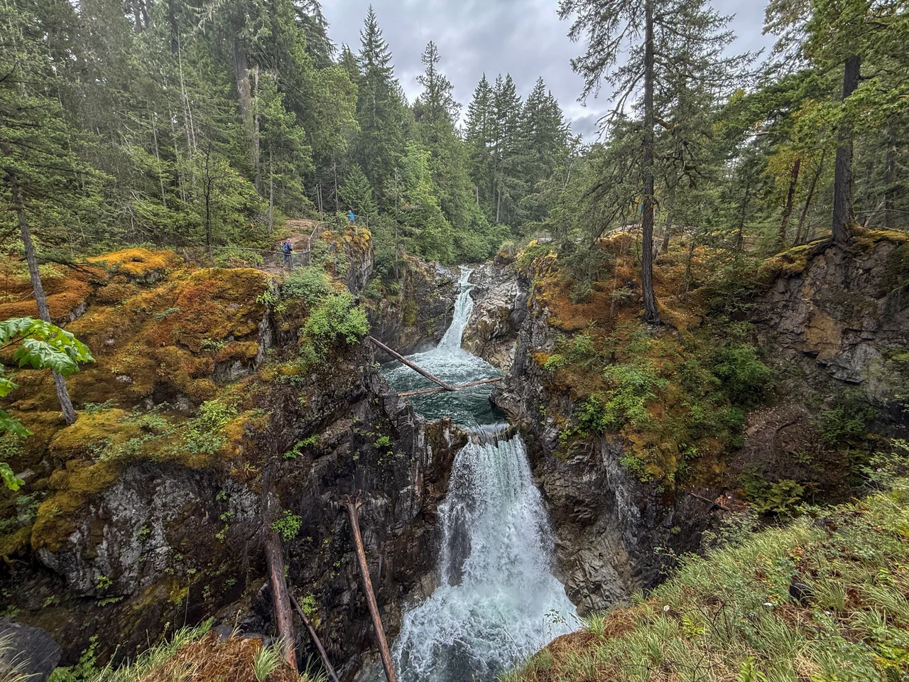

Little Qualicum Falls Provincial Park
Everything has one way out. Rain that lands on the eastern flank of Mount Arrowsmith gathers into the Cameron River, pools in Cameron Lake for a while, and then leaves at the lake's eastern end as the Little Qualicum River - which promptly runs out of patience with flat ground and starts falling. The result is a staircase of water dropping through a rock gorge under a canopy of enormous trees, and a provincial park built around the sound it makes. Little Qualicum Falls is the kind of place Vancouver Island produces almost casually: not a destination people fly across continents for, just 440 hectares of forest, river and noise, fifteen minutes from a small seaside town, with a railway running through the middle of it.
The Trees They Kept
The park was established in 1940, and the reason was the Douglas-fir. In the British Columbia of that decade, the case for leaving a stand of big timber alone had to be argued against a forest industry at the height of its confidence, and the arguments that worked were usually about scenery rather than ecology. Little Qualicum Falls won on both counts: a genuinely spectacular gorge wrapped in genuinely old trees. Four years later, down the same highway on the western shore of the same lake, the timber baron H.R. MacMillan donated 136 hectares of ancient Douglas-fir that became Cathedral Grove - the only highway-accessible protected old-growth Douglas-fir forest in the province, with individual trees more than 800 years old and nine metres around. Cathedral Grove takes the tour buses. Little Qualicum Falls, which got there first, keeps most of its quiet.
Six Kilometres of Trail and a Gorge
The park straddles the Little Qualicum River and maintains about six kilometres of walking trail within its boundary, which is enough to see everything and not enough to get lost. The route loops past upper and lower falls where the river has cut down into bedrock, leaving a narrow gorge of wet dark rock, moss ledges and pools that hold their colour even under grey sky. Spray keeps the air cold near the drops. Campgrounds and day-use areas sit back in the trees, swimming holes form where the river slows, and the fishing is the usual coastal-island mix. It is a park designed around a single sustained experience - walking beside falling water under old forest - rather than around any one viewpoint.
Wind Between Two Mountains
Cameron Lake behaves like a wind tunnel, because in effect it is one. Mount Arrowsmith rises to the south, Mount Horne and Mount Wesley to the north, and the valley between them accelerates whatever air is moving through. By afternoon on a summer day the lake surface goes from glass to whitecaps, and sailboarders who know the timing show up for it. The lake has its own folklore to match. Locals tell stories of Cammie, something large seen moving beneath the surface, and there is a persistent, unverified belief that underwater tunnels connect Cameron Lake to Horne Lake to the northeast. Neither claim has survived scientific scrutiny. Both have survived everything else, which is generally how lake monsters work. What is definitely in the water is rainbow trout, cutthroat and kokanee.
The Line to Port Alberni
A railway runs through the park. The Island Rail Corridor's Port Alberni branch threads the shore of Cameron Lake and passes through the protected forest on its way over to the Alberni Valley - a line built to move timber and people across the island's mountainous spine, long before Highway 4 made the trip routine. Rail service on the island has been intermittent for years, and the corridor's future has been argued over at length, but the grade is still there: a narrow shelf cut into hillside above the water, running beneath trees that were already centuries old when the surveyors arrived. Walk the trails at Little Qualicum Falls and you are moving through three eras of the same landscape at once - the old forest, the railway that was built to take it away, and the park that decided a piece of it should stay.
From the Air
Located at 49.285 N, 124.599 W on central Vancouver Island, British Columbia, at the eastern end of Cameron Lake roughly 15 km east of Port Alberni. The lake is the landmark: a narrow, dark, steep-sided body of water aligned roughly east-west along the Highway 4 corridor, with the Little Qualicum River leaving its eastern end and running northeast to the Strait of Georgia at Qualicum Beach. Mount Arrowsmith (about 1,819 m) dominates the southern side of the valley and is the best single fix in the area; Mount Horne and Mount Wesley form the northern wall. Recommended viewing altitude is 4,500-7,000 ft MSL to keep the whole Cameron valley and the Arrowsmith massif in frame. Nearest fields are Qualicum Beach Airport (CAT4) roughly 20 km northeast, Nanaimo (CYCD) about 45 km southeast, and Comox (CYQQ) some 60 km north; a small regional strip also serves the Alberni Valley to the west. Expect strong afternoon channelling winds along the lake axis in summer and significant mechanical turbulence near the Arrowsmith ridgeline; low cloud commonly caps the pass between the east coast and the Alberni Valley.
Nearby Stories
- Irvine's Landing 7.6 km away
- Canadian Forces Maritime Experimental and Test Ranges 8.5 km away
- Forbidden Plateau 17 km away
- Sandy Island Marine Provincial Park 17 km away
- Barkley Sound 18 km away
- Ladysmith Harbour 23 km away
- Kildonan, British Columbia 28 km away
- Comox Glacier 31 km away