Lusaka–Livingstone Road
On any given morning a truck leaving Cape Town can, in theory, drive itself north all the way to Cairo. The road exists, in pieces, under a United Nations designation called Trans-African Highway 4. One of those pieces is the T1 in southern Zambia, a 430-kilometre stretch connecting Lusaka to Livingstone and, with it, to Victoria Falls. That road carries tourists, commuters, and the ordinary freight of a landlocked economy: sugar from Mazabuka, timber from Choma, and maize trucked from subsistence farms on the plateau. It also carries traffic that started in Windhoek and Cape Town and Gaborone. A single lane each way, it tries to be too many things at once.
Where the T1 Begins
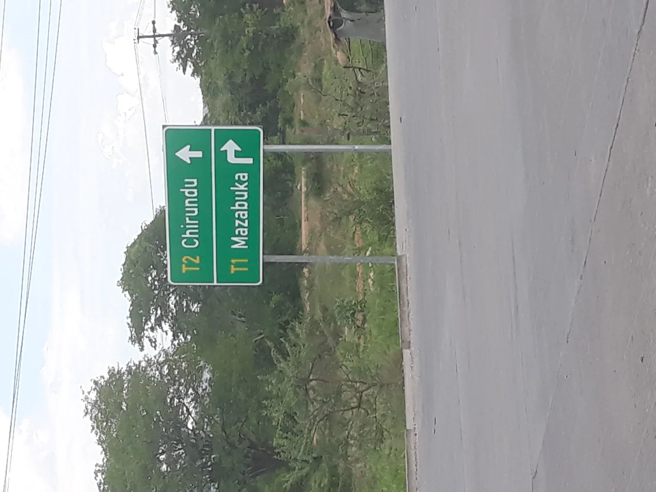
The road does not actually start in Lusaka. It begins 55 kilometres south of the capital, 10 kilometres south of the town of Kafue, at a T-junction called Turnpike in Chikankata District. Here the T1 branches off from the T2, the road that leads north to Lusaka and onward toward the Copperbelt. Just beside the junction is the Kafue Weighbridge, where heavy trucks are assessed and, sometimes, reassessed. For the next 68 kilometres the T1 runs westwards to Mazabuka, the sugar town on the edge of the Kafue Flats. It enters from the north, turns west at ABSA Bank in the centre, turns north again at the Mazabuka Police Station, and from that point it is one continuous road until Livingstone, nearly 400 kilometres on.
Through the Southern Plateau
From Mazabuka the road bends west and then southwest through Magoye settlement to Monze, another 60 kilometres on. Past Monze it runs south for 35 kilometres through Chisekesi, where the D375 branches east toward Gwembe and Lake Kariba, to reach Pemba. From Pemba another 60 kilometres through the small settlement of Batoka, past the Daniel Munkombwe Toll Plaza, brings the traveller to Choma, the capital of Southern Province since 2012. At Choma the T1 meets the M11, which runs west to Namwala and the Itezhi-Tezhi Dam. Sixty more kilometres southwest reaches Kalomo, once the first administrative centre of the former North-Western Rhodesia. A turnoff at Kalomo leads to the southern gate of Kafue National Park, Dundumwezi. From there the road bends southwest through Zimba and onward into Kazungula District toward the Kebby Musokotwane Toll Plaza, and finally to Livingstone and the falls.
A Road That Used to Be Called Something Else
This was once the Great North Road. Before 1935, Livingstone was the capital of Northern Rhodesia, and the road connecting Lusaka to Livingstone was understood as the southern extension of the colony's main north-south artery. Then the capital moved. Lusaka became the seat of government, and Northern Rhodesia's mapmakers redefined their geography accordingly. Lusaka became the southern terminus of the Great North Road, and the stretch south of it, the Lusaka–Livingstone road, was reclassified as something separate. A shift of capital can reshape how a road is understood even before a single kilometre of asphalt changes. Today the road shares its route with the Walvis Bay–Ndola–Lubumbashi Development Road, a regional corridor designed to move Zambian and Congolese copper to the Atlantic coast through Namibian ports. The traffic reflects that dual role: tourists heading for Victoria Falls pass cement-mixer trucks carrying materials for Angolan infrastructure projects.
One Lane Each Way
The T1 is one lane in each direction, which is to say, by international standards, it is barely adequate for the role it plays. Heavy trucks from Botswana, Namibia, and South Africa funnel through on their way to Lusaka, from which they fan out to Tanzania, Malawi and the Democratic Republic of the Congo. The road is often busy, and jams of trucks, buses, and passenger vehicles are common. When trucks break down, which happens, the knock-on delays propagate for hours. Plans for a dual carriageway surface in national budgets and government speeches with some regularity. Meanwhile the road carries on. It passes sugarcane fields around Mazabuka that stretch to the horizon, villages where children wave from the verges, long stretches of miombo woodland, and the broad open approach to Livingstone where the spray from Victoria Falls can be seen rising from 50 kilometres out on a still day. Cairo is a long way, but the road is trying.
From the Air
The Lusaka–Livingstone Road (T1) runs southwest for 430 km through Zambia's Southern Province, passing the approximate midpoint at 16.62°S, 27.33°E. From altitude the road traces a pale, almost dead-straight line through miombo woodland and the broad cultivated fields around Mazabuka. Kenneth Kaunda International (FLKK / FLLS) in Lusaka serves the northern end; Livingstone's Harry Mwaanga Nkumbula International (FLLI) serves the southern end near Victoria Falls. Best viewing altitude is 6,000–10,000 feet AGL; visibility is excellent in the dry season (May–October).
Nearby Stories
- Gwisho Hot-Springs 40 km away
- Rhodesia (region) 87 km away
- Itezhi-Tezhi Dam 99 km away
- Ingombe Ilede 103 km away
- Victoria Falls 148 km away
- Big Tree at Victoria Falls 172 km away
- Victoria Falls, Zimbabwe 191 km away
- 2017 Zimbabwean Coup d'Etat 363 km away