Itezhi-Tezhi Dam
The Kafue River has a rhythm older than any engineer. In the rainy season it swells across the wetlands of the Kafue Flats, swamping grasslands until lechwe antelope swim between the trees. Then it recedes, nutrients settle into the soil, and new grass rushes up to feed buffalo, cattle, and people. For centuries, villages moved with this breathing. In the 1970s, that rhythm met concrete. Between 1974 and 1977, a 62-meter dam rose at the Itezhi-Tezhi Gap, a narrow valley the river had spent millennia carving through a range of hills, and one of Africa's great floodplains began to change.
Why Here
The Kafue River, like most rivers in south-central Africa, is a creature of extremes. In flood it can run at twenty times its dry-season trickle. That is a problem for hydroelectric power, which needs steady flow, and a beautiful gift to the wetlands downstream, which need the opposite. The Kafue Gorge Upper Power Station, more than 260 kilometers below, could not hold enough water to even out the seasons. Engineers looked upstream for a reservoir site and found one in a gap of hills where the river narrowed between cliffs. Build a wall there, they reasoned, and you could capture the flood, then release it slowly to run turbines far to the east. The reservoir that filled behind the 1,800-meter crest now covers 390 square kilometers, flooding a slice of Kafue National Park along the way.
The Flats That Need Floods
Downstream, the Kafue Flats are a wetland designed by water. Grasses, fish, lechwe, sitatunga, and the people who graze cattle and move camps seasonally are all tuned to a March or April inundation that charges the soil with water and nutrients. The dam's designers knew this. They promised an annual "managed flood," a release of 300 cubic meters per second throughout March, to mimic the natural cycle. It was a humane design on paper. In practice, the reservoir has rarely held enough water at the right time, and the demand for electricity has almost always won. Erratic rainfall since 1990 has made the shortfall worse. Fish catches on the flats have declined. Lechwe and sitatunga have seen their breeding grounds disrupted. Grazing lands have shrunk, and woody shrubs now creep into floodplains that used to be pure grass.
A Second Wall, Forty Years Later
For its first three decades, Itezhi-Tezhi was a regulator only. The water that passed through it ran generators downstream, not here. In 2011, that changed. Construction began on a 120-megawatt power station on the dam itself, a 250-million-dollar project run by Itezhi Tezhi Power Company, a joint venture of Zambia's state utility ZESCO and TATA Africa, the continental arm of India's Tata Group. Sinohydro of China handled engineering and construction. Alstom of France supplied two 60-megawatt Kaplan turbines. In 2014, the African Development Bank, the Dutch bank FMO, the Development Bank of Southern Africa, and France's Propaco together loaned the Zambian government 142 million US dollars to fund roughly half of it. By February 2016, the turbines were spinning. Zambia had turned a reservoir into a second generator.
Picture from Space
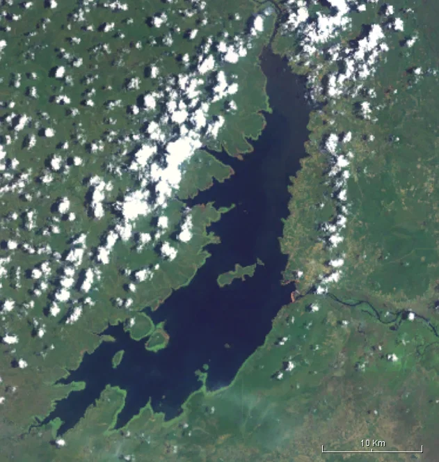
A pair of NASA satellite images taken one year apart in the middle of the dry season tell the story in a single glance. In the first, the Kafue Flats are brown and dry, a single squiggle of main channel running left to right across the frame. In the second, taken after the 2003 to 2004 rainy season when the dam actually opened its floodgates, green floods across the image. More of the flats remain inundated. More vegetation grows. More fish, more lechwe, more grazing. In June 2004, following the release, Zambian authorities agreed with the hydropower company to restore more natural flood releases. That agreement has held imperfectly ever since, a slow negotiation between megawatts and meadows, kilowatt-hours and herbivores. The dam is neither villain nor hero. It is a decision, made and remade, about what a river is for.
Standing at the Gap
The town of Itezhi-Tezhi sits on the east side of the wall, a service community that grew up with the dam. West of the dam, the reservoir stretches for kilometers, its calm surface hiding the drowned course of the Kafue. North and south lie the rolling woodlands of Kafue National Park, some of Zambia's best wildlife country. The dam itself is an unglamorous length of concrete sized for its job. But to stand at the crest is to stand between two systems: the controlled pool on one side, the ancient flood-and-drought cycle on the other, and between them the ongoing argument about which one the future belongs to.
From the Air
Itezhi-Tezhi Dam sits at 15.76 degrees South, 26.02 degrees East, on the Kafue River in west-central Zambia. From 4,000 to 8,000 feet above ground, the long, narrow reservoir reads as a dark vein winding through miombo woodland, with the dam crest a bright line at its eastern end. Lusaka's Kenneth Kaunda International (FLKK) lies roughly 300 kilometers east-southeast. Best light for photography is mid-morning. Haze builds over the Kafue Flats later in the day during the dry season from August through October.
Nearby Stories
- Kafue Flats 39 km away
- Macha Mission 49 km away
- Kafue National Park 57 km away
- Southern Province, Zambia 103 km away
- Lusaka 168 km away
- Kabompo 260 km away
- Barotse Floodplain 308 km away
- Chobe National Park 324 km away