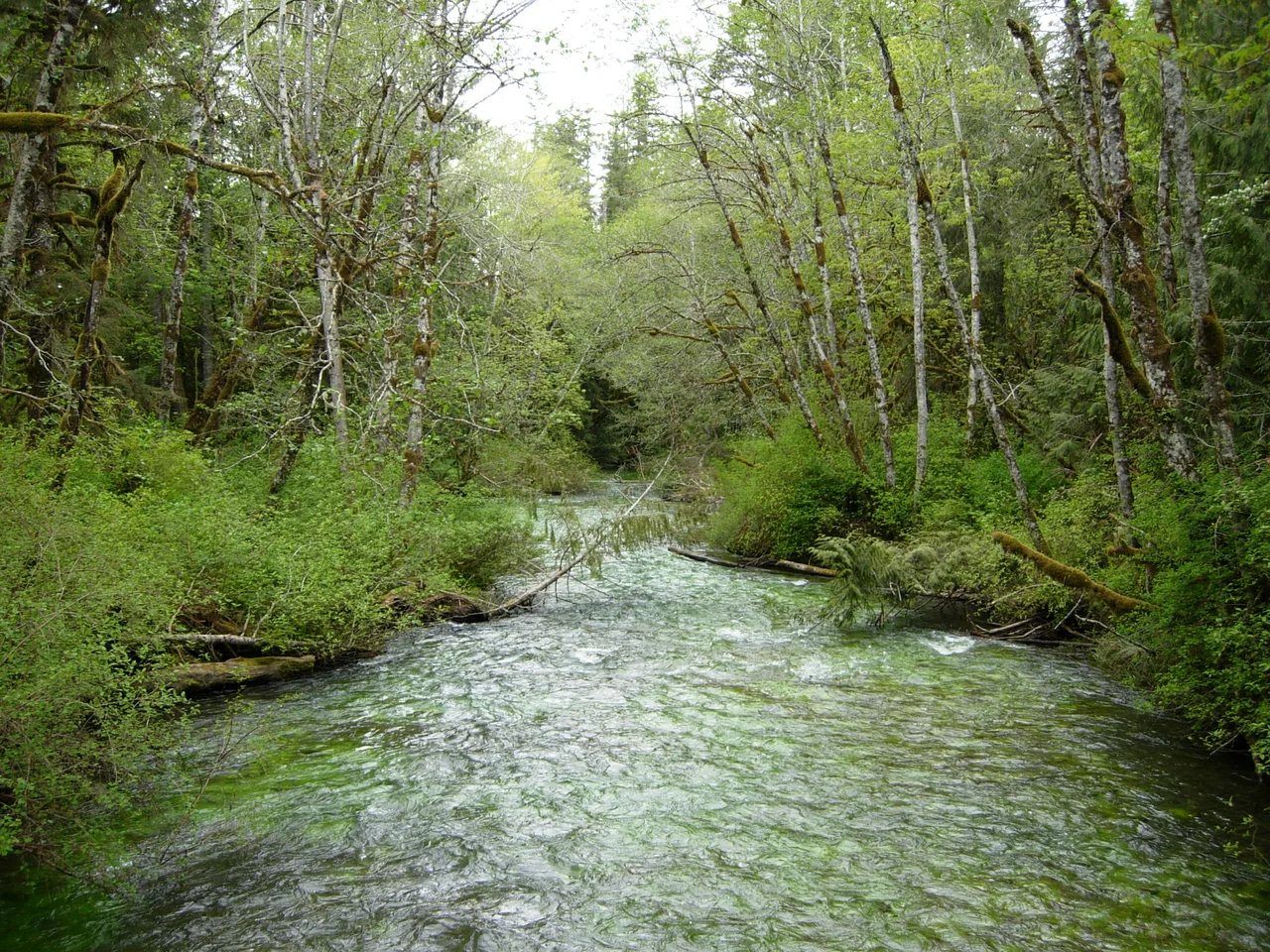

Lyre River
For most of its existence, the lake behind this river drained the other way. Geologists believe Lake Crescent once emptied east through Indian Creek into the Elwha system, until a mountainside came down roughly eight thousand years ago and blocked the outlet. The impounded water rose by as much as eighty feet and went looking for another exit. It found a notch at the northwest end, spilled through, dropped over a set of falls a few miles down, and ran to the sea. The Lyre River is what that accident became — barely five miles of green water between a lake and the Strait of Juan de Fuca, and the reason a fish found nowhere else on Earth has stayed that way.
Singing Waters, and Other Names
The people who lived along it heard music in it. Their name for the river is usually rendered in English as "singing waters," and anyone who has stood near the falls in spring runoff understands the description — the sound arrives before the river does, a steady roar filtered through hemlock. Europeans took two passes at naming it. In 1790 the Spanish pilot Gonzalo López de Haro marked it Rio de Cuesta on his charts. Fifty-seven years later Captain Henry Kellett, surveying this coastline for the Royal Navy, redrew the map and wrote down River Lyre. The English name stuck, though nobody is entirely certain whether Kellett meant the instrument, the constellation, or simply liked the sound of it. What survived the renaming, at least in translation, was the older idea: this is a river you hear.
The Trout That Cannot Go Home
Three miles up from the mouth, the Lyre drops over Lyre River Falls. Fish coming in from saltwater cannot climb it. That single barrier has divided the river into two separate worlds for thousands of years. Below the falls, the Lyre behaves like any healthy Olympic stream, holding coastal cutthroat trout along with both winter and summer steelhead. Above the falls, isolation did what isolation does. Sea-run fish trapped in Lake Crescent when the outlet shifted evolved into something distinct — the Beardslee trout, a landlocked rainbow that exists in this one lake and nowhere else, and that spawns almost entirely in the first few hundred feet of river below the lake outlet. It is a startlingly narrow piece of real estate on which to rest an entire lineage. Siltation and the loss of the log jams that shelter its redds are the standing worries; a few hundred feet of gravel is not much margin for error.
The Eastern Edge
Rivers make convenient boundaries, and the Lyre served as one. The Makah, whose territory ran west to Cape Flattery and the open Pacific, regarded this river as their eastern limit. Klallam people lived along it too, including at the fishing village of Kwahamish near the water. Their account of how the landscape came to be does not contradict the geologists so much as tell the same event differently: Mount Storm King, angered by tribes warring below, threw down a boulder that split a single lake in two — Sutherland on one side, Crescent on the other. Scientists studying the lake bottom have since found evidence of a massive rockslide off Storm King around 1100 BCE, one large enough to have thrown a wave up the far shore. Two systems of knowledge, one falling mountain.
Gettysburg, Population 65
By the early 1890s the settlers had arrived. John Smith held a claim at Piedmont; John Hanson and his wife, Mary Laeger Hanson, homesteaded up near the river's head. On the east bank at the mouth, Robert Getty founded a logging town and gave it a name borrowed from a Pennsylvania battlefield. Gettysburg, Washington, lasted from 1889 into the 1920s. It had a post office and, at the 1910 census, sixty-five residents — small even by the standards of a coast where towns existed as long as the nearest timber did, and then did not. Nothing of it stands. The Washington Department of Natural Resources now runs a campground near the same ground, and the river goes out through Low Point into the strait the way it has since the mountain fell.
From the Air
The Lyre River meets saltwater at 48.161°N, 123.829°W, at Low Point on the north coast of the Olympic Peninsula. Best viewed between 1,500 and 3,500 feet on a track running east–west along the Strait of Juan de Fuca. The river is short and easy to trace: follow the dark crescent of Lake Crescent — unmistakable from the air, a long blue arc pinched between forested ridges roughly six nautical miles inland — and the Lyre is the single outflow leaving its northwest end and running almost straight north to the water. Low Point makes a small blunt nose on an otherwise smooth shoreline. William R. Fairchild International (KCLM) at Port Angeles lies about 15 nautical miles east and is the obvious diversion; Victoria International (CYYJ) is roughly 20 nautical miles north across the strait on Vancouver Island, and Quillayute (KUIL) sits southwest on the outer coast. Expect strong westerly flow funneling down the strait, rapid fog incursions off the Pacific in summer, and the Olympic ridgeline rising sharply to the south — Mount Storm King stands directly above the lake's south shore and turns the valley into terrain you do not want to explore in low visibility.
Nearby Stories
- Sheringham Point Light 4.1 km away
- Ogden Point 8.4 km away
- Makah Museum 11 km away
- Ozette Lake 13 km away
- Destruction Island 16 km away
- Hurricane Ridge 17 km away
- Olympic: Where Rainforest Meets the Wild Pacific 24 km away
- United States Naval Undersea Museum 59 km away