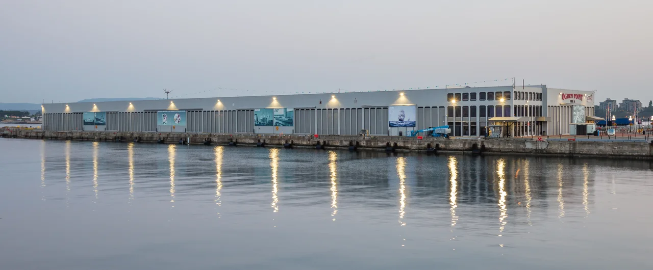

Ogden Point
Directly below the berths where cruise ships the size of city blocks tie up in Victoria, there are giant Pacific octopus. Wolf eels too, along with kelp forest, anemones, nudibranchs, and enough fish and crustaceans that divers travel considerable distances to get in the water here. The cold-water diving at Ogden Point is world-renowned and starts at almost no depth at all - which makes this one of the few places on Earth where a passenger disembarking for an afternoon of tea and gardens is stepping over an octopus.
Built for a Canal Six Thousand Kilometres Away
The piers went in during the early twentieth century, built by the City of Victoria on a bet. The Panama Canal was coming, and with it - everyone assumed - a surge of shipping that would want a deepwater stop near the top of the Pacific coast. The point took its name from Peter Skene Ogden, the Hudson's Bay Company trader and explorer who lived from 1790 to 1854 and whose reach through this country long predated any canal. By 1916 the US Hydrographic Office's Coast Pilots guide was referring to the new works simply as the "Ocean Docks," and noting that a breakwater south of Pier A had been under construction the previous year. Today the facility covers 12 hectares with two finger piers, Pier A to the south and Pier B to the north.
Ten Thousand Blocks of Granite
The breakwater itself is the real structure here: 762 metres of granite and concrete reaching out into the Strait of Juan de Fuca, finished in 1916. More than ten thousand granite blocks went into it, quarried on Hardy Island up the coast, some weighing as much as fifteen tons, stacked in a nine-course pyramid with over a million cubic yards of rock supporting the whole arrangement. For most of a century it was a working wall that people walked at their own risk. Aluminum railings strung with stainless cable went up in 2013, and the walk out to the lighthouse at the end became one of the most reliably spectacular short walks in the city - open water on one side, the Olympic Mountains across the strait, and pilot boats running out to Brotchie Pilot Boarding Station to put pilots aboard inbound ships.
Na'Tsa'maht
The inner face of the breakwater is a canvas. Beginning in 2009 the Greater Victoria Harbour Authority sponsored the Unity Wall Mural - Na'Tsa'maht - honouring the traditions and history of the Salish Nations whose territory this shoreline has always been. Established First Nations artists worked the wall alongside young artists they were mentoring, and the result stretches along the granite in blocks of colour and form that face inward, toward the city, rather than out toward the ships. It is worth noticing what the placement does. Visitors arriving from a cruise liner walk past Coast Salish work on their way into a town whose tourist iconography is otherwise heavily British.
The Busiest Port of Call in Canada
Victoria's position - the southern tip of Vancouver Island, at the entrance to the Strait of Juan de Fuca, an easy run from both Vancouver and Seattle - made it inevitable as a cruise stop. In 2001 the Norwegian Sky came in from Seattle as the first weekly cruise vessel to call here. By 2018 the terminal was scheduled for 245 ship visits between late April and early October, drawn from ten cruise lines, with more than twenty vessels each carrying up to 3,000 passengers, making it the busiest port of call in Canada. Most are single-day or evening stops by ships running the Alaska route out of Seattle, Los Angeles, or San Francisco. Passengers pour off toward Butchart Gardens, Craigdarroch Castle, whale-watching boats, Chinatown, and afternoon tea at the Empress, either on the shuttle or on foot - downtown is a thirty-minute walk along the water. The port also repairs and supplies ships, including deep-sea cable layers, and a heliport at Camel Point runs frequent service to Vancouver and Seattle.
Reef Balls and Currents
In 2008 several groups of reef balls were placed off the breakwater to study how species migrate outward from the wall - a quiet piece of marine research sitting beneath one of the busiest working waterfronts on the coast. The diving is genuinely excellent and genuinely demanding: currents run hard through here, and the hazards are the ordinary ones of open water made sharper by traffic and cold. Local operators recommend a guided discovery dive before anyone strikes out alone. There is also a public boat ramp for trailerable boats, run by the harbour authority, where the launch fee includes parking when there is any to be had.
From the Air
Ogden Point occupies the southwestern corner of Victoria at 48.4150°N, 123.3900°W, at the eastern entrance to Victoria Harbour on the Strait of Juan de Fuca. It is one of the easiest landmarks on this coast to spot from the air: a 762-metre granite breakwater angling out from shore with a lighthouse at its tip, two finger piers behind it, and frequently one or more large cruise ships alongside. Dallas Road traces the shoreline east toward Beacon Hill Park, and Victoria's Inner Harbour with the Parliament buildings and Empress Hotel lies just northeast. Recommended viewing altitude is 1,500-3,000 ft MSL for the breakwater and piers, or 7,000-9,000 ft to frame the whole southern tip of Vancouver Island against Washington's Olympic Peninsula across the strait. Victoria International (CYYJ) sits roughly 13 nm north, Victoria Inner Harbour Water Aerodrome (CYWH) about 1 nm northeast, and William R. Fairchild International (KCLM) at Port Angeles about 18 nm south across the water. Watch for heavy floatplane and helicopter traffic around the harbour and the Camel Point heliport. Summer brings excellent visibility; marine fog can close the strait quickly in late summer mornings.
Nearby Stories
- Lummi Island 1.9 km away
- Koksilah Ridge 2.6 km away
- Deception Pass Bridge 4.4 km away
- Gettysburg, Washington 5.7 km away
- Otter Point, Greater Victoria 5.9 km away
- Whidbey Island 9 km away
- Pender Island 11 km away
- Hurricane Ridge 28 km away