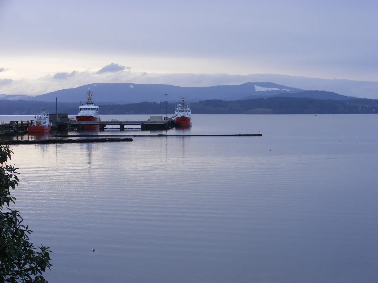

Koksilah Ridge
In Quw'utsun tradition, the first man fell from the sky onto this ridge. Syalutsa came down on Hwsalu'utsum - the multi-summit rise that settlers later labelled Koksilah Ridge - and the creeks that spill off its flanks have carried that story downhill ever since. From the Saanich Peninsula, forty kilometres of water and farmland away, the ridge reads as a long plough blade laid against the western sky, gentle-sloped and unspectacular, easy to overlook. It is the kind of landform you stop seeing after a week of living beneath it. Which makes it strange to learn how much depends on it: three creeks, a salmon river, a century of logging, and an argument about water that British Columbia is still trying to settle.
Plough-Shaped on the Horizon
The summit stands about 892 metres above the sea it overlooks, which on Vancouver Island counts as middling. Height is not what makes the ridge visible. Position is. Koksilah Ridge sits just south of the Cowichan Valley with nothing substantial in front of it, so it fills the western view from most of the valley floor and from the Saanich Peninsula north of Brentwood Bay. Look west from North Saanich or Sidney across Saanich Inlet on a clear March afternoon and the shape resolves: long gentle slopes running up to a blunt crown, more agricultural than alpine in its proportions. Snow behaves oddly on it. In a hard winter it can lie on the upper slopes for six months; in a mild one it shows for a handful of days and is gone.
Three Ages of Rock
Walk the ridge from north to south and you cross a great deal of time. The northern ground is Cretaceous sedimentary rock - shale, sandstone, conglomerate, the compressed leavings of ancient seafloors. Above that sits a pluton of Jurassic granodiorite, a body of coarse igneous rock that cooled deep underground long before the sediments above it existed, and it is this harder mass that holds up the summit. Around the eastern, southern and western margins of the pluton lies something older and more chaotic still: a Pennsylvanian-age jumble of argillite, greywacke, chert and diabase, assembled from fragments that arrived here by the slow violence of plate tectonics. The soils on top of all of it are thin and fast-draining - gravelly sandy loams that shed rain almost as quickly as the coast delivers it.
The Grin
The forest is Coastal Western Hemlock, Douglas-fir and hemlock crowding the lower slopes, amabilis fir joining them above 700 metres where the climate turns moister. Very little of it is old. The timber industry has worked Koksilah Ridge for generations, and the native forest is broken by clear cuts of every size and vintage, most of them invisible from the valley until snow arrives and paints them white against the dark canopy. Residents watched one such cut for years. A grin-shaped patch of young second growth on the southern slope was logged off in 2008, showed brown through that summer, took its first snow in December, and by 2015 had greened over again - a full cycle of industrial forestry played out on a hillside in plain view of Duncan. Island Timberlands holds the tenure. West of the summit, at about 730 metres, sits Lois Lake, a small man-made body of water ringed by logging roads; fishless as of 1988 for want of anyone to fish it, it appeared on a 2020 list of lakes scheduled for stocking with rainbow and cutthroat trout.
Where the Water Starts
Wild Deer Creek, Kelvin Creek and Glenora Creek all begin on these slopes and feed the Koksilah River - Xwulqw'selu in Hul'q'umi'num - which runs down through the valley to the sea. In recent summers that river has nearly stopped. Flows drop to critical lows exactly when farms and industry want the most water, and salmon that have used the system for millennia arrive to find it too warm and too shallow. During one severe drought the province temporarily restricted industrial and forage-crop water use in the watershed to keep fish alive. Out of that pressure came something unprecedented: Cowichan Tribes and the province agreed to build a Water Sustainability Plan for the Xwulqw'selu watershed, the first in British Columbia, weighing storage, water rights, forestry and farming together rather than one at a time. In 2021 the province also established Hwsalu-utsum Park, 143 hectares near the river, named by Cowichan Tribes and protecting pockets of old-growth Douglas-fir, rare grassland and limestone. The ridge that the first man fell onto is, at last, being managed as if the story mattered.
From the Air
Centred at 48.70 N, 123.78 W on southern Vancouver Island, British Columbia, with a summit near 892 m (about 2,926 ft). The ridge is best identified from the east: fly the length of Saanich Inlet and Koksilah Ridge is the long, low, plough-profiled mass filling the western horizon behind the Cowichan Valley. Snow cover between December and March makes the clear cuts read as bright geometric patches and is the fastest way to confirm the ridge from altitude. The Cowichan Valley and the town of Duncan lie immediately north, Saanich Inlet and the Malahat to the east, and the Koksilah River drains northeast to Cowichan Bay. Recommended viewing altitude is 4,000-6,000 ft MSL - high enough to clear the terrain, low enough to pick out the logging-road network and Lois Lake about 1.3 km west of the summit. Nearest fields are Victoria International (CYYJ) roughly 40 km southeast, Nanaimo (CYCD) about 35 km north, and Victoria Harbour water aerodrome (CYWH) to the south. Expect mechanical turbulence on the lee side in a westerly and frequent low cloud caught on the summit when marine air pushes in off the Strait.
Nearby Stories
- Cassidy, British Columbia 3.8 km away
- Jordan River Dam 5.4 km away
- Swan Lake Nature Sanctuary 6.1 km away
- Portland Island (British Columbia) 6.2 km away
- Gulf of Georgia Cannery 18 km away
- Makah Museum 20 km away
- Carmanah Walbran Provincial Park 20 km away
- Alberni Inlet 27 km away