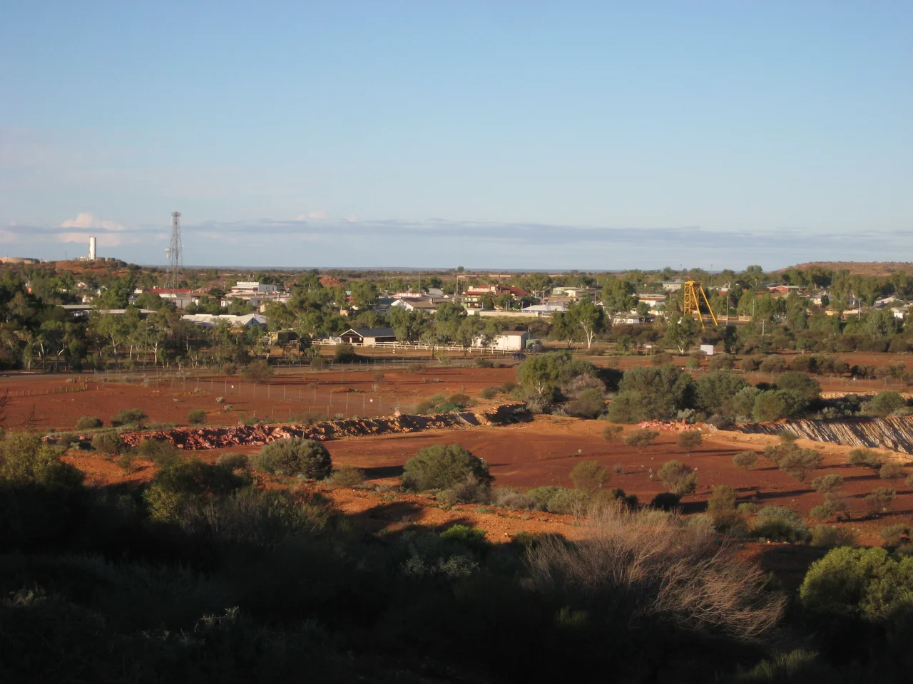

Meekatharra, Western Australia
The name is a small, dry joke that the land made first. In the Yamatji language, Meekatharra means 'place of little water' - and out here on the Murchison, 764 kilometres northeast of Perth, that is less a description than a warning. The country is hot, flat, and parched, the rivers mostly memories of rivers. Yet people have lived on it for tens of thousands of years, and a town of around 850 still holds on at the crossroads, a third of its residents of Aboriginal descent. Meekatharra is what the outback builds when it needs a place to gather: a supply centre, a railhead, a doctor's base, a point where the long roads finally meet.
Gold, and the Luck to Survive It
Like so much of inland Western Australia, Meekatharra owes its existence to gold and its survival to a second strike. The first settlement took root around 1894, and in May 1896 the prospectors Meehan, Porter and Soich found gold, drawing miners in from the other East Murchison fields. The rush was real but brief; the first field faltered fast. Only a fresh discovery in 1899 kept the place alive. The Meekatharra State Battery began crushing ore in 1901, and on Christmas Day 1903 the township was officially gazetted - a settlement that had nearly died twice before it was even legally a town. Gold has come and gone since, in booms through the 1980s and brief revivals that ended in administration, but that early double-or-nothing set the pattern.
The End of the Longest Road
In 1906, surveyor Alfred Canning was sent to carve a stock route from the East Kimberley down to the Murchison - the famous Canning Stock Route, a chain of 51 wells punched through some of the harshest desert in Australia, finished in 1910. When the railway reached Meekatharra in 1910, the town became the railhead at the route's southern end, the point where cattle driven for hundreds of waterless kilometres could finally be loaded onto trains. That same year the first wool shipment rolled out. The railway, more than the gold, is what truly kept Meekatharra alive, serving the pastoral stations until it closed in 1978. Today the cattle and sheep still come, but by road train now - those vast multi-trailer trucks that are the outback's lifeline.
A Doctor in the Sky
In a place this remote, distance is the deadliest condition of all, and Meekatharra answered it from the air. The town became a regional base for the Royal Flying Doctor Service, the legendary outback medical network that turns a light aircraft into an ambulance and a clinic, reaching stations and communities that no road could serve in time. Alongside it runs the School of the Air, which once taught children scattered across thousands of square kilometres by two-way radio. Both are quietly extraordinary institutions, born of the same hard arithmetic: when the nearest help is hundreds of kilometres away, you bring it on wings, or down a wire, or you do without.
A Strip Built for a War, and a Star Born Here
Meekatharra's airport began as a wartime project: Americans built its 2,181-metre runway during World War II, and the strip went on to find an unlikely modern role as an ETOPS diversion airport for transcontinental flights crossing into Australia - a desert bolt-hole for airliners that may never need it but must know it is there. The town has sent more than cattle and ore into the world, too. David Ngoombujarra, the acclaimed Indigenous actor of the Yamatji people, was born here in 1967 as David Starr; spotted busking in Sydney, he went on to win three Australian Film Institute Awards and roles in films such as Rabbit-Proof Fence before his death in 2011. From a place of little water, a great deal has gone out into the wider world.
From the Air
Meekatharra sits at 26.59 degrees south, 118.49 degrees east, in the Murchison region of Western Australia's Mid West, on the Great Northern Highway some 764 km northeast of Perth. Meekatharra Airport (ICAO YMEK) is a significant regional field with a sealed runway around 2,181 metres - long enough to serve as an ETOPS diversion airport for transcontinental traffic - and is the primary destination here, with Skippers Aviation operating services to Perth. From the air the town is a compact grid set against red Murchison plain, marked by the airport, highway, and the scars of historic and modern gold workings nearby. Best viewed at 4,000 to 8,000 feet. The climate is hot and dry with annual rainfall between roughly 200 and 250 mm and the driest stretch from August to November; visibility is typically excellent, though watch for dust and strong afternoon thermals.
Nearby Stories
- Wiluna Railway Line 12 km away
- Karalundi Community 27 km away
- Yarrabubba 29 km away
- Wilgie Mia 48 km away
- Mileura Station 87 km away
- Yeelirrie uranium project 99 km away
- Jack Hills 101 km away
- Gascoyne River 124 km away