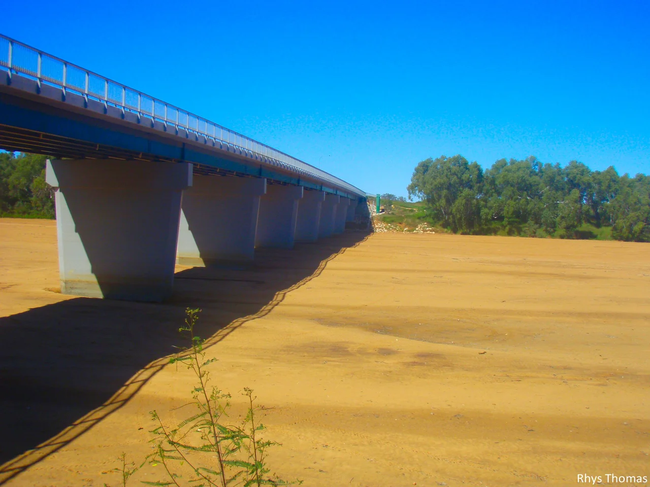

Gascoyne River
Stand on the bank of the Gascoyne River on a July afternoon and you may not see a river at all. What stretches in front of you is a broad ribbon of pale sand, baked hard and shimmering, with gum trees lining the edges as if to mark where water ought to be. The water is there. It is simply running beneath your feet, soaking through the sand in a slow underground current that locals call the upside-down river. At 865 kilometres, the Gascoyne is the longest river in Western Australia, and for most of the year its most important channel is the one you cannot see.
The River That Runs Underground
The Gascoyne flows on the surface for only about 120 days in an average year. The rest of the time it becomes a vast natural reservoir, an aquifer of water held in the sand grains below the dry bed. Towns and farms along its course tap that buried river through shallow bores, drawing up what looks for all the world like water conjured from desert. It is a strangely practical kind of magic: a river that vanishes from sight precisely so that the fierce inland sun cannot evaporate it. In a region where rain is rare and unreliable, the Gascoyne stores its wealth where the heat cannot reach.
When the River Returns
Then the rain comes, and the upside-down river flips right way up. In December 2010, a slow-moving low dumped more than 6,000 percent of the monthly average rainfall on the catchment in just four days. The Gascoyne rose until it crested at 15.53 metres near Fishy Pool, a wall of brown water that swallowed roads, paddocks, and homes. Downstream at Carnarvon, near the river's mouth on the Indian Ocean, entire houses were lifted off their stumps and carried away. Evacuation orders emptied towns. No people died, but an estimated two thousand head of cattle drowned, and the damage ran into the hundreds of millions. Five years later, Cyclone Olwyn struck in 2015 and brought the worst flooding since.
Carnarvon's Long Bargain With the Water
Carnarvon sits where the Gascoyne finally reaches the sea, and the town's whole existence is a negotiation with the river's moods. The same buried water that the floods unleash is what makes Carnarvon's plantations possible the rest of the year, irrigating banana and mango groves that seem impossible in such dry country. The river gives and the river takes. Locals know the rhythm in their bones: the dry months of drawing from the sand, the rare and dangerous weeks when the channel fills and the only safe ground is high ground. To live here is to keep one eye permanently on the weather upstream.
Naming a River You Cannot Always See
On 4 March 1839, the explorer Lieutenant George Grey became the first European to set eyes on the Gascoyne, and he named it for a friend in the Royal Navy, Captain John Gascoyne. The Aboriginal peoples of the region had known this watercourse for many thousands of years before Grey arrived, reading its dry bed and hidden flow as part of the country they belonged to. A European name went onto the map, but the river itself kept its older logic, surfacing and disappearing on a schedule no colonial map could capture. The Gascoyne still does exactly what it has always done, indifferent to whose name it carries.
From the Air
The Gascoyne River runs roughly east to west across the Gascoyne region of Western Australia, reaching the Indian Ocean at Carnarvon. A mid-channel reference point sits near 25.34 degrees south, 119.66 degrees east, inland toward Gascoyne Junction. From the air, the river is unmistakable in the dry season as a bright, sinuous band of white sand cutting through red-brown rangeland, even when no water is visible; in flood it widens dramatically into sheets of muddy water. The nearest major airfield is Carnarvon Airport (ICAO: YCAR) near the coast, useful for following the river inland. Visibility is typically excellent over this arid country. Best flown at low to medium cruising altitude, tracing the sand channel; after heavy rain or a cyclone, expect the floodplain to be inundated for many kilometres on either side.
Nearby Stories
- Murchison River 39 km away
- Peak Hill, Western Australia 53 km away
- Shoemaker Impact Structure 69 km away
- Collier Range National Park 72 km away
- Western Australia 102 km away
- Millbillillie Meteorite 110 km away
- Glikson Crater 186 km away
- Burringurrah Aboriginal Community 233 km away