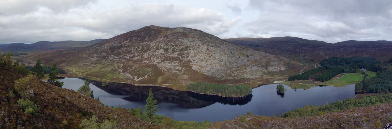

Monadhliath Mountains
Translate the name and the landscape explains itself. Monadh Liath: the grey mountain range. Not jagged, not crystalline, not the high pointed drama of the Cairngorms across the valley — but grey, rolling, ancient, an elevated moorland that has been weathering quietly for more than 400 million years since the Caledonian Orogeny first lifted it. The range runs northeast-to-southwest along the western side of Strathspey, south of Loch Ness, west of the Cairngorms proper, with Corrieyairack Pass at 763 metres usually drawn as its southwestern limit. The high point — Càrn Dearg at 945 metres — sits 40 kilometres south of Inverness. It is one of four Munros in the range, but the interior between them is so trackless, so featureless, so peat-bogged and empty that the maps still call it remote in a country where remote is a relative word.
A Plateau the Ice Forgot
The Monadh Liath is a kind of geological accident. When successive ice sheets covered Scotland during the Pleistocene, the great Cairngorms next door were carved into U-shaped valleys, gouged corries, and steep-walled glens. The Monadh Liath sat under the same ice, but the ice barely moved. It froze to the ground across the high plateau, locked in place rather than flowing, and so the landscape it left behind is a smoothed, rounded surface rather than a carved one. There are no real ridges, no proper corries away from the Munros fringe, only a few short glaciated troughs like Glen Killin on the north. Geologists have only recently understood the mechanism: ice on the plateau froze static, but as it began to flow down into the troughs at the edges, it thickened, accelerated, and warmed enough to erode them. The last enlargements happened during the Younger Dryas, around 12,000 years ago — recent, in geological terms, almost yesterday.
The Findhorn Bends Through
The main valley inside the Monadh Liath is the River Findhorn, and it is one of the most peculiar rivers in Scotland. Most Highland rivers run more or less straight, having been straightened by ice. The Findhorn winds. It is an incised meandering river valley — a relict of pre-glacial drainage that the ice never quite straightened out — turning back on itself in long looping bends as it cuts down through the plateau. The four Munros sit on the Spey rim: A'Chailleach at 930 metres, Geal Chàrn at 926, Càrn Sgulain at 920, and Càrn Dearg at 945. Three of them make a classic circuit walk from Newtonmore in a single very long day, and walkers tend to do them in that combination. The interior, where the Findhorn meanders, is rarely visited even by Munro-baggers. Two hours from the road, you can stand on heather moorland that has changed less over the last ten thousand years than almost anywhere else in Britain.
Wind Farms and a Power Line
The remoteness is recent history, however, and it is being chipped away. The Beauly-Denny power transmission line was completed across Corrieyairack Pass, bringing high-capacity grid infrastructure into a region that had never carried it. The Glendoe Hydro Scheme above Fort Augustus came next: the reservoir and dam are modest, but the access roads needed to service all the weirs diverting water into the catchment have run heavy-duty tracks deep into ground that had no roads before. And the wind farms followed, built where the grid connection and the access roads now made them viable. From the Cairngorm summits, or from peaks in the Western Highlands as far as 50 miles away, the wind turbines now dominate the northwest skyline. The Monadh Liath is designated a Special Area of Conservation; it is also, simultaneously, an industrial landscape. Native woodland is mostly gone, eaten away over a thousand years by sheep, deer, and people. What remains is open, exposed, immense, and changing — but still, on the right grey day, still very much itself.
From the Air
Monadhliath Mountains: 57.167°N, 4.000°W, west of Strathspey and southeast of Loch Ness. The range is a broad rolling plateau averaging 800–945 m elevation rather than peaks, with the highest point Càrn Dearg at 945 m. The Findhorn river makes a distinctive sinuous valley through the centre, and modern wind turbines along the northwest flank are now a visible feature. Best viewed at 5,000–7,000 ft AGL. Nearest airport is Inverness (EGPE), 22 nm north of the high point; military and GA traffic frequents this corridor. Cairngorms airspace and ski-area helicopter operations to the east warrant awareness. Mountain weather here changes fast even in summer.
Nearby Stories
- Culloden 5.6 km away
- Conon Hydro Scheme 8.3 km away
- Fort Augustus 11 km away
- Dalwhinnie distillery 12 km away
- Battle of Cromdale 13 km away
- Pluscarden Abbey 14 km away
- Battle of Mulroy 17 km away
- Battle of Mons Graupius 32 km away