.jpg)
Conon Hydro Scheme
They called it Operation Bathplug. The engineers at Balfour Beatty had driven a sloping tunnel from a point above the future Grudie Bridge power station up to a position just 25 feet beneath Loch Fannich, then carefully shaved the roof down to 15 feet of remaining rock. A sump waited below. Three bulkheads sealed the tunnel against debris. When they detonated the final charge, the rock plug dropped neatly into the sump and water from Loch Fannich began flowing down through the new conduit toward the turbines. It was only the second time this technique had been used in Britain. Balfour Beatty had pulled it off the first time too, at Loch Treig for the Lochaber scheme. The Conon Hydro Scheme—six power stations cascading from the western Highlands to within twelve and a half kilometres of the Cromarty Firth—was full of such moments.
Three Phases, Fifteen Years
The North of Scotland Hydro-Electric Board developed the Conon Valley scheme in three phases between 1946 and 1961. Grudie Bridge came first, generating from 1950 at the confluence of the River Grudie and River Bran just upstream of Loch Luichart. It originally drew water through a tunnel from Loch Fannich without any dam at the loch—the engineers were content to let the water level drop by up to 50 feet. Five years later they added a dam anyway, raising the surface to 840 feet above ordnance datum to gain head and storage. The second phase brought Mossford, Achanalt, Luichart and Torr Achilty stations into service through the 1950s. The third phase, completed by 1961, added the Orrin Reservoir and Orrin Power Station, with two dams holding back a reservoir nearly five miles long. The whole system now generates 107.2 megawatts and produces around 470 gigawatt-hours a year.
The Stone-Faced Concrete Building
Architect James Shearer of Dunfermline had worked on the Board's earlier Nostie Bridge station and had a theory: the power stations should be built of stone to blend with surrounding architecture. He proposed it to engineer MacColl, who readily agreed. But when MacColl came to design Grudie Bridge, he felt stone would be too slow and expensive and drew up sketches for concrete, steel, and glass. He asked Shearer whether he had ever seen what concrete looks like after 20 years in the Scottish weather. Shearer admitted he had not. So MacColl organised a weekend of touring weathered concrete buildings. The result became Board policy: face the concrete in local stone. Grudie Bridge was redesigned and clad in red Tarradale sandstone. Every later Board station followed the principle. James Shearer's Achanalt power station—a compact two-bay structure built into a cliff—is Grade C listed.
Loch Vaich and Its Two Spillway Towers
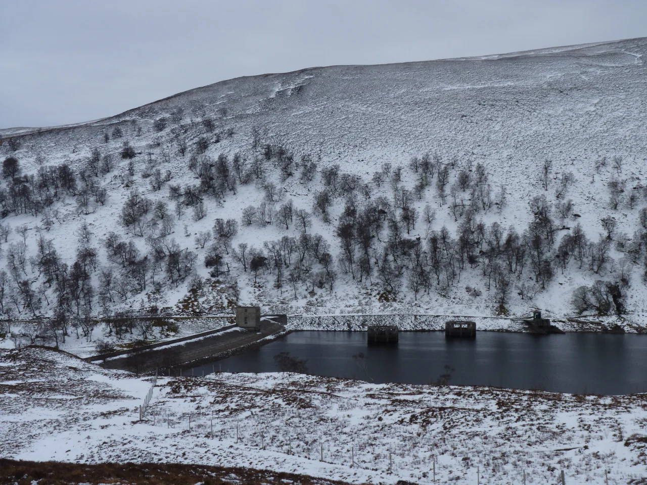
The Vaich dam is one of the more unusual structures in Scotland. To minimise concrete use during a period of material shortages, Williamson and Partners designed a rubble construction with a vertical concrete core wall. The upstream face is coursed random rubble; the downstream face is covered with turf. If water ever topped the dam, that turf facing would erode catastrophically, so two spillway towers stand in the reservoir itself. They connect through pipes at the base of the dam, discharging safely downstream when the loch is high. The rubble came from spoil generated by nearby tunnelling work. The whole arrangement saved enormous amounts of cement and construction time. Loch Vaich now feeds into Loch Glascarnoch, which in turn discharges through a 4.5-mile tunnel to Mossford power station on the bank of Loch Luichart. Loch Droma, originally draining westward to Loch Broom, was redirected eastward into Loch Glascarnoch with a low dam and a penstock.
The Cascade From West to East
The Conon scheme works as a cascade. Almost the entire River Conon catchment ends up passing through the lowest station at Torr Achilty before reaching the sea. Loch Droma at 270 metres above ordnance datum, Loch Vaich at 256 metres, and Loch Glascarnoch at 252 metres all feed Mossford. Loch Fannich at 256 metres feeds Grudie Bridge. Loch Achnalt and Loch a' Chuillin at 111 metres feed Achanalt. Loch Meig at 87 metres feeds into Loch Luichart at 85 metres, and the combined flow drives Luichart power station. Water from the Orrin Reservoir at 256 metres travels through a 17,000-foot tunnel to the Orrin station on the southern bank of Loch Achonachie. And Loch Achonachie at 30 metres is held back by the Torr Achilty dam, with its power station integrated into the downstream face. The whole system discharges into the River Conon about 14 metres above sea level, 12.5 kilometres from the coast.
Borland Lifts and 200,000 Salmon Fry
The Conon and its tributaries carry salmon, and the engineers built fish passes into nearly every dam. The chosen design was the Borland fish lift, similar in operation to a navigation lock. Salmon attracted by water flowing from a lower pool swim into a shaft; a sluice gate closes; the shaft fills; the fish reach the upper pool and continue upstream. Juvenile smolts heading the other way can drop down through the same shaft. A single Borland pass handles surface level variations up to 20 feet, but the Orrin Reservoir varies by more than 70 feet—so the engineers built four passes in series. Similar lifts went in at Torr Achilty, Luichart, Meig, and Achanalt. Before the scheme, salmon could not pass Conon Falls. After the lifts were installed, about 20 miles of river opened to them, all the way up to Achnasheen. As part of the project, 200,000 salmon fry were released into the upper River Bran.
From the Air
Located at 57.554N, 4.598W in the Conon Valley between Inverness and Ullapool. Inverness Airport (EGPE) sits 18 nm to the south-east. The scheme stretches east-west across nearly 30 miles of mountain country, with Loch Fannich and Loch Glascarnoch in the upper west, the Orrin Reservoir to the south, and Loch Achonachie at the eastern end above the Cromarty Firth. Recommended viewing altitude 3,000 to 5,000 ft AGL. The Orrin Dam, 1,025 feet long at roadway level and 167 feet high, is the most striking aerial landmark, set in upland moorland with its 17 spillway sections clearly visible. The Conon scheme's stone-faced powerhouses are deliberately understated against the landscape—a result of James Shearer's policy. Weather varies sharply across the catchment; the western lochs see Atlantic frontal systems while the eastern stations enjoy drier Cromarty Firth conditions.
Nearby Stories
- Balblair Distillery 2.4 km away
- Falls of Glomach 3.1 km away
- Cape Wrath Trail 4.4 km away
- Fortrose Cathedral 5.4 km away
- Alladale Wilderness Reserve 7.9 km away
- Gruinard Island 13 km away
- Glen Affric 15 km away
- Monadhliath Mountains 20 km away