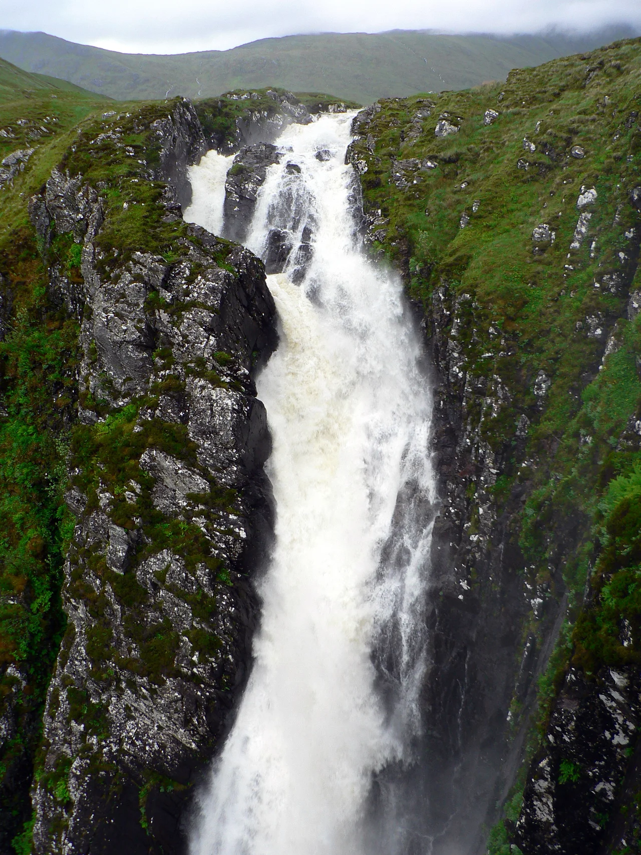

Falls of Glomach
Glomach is Gaelic for 'gloomy' or 'hazy', and also for 'chasm', and the Falls of Glomach manage to be all three at once. The water emerges from open moorland and then, with very little warning, the ground simply falls away beneath it for 113 metres into a slot in the rock so narrow that no camera has ever caught the whole drop in a single frame. Eighteen miles east of Kyle of Lochalsh, the falls have refused to make themselves convenient. You cannot drive to them. You cannot easily photograph them. You have to walk in and stand at the edge, and that is the only way they are willing to be seen.
A Hundred And Thirteen Metres, Straight Down
The figure to remember is 113 metres of single drop, which makes Glomach one of the tallest waterfalls in Britain. It is not the absolute highest - that distinction is contested between several remote Highland cascades - but it is widely considered the most spectacular because of the geometry of its setting. The water arrives across open moor with no warning of what is about to happen. Then the entire river pours over a lip into a deep, narrow rock cleft. The first 110 metres of the drop are nearly vertical, the water hammering down into a pool from which a smaller secondary drop continues. Spray rises constantly. In a high wind the falls catch the updraft and the water blows sideways before it lands - which is part of how Glomach earned its name.
The Walk In
The National Trust for Scotland, which owns the surrounding Kintail and West Affric estates, recommends the route from Morvich on the shore of Loch Duich. From the trailhead the path climbs the Bealach na Sroine - the Pass of the Nose - rising 790 metres over rough country across roughly 17.5 kilometres there and back. The Trust budgets five to six hours for the round trip. Mobile reception is limited. The terrain is open hill, exposed to weather that arrives without warning off the Atlantic. There are other routes in, including an even longer approach from Glen Elchaig, but all of them are remote walks across country that does not forgive carelessness. People still occasionally underestimate the walk, set off in trainers and a light jacket, and find out the hard way what Highland weather can do in three hours.
Rosie McCusker And A Long Wait For Thanks
In 1973 an eleven-year-old girl named Rosie McCusker slipped at the edge of the gorge and fell sixty metres into the cleft. Astonishingly she landed without serious injury - the geometry of the slot, the height of the drop, and the wet rock somehow combined to save her - but getting her out took the Kintail Mountain Rescue Team nine hours and forty people on ropes. The team leader at the time described it as one of the most technically difficult rescues he had ever supervised. Fifty years later, in 2023, Rosie McCusker donated five thousand pounds to the same Kintail Mountain Rescue Team. She had, she said, been thinking about thanking them properly for half a century. The donation made local news and BBC Scotland; the volunteers who pulled her out were mostly long retired, but the team itself continues.
Why You Cannot Photograph It
The viewpoint, when you finally reach it, is a small grassy ledge above the head of the falls. From there you can lean cautiously and look down into the chasm where the water disappears. There is no good way to see the bottom drop. The walls of the gorge close in too tight. The full 113 metres only becomes visible from positions in the chasm that mountaineers occasionally reach with ropes, and even then no single frame captures the whole fall. Photographs always show either the top drop or a fragment of the lower drop. The waterfall, in other words, can be heard and felt and seen in pieces, but never grasped in one go. Which may be the most honest definition of a chasm anyone has ever come up with.
From the Air
Located at 57.2786 N, 5.2892 W in the remote northern edge of the Kintail estate, Highland Scotland. The falls appear as a sudden vertical white line in a narrow rock cleft cutting through open moorland - hard to spot from high altitude but unmistakable when seen from the east at 3000-4000 ft AGL. Nearest aerodrome: Inverness (EGPE) approximately 80 km east. The gorge feeds the Allt a' Ghlomaich which flows north into the River Elchaig and Loch Long. Surrounding terrain is unrelenting Highland hill country: A' Ghlas-bheinn 918 m to the southwest, Beinn Fhada 1032 m further south, Sgurr nan Ceathreamhnan 1151 m to the southeast in Glen Affric. There are no roads within ten kilometres of the falls. The nearest tarmac is at Morvich on Loch Duich. Weather can be aggressive: the Glomach catchment funnels Atlantic systems straight inland. Light is best in the late morning when sun reaches into the gorge from the southeast. Avoid the area entirely in westerly gales - downdrafts off the surrounding ridges can be severe.
Nearby Stories
- High Pasture Cave 2.5 km away
- South Rona 6 km away
- Battle of Mulroy 7.5 km away
- Glenmoriston 8.2 km away
- Torridon 8.5 km away
- Glenfinnan Viaduct 8.6 km away
- Eigg 13 km away
- Conon Hydro Scheme 21 km away