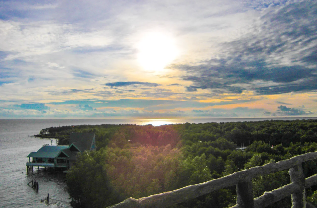

Mũi Cà Mau National Park
The mud arrives first. Carried down the rivers and shoved along this coast by the tide, it settles on the shallows off the southern tip of Vietnam until there is a soft grey bank showing at low water — not land yet, not sea any more. Then a seed the size of a fat green pencil drops into it, and within a season something is growing where nothing could stand. Mũi Cà Mau National Park exists to protect a place that is, in the most literal sense, being made.
Mấm First, Then Đước
There is an order to this. The pioneer is mấm, the Vietnamese name for the Avicennia mangroves, white and black, which will tolerate raw saline mud and root in it while the ground is still half water. Mấm holds the sediment. Once the bank has firmed and risen, đước — the stilt-rooted Rhizophora — moves in behind, along with vẹt, the Bruguiera mangroves, and the forest thickens into the tangle that gives the cape its dark green colour from the air. Around twenty-two mangrove species grow here, most of it naturally regenerating rather than planted, with pockets of chà là palm, ô rô and ráng ferns in the understorey. The forest is not a fixed edge but a slow procession working seaward, one species clearing the ground for the next.
Everything the Mud Feeds
The park's surveys record twenty-six species of mammal, forty-three reptiles, nine amphibians, ninety-three birds and two hundred and thirty-three fish. Numbers like that undersell it, because the interest is in what those creatures are doing. The creeks and flats are a nursery: shrimp, crab and juvenile fish grow up among the roots before moving out to sea, which is why fishing communities for a hundred kilometres in either direction have a stake in these trees. Among the birds counted on the cape are the Chinese egret, the spot-billed pelican, the painted stork, the black-headed ibis and the far eastern curlew, several of them making this a waypoint on long migrations. Long-tailed macaques still work the canopy. Older records from these forests list wild boar, monitor lizards, crocodiles — and, further back, tigers.
Three Certificates
Protection came in stages. A nature reserve was declared at Đất Mũi on 9 August 1986. On 14 July 2003 the Prime Minister upgraded it to a national park covering 41,862 hectares — 15,262 of them inland and 26,600 offshore, with about 12,203 hectares under strict protection — running roughly between 8°32' and 8°49' north and 104°40' and 104°55' east. Then the international recognitions arrived. On 26 May 2009 UNESCO added the park, together with Cù Lao Chàm far up the coast, to its world network of biosphere reserves. On 13 April 2013 the Ramsar Secretariat certified it as wetland site number 2,088 — the second in the Mekong Delta and the fifth in Vietnam. Three separate designations, all of them describing the same argument: that mud with trees on it is worth more than mud without.
What Was Taken Back
The forest has been badly used inside living memory. During the war these were among the woods that American aircraft bombed and sprayed with defoliants, on the reasoning that mangrove hid an enemy — which it did, and which also meant destroying the fuel, timber and fishery of everyone who lived under it. Peace brought a different kind of loss. Between 1990 and 1998 some 4,661 hectares were cut beyond any sustainable rate, much of it by people who had arrived from elsewhere with little else to work with: disabled veterans, demobilised soldiers, retired cadres, resettled families given land at the end of the country and told to make a living from it. Restoration has been slower than the felling. A five-year programme aimed to replant around 150 hectares, and in 2016 the province put 1,300 hectares of protective forest onto the accreting flats.
The Seawall That Grows Itself
The case for all this is not sentimental. Mangrove is the barrier standing between the open sea and one of the most densely farmed river deltas on earth, and it is a barrier that repairs itself, spreads on its own and rises with the sediment instead of being overtopped by it. At the cape the land gains sixty to eighty metres a year on its accreting flank while the eastern shore is cut away, and where the trees are gone the cutting goes faster. The park is therefore two things at once — a wildlife refuge, and a piece of infrastructure that nobody had to build. Stand at the seaward edge at low tide and you can watch it working: water sliding off through the roots, leaving the next few grams of the country behind.
From the Air
The park occupies the southern tip of the Cà Mau peninsula, centred near 8.675°N, 104.7917°E and bounded roughly by 8°32'–8°49' north and 104°40'–104°55' east. From the air it reads as a solid mass of dark mangrove canopy laced with silver tidal creeks, fading at its southwestern edge into the pale tan of exposed mudflat — the clearest visual boundary between land and sea anywhere on this coast, and one that shifts year to year. Recommended altitude is 1,500 to 3,000 feet for the creek detail and canopy texture, or 6,000 feet and above to see the accreting flats against the two seas. Terrain is sea level throughout; there is no obstruction risk beyond the 45-metre flag tower near the cape. Cà Mau Airport (VVCM) lies about 80 km north-northeast, Cần Thơ International (VVCT) roughly 200 km northeast and Phú Quốc (VVPQ) about 210 km northwest. Time flights for the December–April dry season; the southwest monsoon brings persistent haze and towering afternoon convection over the delta.
Nearby Stories
- Sông Đốc 16 km away
- Bạc Liêu 37 km away
- Tho Chau Islands 109 km away
- Sóc Trăng Airfield 112 km away
- An Thoi Naval Base 153 km away
- Japanese destroyer Shigure (1935) 279 km away
- Zahro Express Disaster 302 km away
- Perhentian Islands 371 km away