.jpg)
Sóc Trăng Airfield
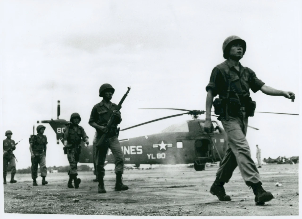
On 15 April 1962 the helicopters of HMM-362 lifted off the deck of the USS Princeton, crossed into the Mekong Delta, and set down on an old airstrip the Japanese army had used two decades earlier, some 85 miles southwest of Saigon. They were the first Marine Corps aviation unit to serve in Vietnam. Their commander, Lieutenant Colonel Archie Clapp, gave his Sikorsky UH-34 squadron a nickname that outlasted the deployment - Archie's Angels - while the operation itself went by the flatter codename Shufly. Sóc Trăng had been selected for an entirely unromantic reason. In 1962 it had one of the very few hard-surfaced runways anywhere in South Vietnam.
Thirty-Two Hundred Feet of Asphalt
The strip is not much: 3,200 feet of asphalt on a 03/21 heading, ten feet above sea level, laid across ground that floods for half the year. The French built it in the colonial era. Japanese forces used it from 1940 to 1945. In a delta where almost everything moved by boat and almost every other airfield was pierced steel planking sinking into mud, a paved runway that stayed usable through the monsoon was a strategic asset out of all proportion to its length. Everything that happened here for the next thirty-five years followed from that single fact of engineering. HMM-362's job was to fly transport and resupply for Army of the Republic of Vietnam units scattered across the delta - country with no roads worth the name and no landing zones except the ones a helicopter made for itself.
The Marines Move North
The Marine presence lasted five months. On 1 August 1962, HMM-163 under Robert L. Rathbun relieved HMM-362, and in early September the squadron began shifting north with its support elements from MAG-16, completing the move to Da Nang Air Base by 20 September. Da Nang would become the centre of gravity for the rest of Operation Shufly, and Sóc Trăng receded into the background of the Marine Corps story almost as soon as it entered it. What the delta got instead was the Army, which stayed for eight years.
Hueys and Dust Off
The 93d Transportation Company arrived in June 1962 and worked out of Sóc Trăng until 23 June 1963, when it was inactivated and its people and aircraft were used to stand up the 121st Aviation Company (Airmobile Light) the same day - the unit simply changed its name around the men flying the aircraft. The 336th Assault Helicopter Company operated from here as well, flying UH-1 Iroquois. Alongside the gunships and troop lifts came a different kind of flying. Detachment A of the 57th Medical Detachment (Helicopter Ambulance) brought UH-1Bs to Sóc Trăng in March 1964, followed by the 82nd Medical Detachment from October 1964 until 15 March 1969. These were the Dust Off crews: unarmed helicopters, marked with red crosses, whose entire tactical doctrine was to fly into a fight already in progress and take the wounded out. They flew for anyone who called.
Two Bad Days
On 19 May 1967, two UH-1Ds of the 336th were returning from a combat support mission when Gold 2 struck Gold 3 on the approach to Sóc Trăng. Gold 2 broke up in the air, killing all four men aboard: Warrant Officer Gediminas J. Eidukaitis of Cleveland, Ohio, at the controls; Warrant Officer Michael Aaron Kight of Waterbury, Connecticut, twenty-one years old, in the other seat; Specialist 4 Burton I. Sharp of Taylor, Michigan; and Corporal Raymond H. Tighe of Winton, California. In the damaged Gold 3, the gunner, Specialist 4 Charles W. Larman of Oxon Hill, Maryland, was struck by his own aircraft's main rotor and killed. Five years later, on 12 August 1972, a Lockheed C-130E Hercules of the 776th Tactical Airlift Squadron, tail number 62-1853, was shot down as it took off from the same runway. Forty-four people were aboard. Thirty of them died.
The Flag Change
On 4 November 1970 the United States handed Sóc Trăng over to the Republic of Vietnam Air Force. A photographer from the U.S. military recorded the moment - Vietnamese air crewmen lined up before one of the aircraft, waiting for the American flag to come down and theirs to go up. The image survives in the National Archives, and it has the particular stillness of a picture taken by someone who understood exactly what he was documenting. The base remained in use until 1975. Today the airfield is disused, but it is still legible from orbit - the outline remains plainly visible on satellite imagery, inside a city that has grown out to meet it. Since the administrative merger of June 2025, the ground it occupies is part of Cần Thơ.
From the Air
Located at 9.58°N, 105.959°E, elevation 10 ft, on the eastern edge of the former Sóc Trăng city. The single runway is 03/21, 3,200 ft of asphalt, and it still carries the IATA identifier SOA although the field is disused and has no ICAO code or air traffic services. Do not plan an arrival here - the surface is unmaintained and the surrounding area is built up. For a photographic pass, 1,500-2,500 ft on a 03 or 21 alignment gives the clearest read of the runway outline against the urban fabric that has grown around it. The nearest operating field is Cần Thơ International (VVCT/VCA, elev. 10 ft, 3,000 m asphalt runway 06/24), about 34 nm north-northwest; Cà Mau (VVCM/CAH) lies roughly 60 nm southwest. The Hậu River, several kilometres wide, is the dominant navigational feature to the north and east. Terrain is flat at sea level. Best visibility December through March; monsoon convection and haze dominate May through October.
Nearby Stories
- Giá Rai 9.3 km away
- Hậu Giang province 23 km away
- Collapse of Can Tho Bridge 32 km away
- Kiên Giang province 37 km away
- Bạc Liêu 55 km away
- Hàng Dương Cemetery 70 km away
- Con Dao 99 km away
- Thien Hau Temple, Cholon 102 km away