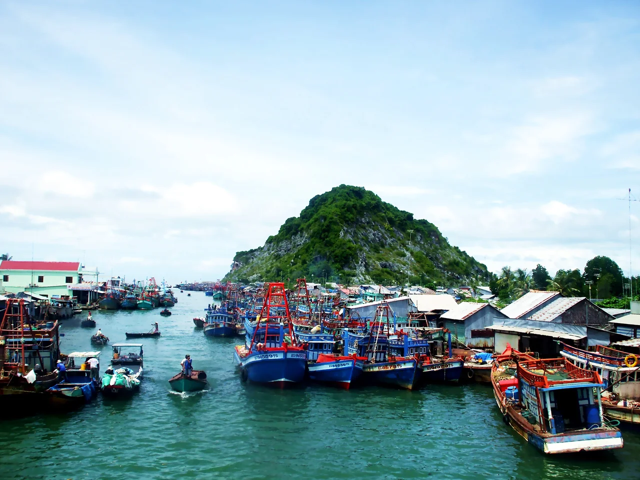

Kiên Giang province
The province is gone. On 12 June 2025 Vietnam's National Assembly dissolved Kiên Giang and folded it into An Giang, and a line that had been drawn on maps since 1976 simply stopped existing. Nothing on the ground noticed. The gulf still comes in flat and brown-green off Rạch Giá, the peat forest at U Minh Thượng still smolders in the dry season, the limestone knuckles at Hòn Chông still stand offshore looking like a piece of Ha Long Bay that drifted eight hundred kilometers south. Names in this corner of Vietnam have always been provisional — Cambodian, then Chinese, then Nguyễn, then French, then Vietnamese again — and the land has outlasted every one of them.
Strong River, Salt Water
Kiên Giang covered 6,352 square kilometers of Vietnam's far southwest, and its name is usually read as something like "strong river" — a modern coinage, with no classical Chinese characters behind it, because the province was invented after Vietnam had already switched to the Latin alphabet. The mainland tilts almost imperceptibly from northeast down to southwest until it slides into the Gulf of Thailand. Behind the coast lie plains, canals, forest and a scatter of low mountains; offshore lie more than a hundred islands. The weather is metronomic. Monthly average temperatures sit between 27 and 27.5°C all year, the rains run from April to November, and the dry months from December to March. Typhoons do not make landfall here, though their rain does, arriving in sheets at the end of the wet season. Mainland rainfall runs 1,600 to 2,000 mm a year; on Phú Quốc it can reach 2,800.
The Man Who Invented Hà Tiên
In the late 1600s a Chinese merchant named Mạc Cửu, one of many Ming loyalists who left China rather than live under the Qing, arrived on this coast with a following. Cambodia, then a vassal of the Nguyễn lords, granted him land, and he turned a swampy river mouth into a trading port that drew ships, silver and Chinese, Khmer and Vietnamese settlers alike. Then he did the shrewdest thing of his career: rather than wait to be conquered, he handed the town's sovereignty to the Nguyễn lords and kept the running of it. Lord Nguyễn Phúc Chu gave the place its name — Hà Tiên, river spirit. Mạc Cửu's son Mạc Thiên Tứ governed after him, keeping the family's grip on the coast through most of the eighteenth century. By 1832, when Emperor Minh Mạng reorganized the south into six provinces, Hà Tiên was one of them.
Only When They Pull Up All the Grass
Nguyễn Trung Trực was a fisherman, born in 1838 into a country the French were in the process of taking. On 10 December 1861 he led roughly 150 men, disguised as rice merchants, onto the French vessel L'Espérance on the Nhật Tảo canal; they killed about twenty of the crew and burned the ship to the waterline. Seven years later he took the French fort at Kiên Giang, killing the colonial-appointed provincial chief and some thirty of its defenders. He was captured, and on 27 October 1868 the French beheaded him at Rạch Giá. He was thirty years old. Offered a place in the colonial administration beforehand, he had answered that the Vietnamese would stop fighting only when the invaders had pulled up every last blade of grass in the country. His temple stands in Rạch Giá today, and the crowds that fill it each lunar August are among the largest religious gatherings on this coast.
Lines Drawn on Water
French administrators redrew the region in 1876, splitting the old Hà Tiên territory into two arrondissements; on 1 January 1900 those became the provinces of Hà Tiên and Rạch Giá. Seventy-six years later, in 1976, the reunified Vietnamese state fused Rạch Giá province with three districts taken from Long Châu Hà and called the result Kiên Giang. Rạch Giá became its capital, and by 2024 it held close to 460,000 people — a city that had literally manufactured its own ground, pushing new wards out into the gulf on reclaimed land in a project Vietnamese calls lấn biển, encroaching on the sea. Then came the 2025 reorganization, which erased Vietnam's district tier and cut the country to 34 provinces. Kiên Giang, at forty-nine, was not among the survivors.
What the Name Still Sells
Phú Quốc lies off the northwestern end of the old province: 575 square kilometers, Vietnam's largest island, about 157,600 residents, and a fish-sauce industry whose reputation is the reason its producers spent years fighting for legal protection of the name. In June 2025 the island became a special administrative zone under An Giang — the only Vietnamese city to be reorganized that way. On the mainland the economy remains what it always was, rice going out by canal and fish coming in by boat. Look for Kiên Giang on a new map and you will not find it. Look on a bottle of nước mắm, or on a bag of dried squid in a Rạch Giá market, and there it is.
From the Air
The former province centers on roughly 10.0°N, 105.17°E, spanning Vietnam's Gulf of Thailand coast from the Cambodian border down to the Cà Mau peninsula. Rạch Giá Airport (VVRG/VKG) serves the mainland with a 1,500 m runway; Phú Quốc International (VVPQ) handles the island's traffic and international services; Cần Thơ International (VVCT) lies about 100 km east. At 5,000-8,000 ft the geometry is unmistakable — a grid of dead-straight canals ruled across flooded rice, ending abruptly at a coastline with almost no relief, then islands scattered across the gulf. The limestone outcrops around Hòn Chông and Kiên Lương break the flatness sharply. Visibility is best from June through October between storm cells; February through April brings persistent agricultural haze that can flatten the horizon entirely.
Nearby Stories
- Sóc Trăng 1.4 km away
- Óc Eo 15 km away
- U Minh Thượng National Park 25 km away
- Sóc Trăng Province 30 km away
- Hà Tiên 37 km away
- Battle of Tri Phap 40 km away
- Hà Tiên Province 59 km away
- Tho Chau Islands 147 km away