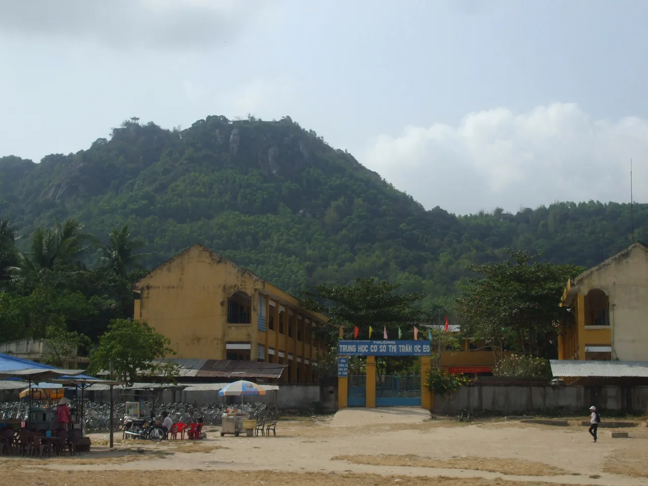

Óc Eo
The first trench went into the ground on 10 February 1942, in the middle of a world war, because someone had studied an aerial photograph of the Mekong Delta and noticed that the rice paddies were wrong. Straight lines ran beneath them - canals, silted up and ploughed over, laid out in a deliberate grid across the flatland of what is now An Giang Province in southern Vietnam. Louis Malleret put his excavation where the lines crossed. Over the seasons that followed he uncovered a city of 450 hectares that had, sixteen or seventeen centuries earlier, handled objects which began their lives at the other end of the known world.
Lines Under the Rice
Everything about the plan of Oc Eo is water. A single canal bisects the site lengthwise, with four more running across it, and archaeologists suspect that houses on pilings were ranged along those transverse channels - a settlement built to be moved through by boat rather than on foot. One canal ran out to the town's seaport. Another struck 68 kilometres north-northeast to Angkor Borei, in what is now Cambodia, linking the delta port to the inland centre.
The scale of it changed how the whole region is described. Archaeologists now use Oc Eo culture as a technical term for the material world of the Mekong Delta in this period, and related sites turn up across southern Vietnam. At Thap Muoi, north of the Tien Giang River, one of them yielded a stele bearing a Sanskrit text of the sixth century.
What Was Actually Found
Be careful here, because this is the part of the story that inflates with every retelling. The excavations produced pottery, tools, jewellery and the moulds used for casting it, coins, and religious statuary. Among the imported material were Roman gold medallions from the reign of Antoninus Pius and possibly of his successor Marcus Aurelius, alongside local gold jewellery made in imitation of Roman coinage of the Antonine period - designs copied by goldsmiths who had handled the originals.
That is a startling and genuine fact. It is not the same thing as a Roman trading post. A small number of gold objects, some worn as pendants, establishes that this delta sat at the far end of a chain of exchange running through India; it does not put Italians on these canals. Oc Eo also struck its own money - Malleret recovered eight silver coins stamped with the hamsa, the sacred goose of Indian iconography, apparently minted in the delta itself. And a Vishnu of the sixth or seventh century, Indian in subject and unmistakably Southeast Asian in face and bearing, came out of the same ground. It stands today in the Museum of Vietnamese History in Ho Chi Minh City.
Cattigara, Possibly
Malleret believed he had found Cattigara, the port at the eastern limit of the world as Ptolemy's Geography described it in the second century. The argument is elegant. Aerial survey in 1958 showed that a distributary of the Mekong had once reached the Gulf of Thailand near Ta Keo, and Oc Eo was linked to that outlet by canal - which would make the branch Ptolemy called the Cottiaris a real river rather than a rumour. Cattigara itself may render a Sanskrit name: Kottinagara, the strong city, or Kirtinagara, the renowned one.
Elegant is not the same as proven. No inscription here says Cattigara, and the identification has been argued over ever since Malleret proposed it. Hold it loosely - a good hypothesis that has coloured a great deal of writing about this place.
The Kingdom That May Not Have Been One
Oc Eo is routinely called the great port of the kingdom of Funan, and that phrase needs unpacking. Funan is a name from Chinese dynastic histories, drawn from the reports of envoys and travellers and from embassies sent to the imperial court. It appears in no inscription from Vietnam or Cambodia. Whatever the people of this delta called their polity, they did not call it that.
The Vietnamese archaeologist Ha Van Tan argued that a single Funan culture spanning the Mekong to the Chao Phraya cannot actually be demonstrated - that shared jewellery and seals across those regions show trade, not a shared state, and that each site carries the marks of its own development. He backed Claude Jacques in urging that the name be dropped in favour of ones the inscriptions actually use: Aninditapura, Bhavapura, Shresthapura, Vyadhapura. In Ha Van Tan's reading, Oc Eo grew from local roots in the late neolithic and early metal age into a commercial centre positioned on the sea routes, a meeting ground for craftsmen and traders, and the Indian influence it absorbed there stimulated a development already under way.
The Sea That Walked Away
The port is not on the coast any more. Siltation carried the shoreline outward over the centuries, and the anchorage that connected Oc Eo to the Gulf is now dry farmland well inland - one reason the site sat unrecognised for so long beneath the rice.
What keeps coming out of it is food. In 2023 researchers reported residues from stone grinding tools at Oc Eo - an implement roughly the size and shape of an anvil, carrying the earliest evidence of spice processing yet documented in Southeast Asia. Cooking travelled the sea routes alongside gods and gold. Vietnam now treats Oc Eo and the neighbouring hill of Ba The as a special national relic and has been assembling a World Heritage nomination covering some 433 hectares, with inscription hoped for later this decade.
From the Air
Oc Eo lies at 10.233 N, 105.163 E in Thoai Son District, An Giang Province, southern Vietnam. The Mekong Delta here is almost perfectly flat and green to the horizon, which makes the one landmark unmistakable: Ba The, an isolated hill rising abruptly from the paddy immediately beside the site. Find Ba The and you have found Oc Eo. In low sun the ancient canal grid still shows as faint linear tonal changes in the fields - the same signature that gave the site away to aerial photographers in the 1930s and 40s. Rach Gia (VVRG) is the closest airfield, roughly 30 km west toward the Gulf of Thailand; Can Tho International (VVCT) lies about 60 km east, and Tan Son Nhat (VVTS) at Ho Chi Minh City roughly 190 km northeast. Best viewed from 2,000-4,000 ft with the sun low. The delta is hazy year-round and the May-November monsoon brings towering afternoon convection; morning flights give the cleanest air and the best cross-lighting on the buried canals.
Nearby Stories
- Hòa Hảo 8.6 km away
- Kiên Giang province 14 km away
- Battle of Tri Phap 31 km away
- Hà Tiên 33 km away
- Sóc Trăng 39 km away
- Phnom Sorsia 49 km away
- An Thoi Naval Base 82 km away
- Tet Offensive Attack on Tan Son Nhut Air Base 94 km away