
Phnom Sorsia
Wait at the eastern side of the hill as the light goes and you will hear it before you see it: a dry rustling that builds inside the rock until the first bats come out of a narrow chimney in the limestone, then thousands more behind them, funnelled by the shape of the passage into a rising column. Local men are standing there with lengths of bamboo, swatting at the column as it climbs. There is nothing ceremonial about it and nothing laid on for visitors. Bats are eaten across rural Cambodia, and a cave holding several thousand of them, emptying through one predictable exit at one predictable hour, is a reliable thing to have at the edge of your village.
An Island Made of Old Seabed
Phnom Sorsia stands about eighteen kilometres east of Kampot city, reached by a dirt track that leaves National Highway 33 and runs out through the paddy. From a distance the hill does not look like a hill so much as a mistake — a wooded lump of grey rock shoved up out of dead-flat rice fields, with nothing between it and the next one but water and green. These are karst towers, the eroded remnants of an ancient limestone seabed, and southern Cambodia is dotted with them. Water has been working on their insides for far longer than anyone has been climbing them, hollowing out chambers, stalactites and passages. From the summit of Sorsia there is no drama at all in the view, just rice in every direction to the horizon, which is exactly what makes standing up there feel like standing on the deck of something.
Rung Damrey Saa
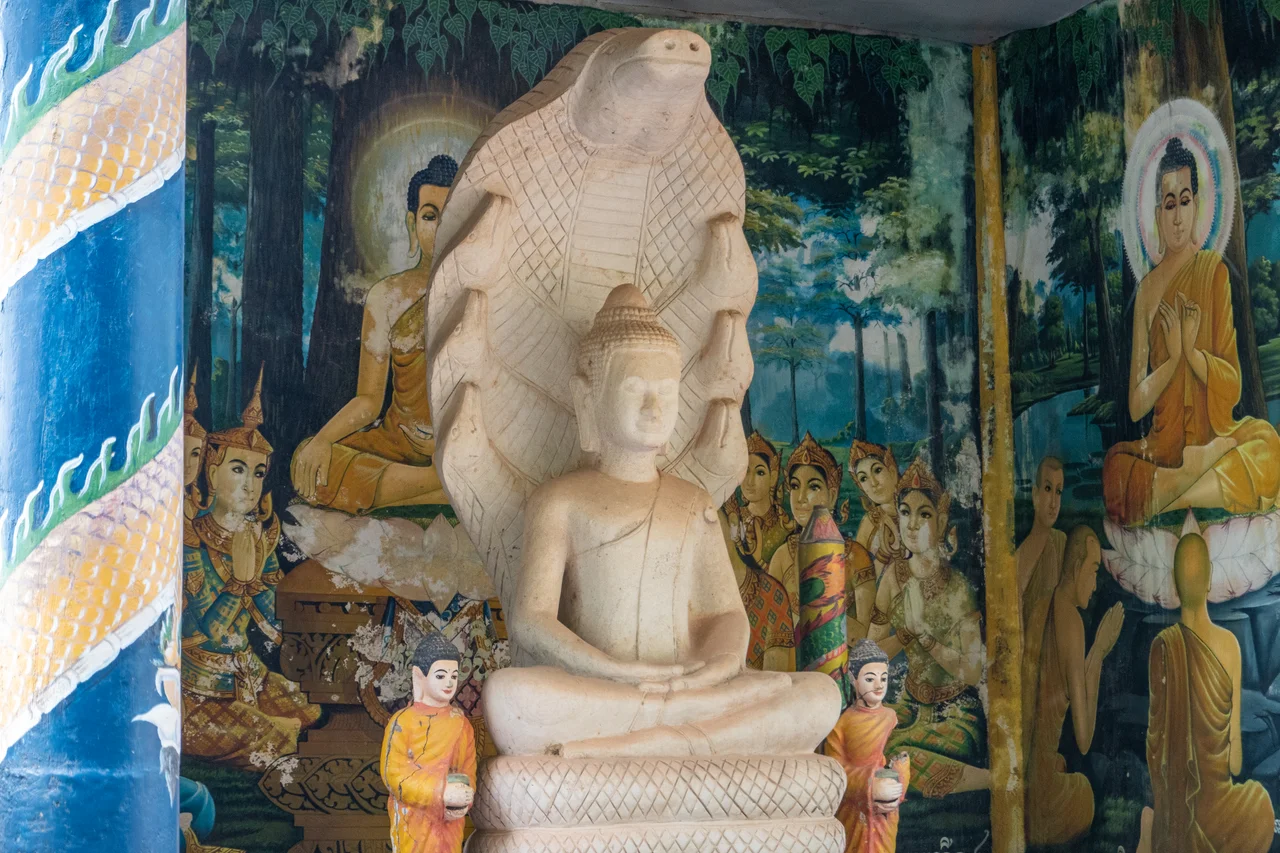
The main cave is called Rung Damrey Saa — the White Elephant's Cave. Its stalagmites, pale and rounded and heavy at the base, are read as a herd of white elephants, and one formation is taken for the head of a single animal. The naming is not casual. In Theravada Buddhist tradition a white elephant appeared to Queen Maya in the dream that announced the Buddha's conception, and across mainland Southeast Asia the possession of a white elephant marked a king as legitimate and his reign as blessed. To find one asleep in the rock, made by dripping water over tens of thousands of years, is the sort of coincidence that turns a cave into a shrine. Two Buddha statues sit to the right of the entrance. A pool of cool water lies concealed deeper in, reached through a hole in the stone.
The Stairs and the Stupa
Phnom Sorsia is a holy hill, and it has been shaped accordingly. Steps have been cut into the slope in a long winding line, branching to reach both the White Elephant Cave and the summit, where a stupa stands. There is a temple partway up, painted in the loud, saturated colours that Khmer religious buildings wear without apology — reds and golds and sky blues that would look garish anywhere else and look entirely correct here. The signage at the road, in the flat optimism of Cambodian tourism promotion, calls the whole thing the Phnom Sorsia Resort. There is no resort. There is a hill, a staircase, some caves, a temple and a stupa, which between them are worth considerably more than the sign promises.
A Landscape of Sacred Hills
Sorsia is one stop on a circuit rather than a destination in itself, and the circuit is the point. Eight kilometres northeast of Kampot, Phnom Chhnork holds a small brick temple to Shiva built in the seventh century, in the Funan period, standing inside a cave mouth and reached by its own stone steps — roughly thirteen hundred years old and still under a limestone roof. Further east, the caves at Kampong Trach draw swimmers into collapsed chambers open to the sky. The pattern repeats across this corner of Cambodia: wherever the rock rose out of the rice, people climbed it, went inside, and left something behind. Hindu first, then Buddhist, and in the case of Sorsia's bat cave, something older and more practical than either.
From the Air
Phnom Sorsia is at 10.6342°N, 104.3272°E, roughly 18 km east of Kampot city and about 17 km north of the coast at Kep. The hill itself is small — a low forested karst tower standing on a plain that is almost at sea level — so it is best identified by context rather than size: look for the string of isolated limestone outcrops running east from Kampot toward Kampong Trach and the Vietnamese border, dark green knuckles in an otherwise unbroken sheet of paddy. National Highway 33 runs past the site on its way to the Prek Chak border crossing. Best viewing altitude is 2,000-4,000 ft; below that the towers are hard to separate from tree lines, and above 8,000 ft they vanish into the pattern. The Bokor escarpment fills the western horizon. Nearest airports are Sihanouk International (VDSV) about 120 km west and Techo International (VDTI) about 130 km north; Phú Quốc (VVPQ) lies southeast across the gulf in Vietnam. Afternoon build-ups are common in the May-October monsoon.
Nearby Stories
- Koh Ach Seh 9.1 km away
- Takéo province 9.6 km away
- Kbal Chhay Waterfall 12 km away
- Lê Văn Duyệt 19 km away
- PMTair Flight 241 32 km away
- Tatai Wildlife Sanctuary 42 km away
- Óc Eo 46 km away
- Mayaguez Incident 64 km away