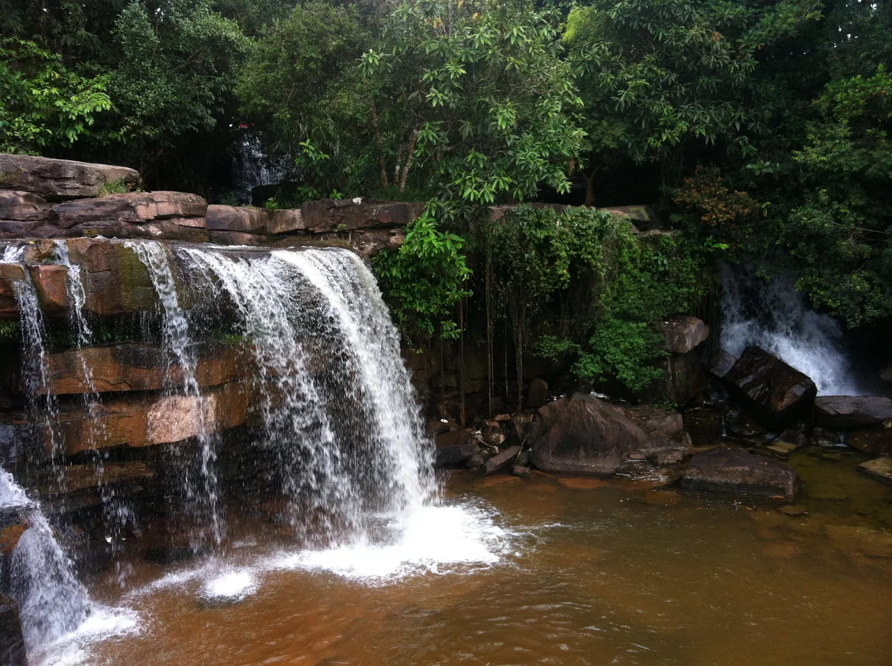

Kbal Chhay Waterfall
Turn the tap in a Sihanoukville hotel room and the water has come down out of the hills behind the city, from a waterfall most guests will never bother to visit. Kbal Chhay is not far — about seven kilometres out of town, then another nine along a track that turns the colour of paprika in the dry season and coats every vehicle, sandal and shin that travels it. What waits at the end is a broad spill of water over rock ledges, shaded, loud in the wet months, and busier with Cambodian families than with foreigners.
Why a New City Needed a Waterfall
Sihanoukville is younger than most of the people who live in it. The whole city was laid out from 1955 to serve Cambodia's first deep-water port, which meant building an entire city's infrastructure out of coastal scrub — including a water supply for a population that had not arrived yet. Kbal Chhay was the answer. The hills inland of the port catch a serious monsoon; this stretch of coast takes something like 2,200 millimetres of rain a year, most of it between April and November. Piping that down to the new port town was the obvious move, and until 1963 the falls did exactly that job.
The Years the Water Stopped
Then the arrangement ended, because the forest around the falls became a place for insurgents to disappear into — the communist movement that would become the Khmer Rouge. What had been a piece of municipal plumbing turned into contested ground, and for the next three decades Cambodia's history ran straight through country like this: forested, roadless, easy to hide in and impossible to police. The villagers who lived in these hills rarely appear in anyone's telling of the story, and they were the ones who could not leave. Kbal Chhay's decades of silence are a small entry in an enormous ledger, and the ledger is mostly written in ordinary lives.
A Road, and Then Visitors
The falls came back into public life in 1998, when the Kok An Company cut a road into the area and developed the site for local and international tourists. That single act of construction is what makes Kbal Chhay what it is today. It is not a wilderness experience and does not pretend to be. Food stalls crowd the banks, bamboo platforms hang over the water, families arrive with coolers, and the main activity is getting in — Cambodians treat the pools as swimming water rather than scenery to photograph from a distance. On a hot Sunday the noise of the falls competes with the noise of the crowd, and loses.
Sixteen Kilometres of Laterite
The drive is half the character of the place. Once the sealed road runs out, the track to Kbal Chhay is laterite — the iron-rich soil that gives so much of southern Cambodia its rust-orange colour — and in the dry months it hangs in the air behind every motorbike as a fine red powder that settles on leaves, skin and roadside stalls alike. In the wet season the same surface turns to a slick that tests a small motorbike's nerve. Either way, the last nine kilometres filter the crowd. Sihanoukville had roughly 90,000 residents in 2008 and then spent the 2010s becoming an entirely different city, but the road out to the falls has never quite kept pace with the ambition down on the coast, and that is arguably in the waterfall's favour.
Two Jobs at Once
The Royal Government of Cambodia has since taken the site back, and Kbal Chhay once again supplies clean water to the city below. That gives the place a double life not many attractions manage: a weekend picnic ground that is simultaneously working infrastructure. In the dry season the flow narrows to threads across dark rock and the track out is dust to the ankles. From May onward the monsoon reloads the hills, the ledges vanish under white water, and the falls become genuinely powerful. Either way the water keeps going where it has gone since 1955 — downhill, through the pipes, into the port city that could not exist without it.
From the Air
Kbal Chhay lies inland at 10.6748°N, 103.609°E, roughly 13 km north-east of central Sihanoukville in the forested hills behind the coast. It is a difficult target from the air — the falls are small and largely under canopy — so navigate on the surrounding features instead: the Sihanoukville port and Bay of Kampong Som to the south-west, National Road 4 running north-east toward Phnom Penh, and the wooded ridgeline that separates the coastal plain from the interior. Sihanouk International Airport (VDSV / KOS) is about 10 km south-south-east, making this a common overflight on approach. Fly it low and slow at 1,500-3,000 feet in the late wet season, when the watercourse is full and shows as a bright break in the forest. From December to March the flow drops sharply and the site can be almost invisible from above.
Nearby Stories
- Kampot 12 km away
- Koh Ach Seh 28 km away
- Cambodian campaign 33 km away
- Tatai Wildlife Sanctuary 33 km away
- Mayaguez Incident 45 km away
- Koh Kong Island 48 km away
- Koh Poulo Wai 52 km away
- Koh Kong 110 km away