.JPG)
Takéo province
Two boys were born in Takéo about thirty kilometres and fifteen years apart. One, from Pra Keap village in Tram Kak, grew up to be Chhit Choeun - Ta Mok, Brother Number Five, chief of the Khmer Rouge army, the man Cambodians called the Butcher. The other, from Samrong Yong in Bati, became a gynaecologist in Phnom Penh, hid his education for four years to stay alive under Ta Mok's regime, and in 1985 walked onto a Los Angeles stage to collect the Academy Award for playing a survivor of it. Haing S. Ngor had never acted before. This province of rice, water buffalo and abrupt isolated hills produced them both, and it is not remotely done producing consequential people.
Where the Khmer World Begins
Takéo covers 3,563 square kilometres of southern Cambodia west of the Bassac River, bordered by Kampot, Kampong Speu and Kandal, with the Vietnamese province of An Giang along its southern edge. The 2024 count put the population at 1,097,243, sixth largest in the country, though the provincial capital Doun Kaev remains a town of under forty thousand - a modest administrative seat for a place that has been continuously important for two thousand years. Cambodians call Takéo the cradle of Khmer civilization, and the claim rests on hard archaeology: the kingdom of Funan, the earliest state in mainland Southeast Asia, had its heartland here, and its successor Chenla grew out of the same ground. The province was formally constituted in 1907. Its human development index, 0.612 as of 2017, ranks second among Cambodian provinces.
A Province That Floods on Purpose
The land is flat to the point of abstraction. During the wet season the Mekong system backs up across it, and paddy fields become a shallow inland sea broken only by dykes, palm lines and the raised platforms villages sit on. Getting to Angkor Borei from Takéo town means an hour by boat, and the trip is the attraction: farmers working knee-deep in half-drowned rice, fishermen setting traps in fields that were dry ground three months earlier, duck farms in their thousands. Heavy wooden cargo boats push up the same channels from Vietnam, which is close enough here that the border is a working economic fact rather than a line on a map. When the water drops, the boats stop and the roads start, and the whole rhythm of the province inverts.
Mountain of the Sun
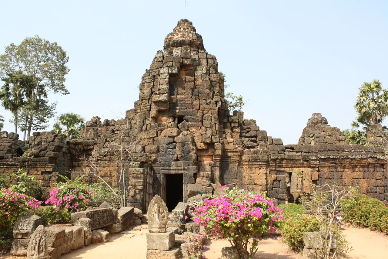
Rising out of that plain about 27 kilometres north of Doun Kaev, Phnom Chisor is a 133-metre hill with an eleventh-century temple on top. Suryavarman I built it and named it Sri Suryaparvata, Mountain of the Sun - a piece of royal branding that also linked the reigning house to the older sacred landscape spread out below, where Funan and Chenla had ruled before Angkor existed. The climb is the point: a long stone stairway of several hundred worn steps, in poor repair, that delivers you to sandstone galleries and a view across water and rice to the horizon in every direction. Beverage stalls at the summit sell cold drinks to anyone who makes it up, which in the dry season is a genuine achievement.
The Ones Who Came Out of Here
Ngor survived by pretending to be a taxi driver, and the cost of that lie was catastrophic: when his wife went into obstructed labour in 1978, the doctor in the room could not act without revealing himself, and she died. He was murdered outside his Los Angeles home in 1996. Ta Mok was captured in 1999 and died in custody in 2006, aged around eighty-one, having never faced trial. Between those poles the province produced Preah Maha Ghosananda, born in Treang district, who became Supreme Patriarch and in 1992 led the first Dhammayietra - a 125-mile walk through mined countryside that started with 350 monks and arrived in Phnom Penh as a national event. It also produced Kem Ley, born in Tram Kak in 1970, the political analyst shot dead in a Phnom Penh petrol-station café in 2016 days after criticising the prime minister's family. Roughly two million people lined the road when his body was carried home to Takéo.
Village Arithmetic
Administratively the province is nine districts and one municipality, ninety-seven communes and three sangkats, and 1,117 villages - and that last number is the one that describes daily life. Theravada Buddhism accounts for 99.2 per cent of the population, and the wat is still the organising institution of a Takéo village: school, hall, calendar, cemetery and social safety net in one walled compound. Cham Muslims, about six-tenths of a per cent, have been here for centuries, and a small Christian minority makes up most of the remainder. It is not a wealthy province. It is a densely inhabited, deeply rooted one, close enough to Phnom Penh to send its young people north for work and far enough from the tourist circuit that almost nobody stops.
From the Air
Centred near 10.98°N, 104.78°E, about 75 km south of Phnom Penh and immediately north of the Vietnamese border. From 3,000-6,000 ft the province reads as an almost unbroken plain of paddy at 5-20 m elevation, cut by straight irrigation channels and dotted with the palm-fringed mounds of villages; the only vertical references are isolated limestone and granite outcrops, chiefly Phnom Chisor (133 m) about 27 km north of Doun Kaev and Phnom Da southeast of Angkor Borei. In the wet season, June to October, most of the surface is standing water and the visual character changes completely. The Bassac River marks the eastern boundary. Nearest fields: Techo International (VDTI/KTI, opened September 2025) roughly 30 nm north in Kandal Stueng; the former Phnom Penh International (VDPP) about 45 nm north, now largely military and general aviation; Sihanoukville International (VDSV) about 90 nm west-southwest. Best light and visibility are November through February; monsoon convection can build fast over the plain in the afternoons.
Nearby Stories
- Phnom Sorsia 14 km away
- Lê Văn Duyệt 17 km away
- Tuol Sleng Genocide Museum 33 km away
- Cambodian campaign 44 km away
- Battle of Tri Phap 56 km away
- Southern Cardamom National Park 84 km away
- Battle of Prek Klok I 84 km away
- Battle of Loc Ninh 100 km away