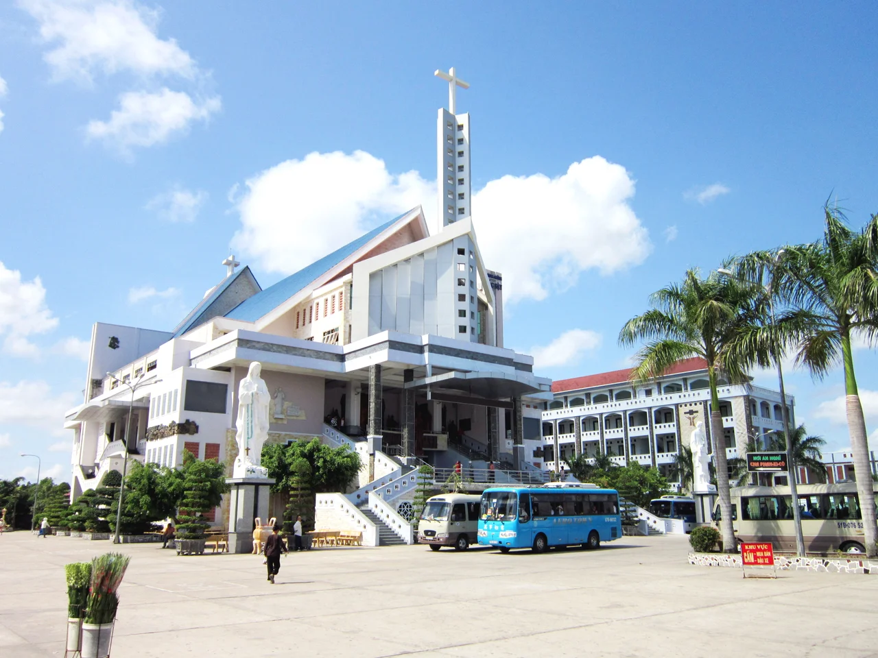

Giá Rai
The rice was cut and stacked when the militia arrived. On 16 February 1928, at a field called Nọc Nạn in Phong Thạnh village, two French officers and a detachment of local militia came to seize a harvest that the family who grew it had been told, through four separate lawsuits, no longer belonged to them. The Biện Toại family had cleared that ground themselves — some seventy-three hectares taken out of swamp before 1900 and held with proper colonial land certificates by 1912. Then a wealthier neighbour filed a claim with conveniently vague boundaries, and the paperwork went the way paperwork usually went.
Nọc Nạn
By 1926 a governor's decree had handed fifty hectares of the family's land to the rival claimant, who promptly sold it on to the mother-in-law of the district chief's brother. The seizure of the standing crop was the endpoint of that transfer. When Nguyễn Thị Trọng demanded to see the order, one of the officers struck her; she pulled a knife and was knocked unconscious. Her brother Mười Chức and the rest of the family came at the officers with machetes and staves. The shooting that followed killed Mười Chức, killed his wife — who was pregnant — and killed a relative who died of his wounds in hospital days later. One of the French officers, Tournier, died in hospital the next day. It had taken minutes.
The Verdict That Was Not Supposed to Happen
Colonial courts were not in the habit of siding with delta peasants against the men who held the deeds. On 17 August 1928 the surviving members of the family stood trial in Cần Thơ, defended without fee by two French lawyers, Tricon and Zévaco. The prosecutor, Moreau, used his own address to say plainly that he understood why these people had picked up machetes. Biện Toại was acquitted. So were his sister Nguyễn Thị Liễu and his son. Nguyễn Thị Trọng received six months, already served in detention. The case ran in newspapers across Cochinchina and became shorthand for everything wrong with colonial land administration — a verdict that changed nothing structural and was remembered anyway. The site was recognised as a national historical relic on 30 August 1991, and the memorial there was rebuilt and reopened in 2008.
Milky Mangrove
The town's name comes from a tree. Giá Rai derives from the same root as Rạch Giá — the creek of the giá, the milky mangrove Excoecaria agallocha, whose caustic white sap gives it its English name and its reputation. French Cochinchina carved Giá Rai out of parts of Vĩnh Lợi and Cà Mâu on 5 October 1917, and from 5 April 1944 the district government sat at Phong Thạnh, the same village as the Nọc Nạn field. What followed was a century of redrawn boundaries: Ba Xuyên province in 1956, Bạc Liêu again from 1964, Minh Hải after reunification in 1976, back to Bạc Liêu when Minh Hải was split in 1996. In 2001 the district was halved, with the coastal southern portion becoming Đông Hải. On 15 May 2015 what remained was reconstituted as Giá Rai town.
The Priest at Tắc Sậy
Along Highway 1, in the Tắc Sậy area, stands a church that draws visitors from across southern Vietnam and well beyond the Catholic community. Francis Xavier Trương Bửu Diệp, born on 1 January 1897, served as parish priest here for sixteen years. In the violent confusion that followed the Second World War he was detained along with a group of his parishioners, and by the account the parish has preserved he offered his own life so that they would be spared. He was killed on 12 March 1946 and buried at Tắc Sậy. Devotion to him grew steadily and largely without official encouragement. Pope Francis signed the decree recognising his martyrdom in November 2024, and on 2 July 2026 he was beatified at the church itself, with 12 March fixed as his feast day.
Ponds, Highway, and the End of the Town
Modern Giá Rai covers about 354 square kilometres of dead-flat ground between the cities of Bạc Liêu and Cà Mau, and the land has largely gone over to water on purpose. Something over 22,000 hectares are given to aquaculture, mostly brackish-water shrimp, producing tens of thousands of tonnes a year alongside rice and processed fish. National Highway 1 runs straight through, and the Quản Lộ–Phụng Hiệp canal carries the barge traffic. Then, on 12 June 2025, the National Assembly merged Bạc Liêu province into Cà Mau and abolished the district tier nationwide. From 1 July, Giá Rai town was gone, its wards and communes reporting straight to the province — the latest redrawing in a place that has been redrawn about once a generation since 1917.
From the Air
Giá Rai sits at 9.25°N, 105.417°E, roughly midway along National Highway 1 between Cà Mau city (about 30 km west) and Bạc Liêu (about 30 km east). Elevation is barely above sea level and there is no relief whatsoever; from 2,000–4,000 ft the defining feature is the shrimp-pond mosaic — thousands of rectangular water panels that flash silver or slate depending on sun angle — bisected by the arrow-straight line of Highway 1 and the parallel Quản Lộ–Phụng Hiệp canal. Wind turbines along the Bạc Liêu coast to the southeast are useful long-range references. Nearest field is Cà Mau (VVCM/CAH). Wet-season afternoons build heavy cumulus; the dry months from December to April offer the cleanest visibility.
Nearby Stories
- Đầm Dơi 5.7 km away
- Sóc Trăng Airfield 18 km away
- U Minh Thượng National Park 25 km away
- Sóc Trăng 49 km away
- Con Son Island 90 km away
- An Thoi Naval Base 101 km away
- Phú Quốc Prison 122 km away
- Japanese destroyer Shigure (1935) 346 km away