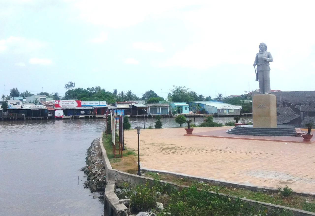

Đầm Dơi
In 1836, imperial surveyors compiling the gazetteer Đại Nam nhất thống chí wrote down two names for a stretch of swamp near the bottom of the empire. One was xứ Đầm Dơi — the country of the bat swamp. The other, right next door, was xứ Đầm Quạ, the country of the crow swamp. Neither was an administrative unit; they were simply what people called the wetlands when a tax clerk needed something to write in the column. Thirty-one years later a French colonial administration merged the two, kept the bats, and dropped the crows. Đầm Dơi has been on the map under that name ever since.
Crocodiles Between You and Everywhere Else
For roughly a century — from the mid-1800s until the Second World War — this district was effectively cut off from the rest of Cochinchina. Not by distance, which was trivial, but by texture: an unbroken lattice of rivers, tidal creeks, canals and mangrove, populated by crocodiles and snakes, with no dry route through it. The township itself sits where three rivers converge, the Cửa Lớn, the Đầm Dơi and the Gành Hào, and a fourth channel to the east carries the marvellous name Đầm Chim, the swamp of birds, before it reaches the sea at the Hố Gùi estuary. Roads came late and came narrow. Two were built under the Republic of Vietnam — Đầm Dơi to Cà Mau, and Đầm Dơi to Thanh Tùng — and both were undersized almost from the day they opened.
Vùng Đỏ
The same terrain that isolated Đầm Dơi made it, during the Vietnam War, nearly ungovernable. Việt Cộng units used the channel network exactly as it invited them to, and American intelligence files record that the district was classified early as a vùng đỏ — a red zone — by the Republic of Vietnam's forces. The phrase is administrative and bloodless. What it described was a place where sustained fighting was expected and where civilians had no safe position to occupy: too remote to be protected, too contested to be left alone. People farmed, fished and raised children inside that designation for the better part of two decades. When An Xuyên province was dissolved on 1 May 1975, the district was renamed Ngọc Hiển; the name Đầm Dơi did not return until Decision 168-HĐBT restored it on 17 December 1984.
The Goddess and the Snakehead
Local tradition dates the founding of the settlement at Thanh Tùng to 1820, and to two men from central Vietnam — Tô Minh Chánh and Nguyễn Văn Lành — who came south looking for land to reclaim. Their boat reached a river junction and a snakehead fish jumped into it. They read the fish as an omen, stopped there, built a village, and raised a temple to the goddess who guards the place, bà chúa xứ; a smaller shrine in the same yard honours the tiger spirit, lord of the mountains, in a district that has no mountains at all. Every year on the 15th to 17th of the second lunar month, as the south braces for the rains, the whole district converges on Thanh Tùng for the Lễ vía Đức Bà Thủy Long, the festival of the Water-Dragon Goddess. On 25 March 2024 Vietnam's Ministry of Culture, Sports and Tourism inscribed it as national intangible cultural heritage.
Closer to Bạc Liêu Than to Cà Mau
Culturally, Đầm Dơi has always leaned east. Researchers note the tell: the floating markets that define so much of Cà Mau barely appear here, while performance traditions carried by the Teochew Chinese community are everywhere. The district's eastern outlet is Gành Hào — the canal of oysters — a substantial seaport it shares with the neighbouring Đông Hải district, and the road from there runs to Bạc Liêu, where Cao Văn Lầu composed Dạ cổ hoài lang between 1917 and 1919 and gave southern Vietnam the vọng cổ form that still anchors cải lương theatre. Đầm Dơi sits inside that musical catchment rather than Cà Mau's, and singers from the district have made a steady living in cải lương and nhạc vàng.
The Endless Field
In November 2005 a young writer born in this district in 1976 published a novella called Cánh đồng bất tận — The Endless Field — about a father, two children, and a duck-herding boat drifting through exactly this landscape of salt, canals and casual cruelty. Nguyễn Ngọc Tư won the Vietnam Writers' Association Award for it in 2006, the Southeast Asian Writers Award in 2008, and Germany's Liberaturpreis in 2018; the film adaptation took 17 billion đồng at the Vietnamese box office in 2010. The country she describes is measurable: 65,584 hectares of shrimp ponds against 7,720 hectares of remaining mangrove, 226,118 people across 816 square kilometres at the end of 2024. In 2025 the district itself was abolished along with every other district in Vietnam, and its sixteen communes now answer directly to the province. The bat swamp outlasted the paperwork again.
From the Air
Đầm Dơi township lies at approximately 8.96°N, 105.24°E, about 30 km southeast of Cà Mau city on the East Sea side of the peninsula. From 4,000–8,000 feet the defining feature is water geometry: three rivers meeting at the town, and beyond them a mosaic of rectangular shrimp ponds that catch the sun like broken glass, sharply distinct from the darker mangrove ribbons along the 22 km of coast. The Gành Hào estuary to the northeast and the Hố Gùi estuary to the east are reliable coastal fixes. Nearest airport is Cà Mau (VVCM / CAH), 1,500-metre runway 09/27, roughly 25 nm northwest. Terrain is essentially at sea level with no obstacles beyond masts and towers; the hazards here are weather, not relief — heavy convection and reduced visibility from May to November, best conditions December to April.
Nearby Stories
- Ca Mau 16 km away
- Phan Ngọc Hiển 40 km away
- Sóc Trăng Airfield 51 km away
- Bassac River 83 km away
- An Thoi Naval Base 128 km away
- Tho Chau Islands 148 km away
- Zahro Express Disaster 304 km away
- Japanese destroyer Shigure (1935) 310 km away