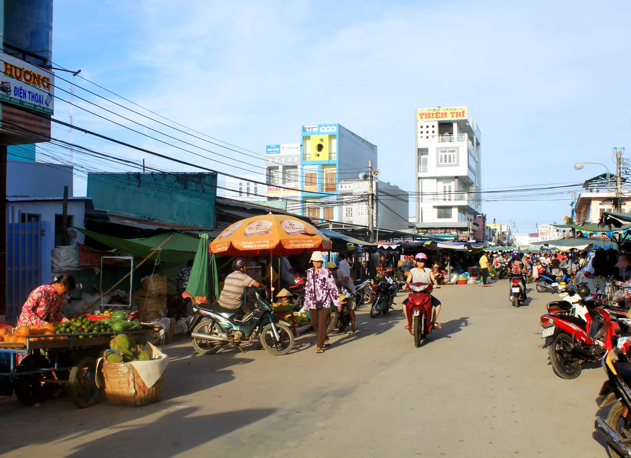

Năm Căn district
Two hundred years ago, so the local story goes, a Chinese trader remembered as Chệt Hột put up five stilt houses on the riverbank here and planted a field above them. The fish and crab were extraordinary, other families came, and travellers began describing the spot by the only landmark that mattered: the row of five. Năm Căn means exactly that — five compartments, the bays of a stilt house counted off between its posts. By the time the Nguyễn court's surveyors compiled their cadastral register in 1836, the name was already on the books among the settlements of đạo Long Xuyên.
A River With No Source
The reason anyone settled here at all is the Cửa Lớn, and it is a genuine oddity. Fifty-eight kilometres long, it is the only river in Vietnam that begins at the sea and ends at the sea. It has no headwaters and no lower course. Water enters at the Bồ Đề mouth on the South China Sea side, where the channel runs six hundred metres wide and nineteen metres deep, narrows to three hundred metres and fourteen metres of depth as it passes Năm Căn township, then fans out at the Ông Trang mouth on the Gulf of Thailand side into something closer to a bay — more than eighteen hundred metres across, but shallowed to four or five metres. What it really is, is a tidal channel connecting two seas that keep different schedules, and the South China Sea usually wins the argument. Distributaries branch off it every kilometre or less, some no wider than a ditch, others full rivers wandering off into the forest.
The Island Behind the Bridge
The Cửa Lớn does something else worth noticing on a map. Together with its associated channels it cuts the whole southern tip of the Cà Mau peninsula clean away from the rest of Vietnam — the cape, the national park, Rạch Gốc, all of it sitting on what is functionally an island, reached by the Năm Căn bridge. That crossing is why the town matters far beyond its size. Everything travelling by road to the southernmost point in the country passes through here, and Năm Căn port sits on the left bank just outside the settlement, working the estuary traffic in both directions.
Crab, Shrimp and the Brackish Trade
The water here is neither salt nor fresh. A handful of small rivers — the Đầm Dơi, the Đầm Chim, the Cái Ngang — push freshwater in against the tide, and the brackish result is unusually productive. Năm Căn crab has a reputation across the delta, and the district's economy has always rested on fisheries first, with commerce and services layered on top: ice and fuel and chandlery for the boats, transport, hotels and restaurants, an industrial zone, and more recently ecotourism aimed at visitors heading for the cape. Kinh, Hoa and Khmer families cleared and settled these mangroves alongside one another, and all three communities still live here. The older trade of the district — cutting mangrove for charcoal — has largely given way to shrimp ponds, which is a mixed blessing for a coastline that depends on its trees.
Made, Unmade, Made Again
Administratively, Năm Căn has led a restless life. In December 1984 the district was renamed Ngọc Hiển, after the executed revolutionary Phan Ngọc Hiển, and the old name disappeared from the register. It came back on 17 November 2003, when a decree carved a new Năm Căn district out of part of Ngọc Hiển. In its final form the district ran to 490.70 square kilometres across one township and seven communes — Hàm Rồng, Đất Mới, Hàng Vịnh, Hiệp Tùng, Tam Giang, Tam Giang Đông and Lâm Hải — with Năm Căn township as its seat. The 2019 census counted 56,813 people. By the end of 2024 the provincial figure had reached 81,095, most of the growth clustered around the port and the highway.
Struck Off
Then it vanished again, and this time not alone. On 12 June 2025 the National Assembly merged the neighbouring province of Bạc Liêu into Cà Mau; four days later it resolved to end district-level government throughout Vietnam, with effect from 1 July 2025. Every district in the country was dissolved at once, leaving provinces dealing directly with communes. What had been Năm Căn district is now covered by Năm Căn and Tam Giang communes and part of Đất Mới. None of which troubles the place much. The bridge still carries the road south, the port still works the tide, and the crabs are still sold under the name of five houses that a trader put up on the mud before anyone thought to write any of it down.
From the Air
Năm Căn sits at 8.7599°N, 104.9942°E on the Cửa Lớn River, about 55 km south of Cà Mau city. The river is the navigation feature: a broad dark channel running roughly east-west across the peninsula, unmistakable because it connects open water to open water with no visible source, and because a distributary peels off it every kilometre. Look for the Năm Căn bridge and the port basin on the left bank, and the grid of shrimp ponds spreading north and east. Recommended altitude is 3,000 to 6,000 feet, high enough to hold both river mouths — Bồ Đề to the east, Ông Trang to the west — in a single frame. Cà Mau Airport (VVCM) lies about 50 km north-northeast; Cần Thơ International (VVCT) roughly 170 km northeast; Phú Quốc (VVPQ) to the northwest across the Gulf of Thailand. December to April gives the best visibility; the wet season brings afternoon thunderstorms and low cloud over the delta.
Nearby Stories
- Sông Đốc 16 km away
- Bạc Liêu 37 km away
- Tho Chau Islands 109 km away
- Sóc Trăng Airfield 112 km away
- An Thoi Naval Base 153 km away
- Japanese destroyer Shigure (1935) 279 km away
- Zahro Express Disaster 302 km away
- Perhentian Islands 371 km away