
Nenthead
Imagine an HR department in 1737 deciding to build a village from scratch on a moor at 1,437 feet, in some of the wettest, coldest, snowiest country in England, and giving the resulting place a school, a reading room, public baths, and a wash-house before most cities had any of those things. That is essentially what happened at Nenthead. It was one of the earliest purpose-built industrial villages in Britain, and the people behind it were not industrialists in any modern sense - they were Quakers, and they were chasing the lead seams that ran in dark veins through the rock below.
Built for the Ore
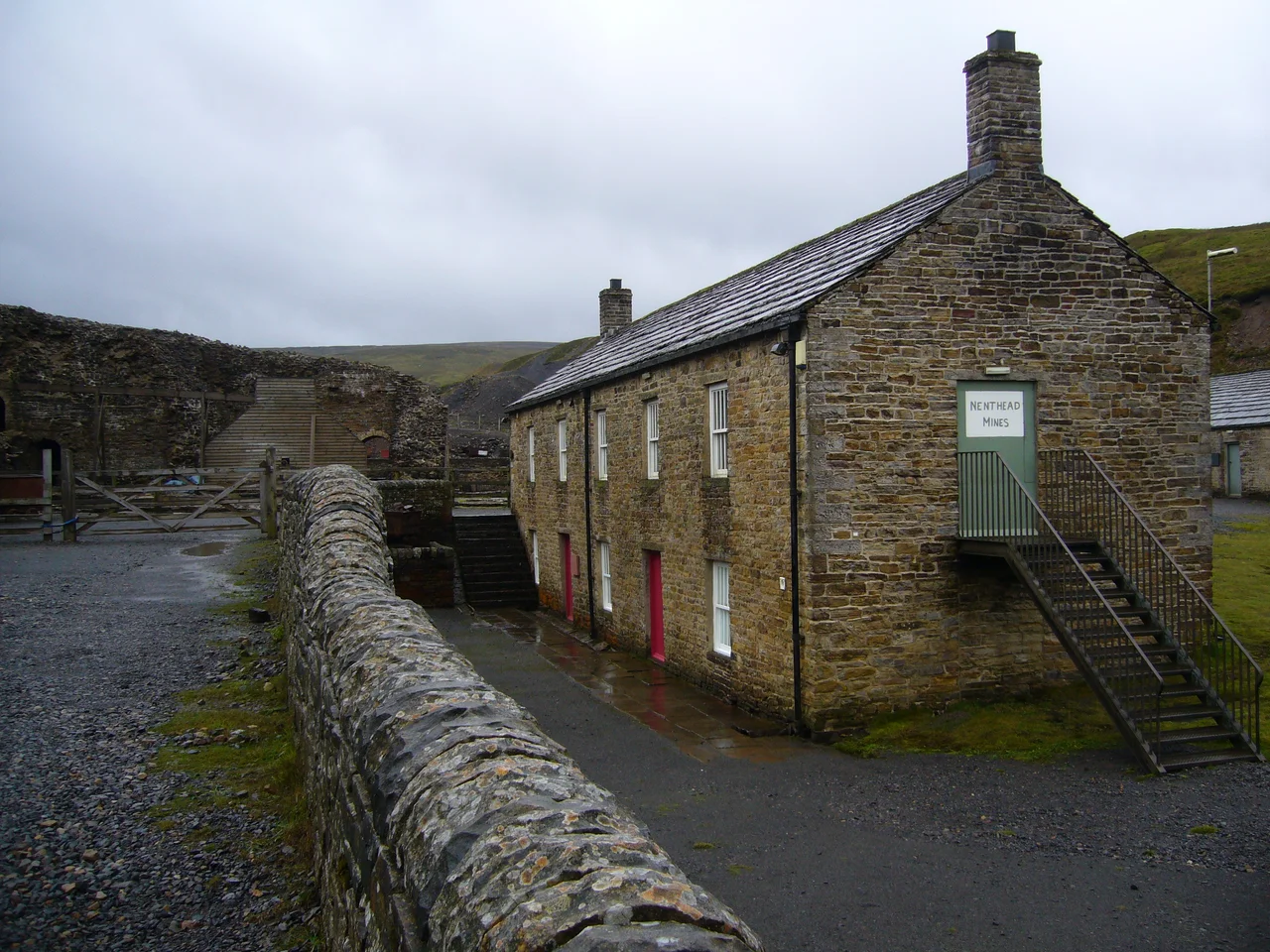
The first smelt mill at Nenthead was built in 1737 by George Liddle. The London Lead Company - the Quaker-owned firm that would come to dominate North Pennines lead mining - subsequently expanded it. By 1882 the mill was capable of smelting 8,000 bings of ore a year, a quantity equivalent to 64,000 hundredweight. The village that grew around the mines was, by 1861, home to about 2,000 people, mostly Methodist, mostly employed by the London Lead Company in some of the most productive workings in Britain. The Quakers who ran the company believed - genuinely, as part of their faith - that workers' welfare mattered, and they built infrastructure to match. Schools and reading rooms went up alongside engine houses. It was paternalistic, yes, but it was paternalism with bath houses. For a high-Pennines lead-mining village, Nenthead in its boom years offered a quality of life that genuinely shocked Victorian visitors who came expecting destitution.
The Workings Below
Nenthead's mines are some of the most extensive in the North Pennines. The Rampgill mine alone had a 260-foot engine shaft and was worked using horse whims - winding gear powered by horses walking in circles, an old technology that lasted longer here than in flatter, more accessible places. Accessible parts of the mine survive today as part of the Nenthead Mines heritage site, where the ruins of the smelt mill stand at the head of the village and underground tours run into the levels when conditions allow. The main mines closed in 1961. In 2013, the Canadian company Minco sank boreholes 1,640 feet deep to assess the zinc deposits that lie beneath the village - the metal that earlier generations had thrown away as worthless still sits there, 490 feet below the surface, in quantities the old miners could not reach with their hand tools.
Cold, Snow, and Endurance
Nenthead has one of the coldest and snowiest climates in England. At a northerly 55° N and 437 metres above sea level, it sits on the boundary between a cool oceanic climate and a borderline subpolar oceanic one. The average annual temperature is 6.5°C; about 1,095 mm of precipitation falls each year, much of it as snow. The road in from Alston - 4.4 miles to the west - is one of the first in Cumbria to close when serious weather arrives. The village can be cut off for days. Newcastle is 44 miles east, Carlisle 34 miles north-west, Hexham 20 miles west, Penrith 24 miles east; none of them are close in any practical sense, and bus services have been threatened by repeated rounds of council cuts. People who live here choose to. They have to.
The Flag and What It Means
In 2014 the village adopted its own flag - designed by vexillologist Philip Tibbetts and registered with the Flag Institute on 11 May 2014. It is a remarkable piece of compressed local meaning. The green triangle represents the head of the River Nent valley, from which the village takes its name; the green shade matches the historic Flag of Cumberland. The eight-pointed star at the centre of the triangle is the Star of Quakerism, a nod to the company that built the village and the religious community that ran it. The black-and-white vertical hoops are the lead and silver ore seams that lie in the rocks below. Lead, faith, geography, and water: a whole village reduced to a rectangle of cloth. The economy now runs on tourism - the C2C cycle route passes through, the heritage centre draws visitors, the Hive at the old chapel hosts events - but every Nenthead flag flown is a small reminder of what put the village here in the first place.
From the Air
Coordinates 54.785 N, 2.335 W, at 437 metres (1,437 feet) above sea level at the head of the River Nent valley. The village shows from the air as a tight cluster of stone buildings between high moorland slopes, with the spoil heaps of the Nenthead Mines spread across the surrounding fells. Best viewed at 3,000-4,500 feet AGL; expect cloud and turbulence here when most lower elevations are clear. Nearest ICAO airport: EGNT (Newcastle), about 30 nm to the north-east; EGNC (Carlisle Lake District) is about 25 nm to the north-west.
Nearby Stories
- Hadrian's Wall 1.7 km away
- Nine Standards Rigg 4.3 km away
- Crook, County Durham 4.8 km away
- Gosforth Park 9.4 km away
- Richmond Castle 10 km away
- Ambleside 12 km away
- Caldbeck 16 km away
- Battle of Arkinholm 19 km away