
Nine Standards Rigg
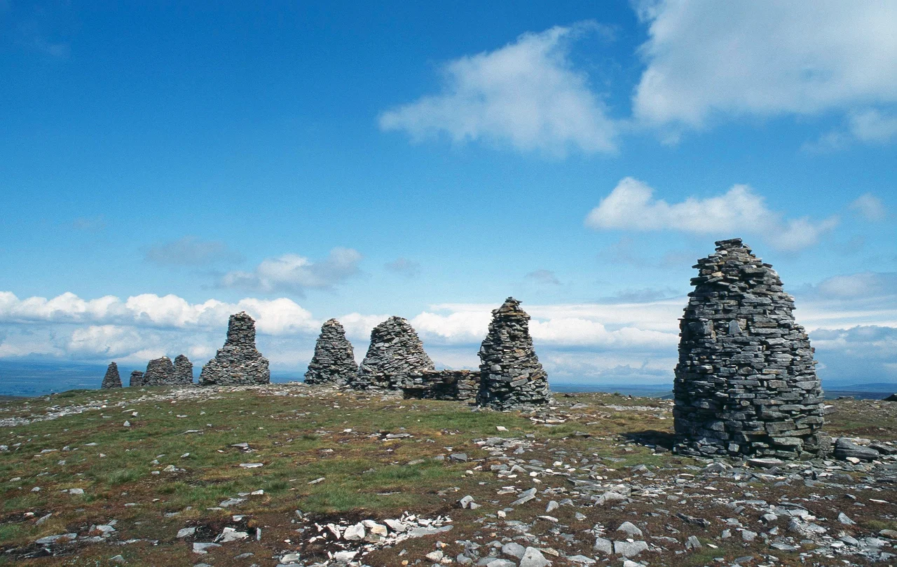
Nobody knows who built them, or why. Nine massive stone cairns stand in a line near the top of Hartley Fell at 650 metres above the Cumbrian moors, some originally more than four metres high, weathered by centuries of wind and rain. The locals call them the Nine Standards, and they have given their name to the entire fell. Theories abound. Boundary markers between old Westmorland and Swaledale? Decoys arranged to fool invading Scots into thinking an army camped on the ridge? A medieval folly built simply because someone wanted to? The cairns keep their secret.
Where the Waters Divide
The Nine Standards stand on a watershed, that invisible line where a falling raindrop chooses its sea. Water draining north-west feeds Scandal Beck and joins the River Eden, flowing eventually to the Solway Firth and the Irish Sea. Water draining south-east becomes Whitsundale Beck, runs into the River Swale, and ends up in the North Sea via the Humber. Stand at the cairns on a wet day and you can almost see the choice being made underfoot. The summit itself, marked by an Ordnance Survey trig point a short distance south, is technically the highest ground, but walkers always make for the Standards. Better view, better company, more story to tell.
On the Coast to Coast
Alfred Wainwright's Coast to Coast Walk passes right by the cairns on its long traverse from St Bees on the Irish Sea to Robin Hood's Bay on the North Sea. Walkers grinding eastward out of Kirkby Stephen toward Keld see the Standards appear on the ridge ahead like sentries waiting at a gate. The boggy descent off the eastern side, across peat that swallows boots whole, has become so notorious that the route now rotates between several variants to give the ground time to recover. Those who pause at the cairns find themselves looking back toward the Lake District and forward into the Yorkshire Dales, an entire country compressed into a single panorama.
The Long View
On a clear day, the view rewards the climb extravagantly. Cross Fell and Great Dun Fell mark the northwest horizon, the highest summits of the Pennines crowned by the Great Dun Fell radar station's white golf ball. Wild Boar Fell and the rolling Howgills sit south-west, fells with names earned in older centuries. Further west, the High Street range of the eastern Lake District rises in a serrated line, a Roman road still traceable along its spine. South-east stands Great Shunner Fell, crossed by the Pennine Way. The summit is part of the North Pennines Area of Outstanding Natural Beauty, a designation that protects rather than tames, leaving the cairns to weather as they have for centuries.
Mystery Above the Eden
The historic record is silent on origin. No charter mentions building them, no chronicler records who carried the stones uphill or when. Some were originally substantial structures, taller than a person, requiring real effort and intention. Others may be later additions, repaired or replaced as wind and frost worked them down. The boundary marker theory has appeal because the line they trace happens to mark the old divide between Westmorland to the north-west and the Yorkshire dale of Swaledale to the south-east, two regions that for centuries had every reason to want their border made plain. But until someone finds a document or a buried inscription, the Nine Standards will keep doing what they have always done: standing on the ridge, watching the weather move through the gap, refusing to explain themselves.
From the Air
Located at 54.4541°N, 2.2716°W at 662 m elevation. The Nine Standards form a distinctive line of cairns visible on the high Pennine moorland a few miles south-east of Kirkby Stephen, just outside the Yorkshire Dales National Park boundary. The cross-shaped radar station on Great Dun Fell to the north-west is a key visual landmark. Nearest airports: Carlisle (EGNC) about 36 nm north-west, Newcastle (EGNT) about 45 nm north-east. Expect rapid weather changes, strong winds, and dense hill fog. Best viewed from 3,000-5,000 ft AGL in clear conditions for a sense of the watershed ridge running between the Eden and Swale catchments.
Nearby Stories
- Richmond Castle 1.3 km away
- Upper Teesdale 2.1 km away
- Morecambe Bay Cockling Disaster 3.8 km away
- Crook, County Durham 5 km away
- Windermere Jetty: Museum of Boats, Steam and Stories 8 km away
- Malham Cove 11 km away
- Fountains Hall 12 km away
- Caldbeck 17 km away