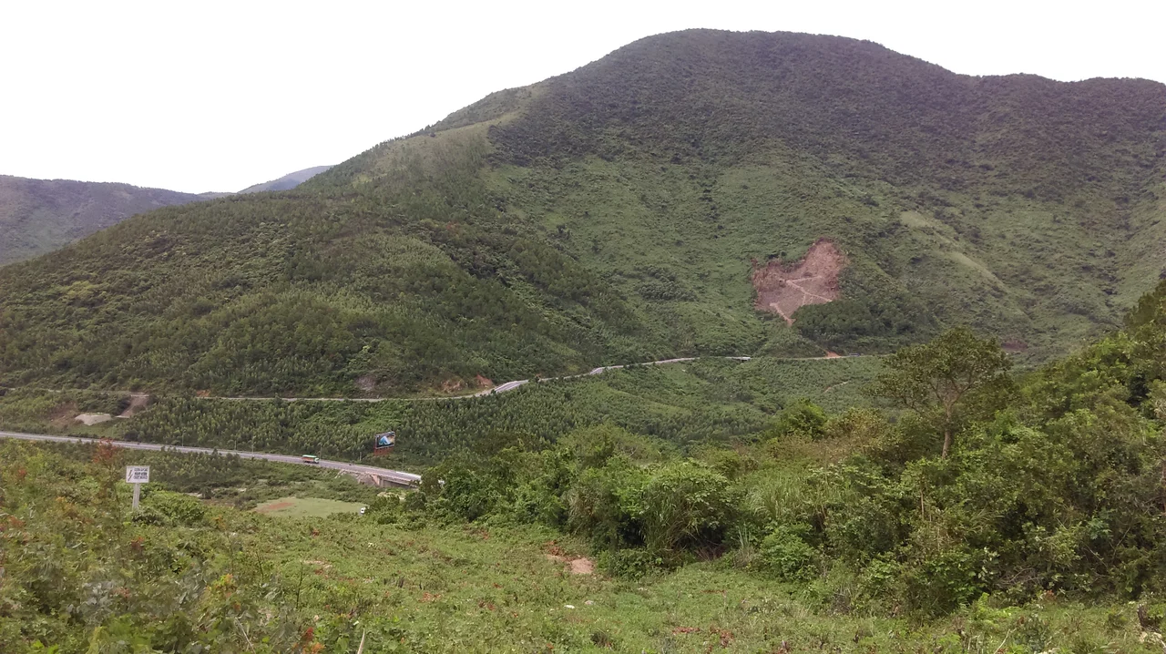

Ngang Pass
Bước tới đèo Ngang, bóng xế tà — "Coming up to Ngang Pass, the light already slanting." It is the first line of an eight-line regulated verse in Nôm script, written by a woman literature knows almost entirely by her husband's job title: Bà Huyện Thanh Quan, the wife of the district magistrate of Thanh Quan. Her name was Nguyễn Thị Hinh, she lived from 1805 to 1848, and she crossed this pass on her way south to Phú Xuân to take up a post at the imperial court. She arrived in the late afternoon, looked at the view, and wrote eight lines that end with her turning away from it entirely. The road she climbed is still up there. Almost nobody drives it, because the traffic now goes underneath.
The Narrowest Place
Vietnam is at its thinnest here. The Hoành Sơn, a spur running east off the Annamite Range, comes all the way down to the sea, pinching the coastal plain to nothing. The only easy way past is over a saddle roughly 250 metres above sea level, and that saddle is the Ngang Pass — đèo ngang, the transverse pass — carrying National Route 1 across the boundary between Quảng Bình and Hà Tĩnh provinces.
Geography this tight produces obvious military logic. A force holding the pass could choke the country's main north–south artery with very few men, and for most of a thousand years somebody was doing exactly that. Until 1069 the ridge marked the frontier between Champa to the south and Đại Việt to the north, when the Lý dynasty annexed Quảng Bình and moved the border on. French colonial writers called the pass the Porte d'Annam, the gate of Annam, which was less a metaphor than a description.
The Gate at the Top
In 1833 — the fourteenth year of his reign — the emperor Minh Mạng had a masonry gateway built across the summit: Hoành Sơn Quan, the Transverse Mountain Gate. Its purpose was administrative more than defensive. The Nguyễn court wanted a record of who was moving between its provinces, and a stone wall over four metres high with one arch through it is an efficient way to get one.
The gate did not stand alone. A thousand stone steps once climbed to it from each side, two thousand in all, cut into the slope for travellers on foot. They have not weathered equally. Several hundred survive on the northern approach; on the southern side the stairway has vanished, leaving only the scar where it ran.
The gate has now outlived its own jurisdiction, and the two provinces it once separated both want it. Hà Tĩnh points to the surveyed boundary. Quảng Bình points to the histories and the poems, which have called the gate theirs for two centuries. Nobody has settled it.
Grass and Stone, Leaves and Flowers
The poem is a thất ngôn bát cú, the strict Tang-derived form Vietnamese scholars reserved for serious feeling. Bà Huyện Thanh Quan gives the pass one line of landscape — grass and trees jostling the rocks, leaves jostling the flowers — then two lines of human scale: a few woodcutters stooping below the mountain, a scatter of market houses by the river. Then two birds, whose names in Vietnamese pun on quốc, country, and gia, home. Then she stops walking.
Dừng chân đứng lại; trời, non, nước. Một mảnh tình riêng, ta với ta. She halts; there is sky, mountain, water; and there is a fragment of private feeling, herself with herself. The scenery is enormous and it is no company at all.
She was travelling to serve the court of Minh Mạng — the same emperor whose masons had raised the gate at the top of the climb. She walked through it and did not mention it.
Nobody Has to Climb It Now
For most of its working life the pass was a serious obstacle: steep, tightly wound, and hard on brakes and nerves in the wet. Construction of a road tunnel beneath it began in 2004, and the climb became optional. Route 1 traffic — the container trucks, the sleeper buses, the motorbikes riding the length of the country — now passes through the mountain in a couple of minutes and never sees the top.
What is left above is one of the better drives in central Vietnam. The serpentine road still switchbacks up through scrub and bare rock to the gate, carrying almost nothing but sightseers. From the summit the Hoành Sơn drops away east into the sea, and on a clear morning the coastline runs visibly in both directions — north into Hà Tĩnh, south into Quảng Bình. The border below still matters, but only to administrators. Everyone else is underground, going ninety.
From the Air
Ngang Pass sits at 17.956°N, 106.468°E, on the Quảng Bình–Hà Tĩnh provincial line where the Hoành Sơn spur meets the coast. The summit is around 250 m (820 ft) MSL, so terrain clearance is modest, but the ridge rises sharply from sea level within a few kilometres — treat the whole spur as high ground. From the air the pass reads as a notch in the last ridge before the shoreline, with National Route 1 visible switchbacking to it and the modern tunnel portals at either end. A viewing altitude of 3,000–5,000 ft AGL shows the pass, the gate ruin at the saddle, and the coast on both sides in one frame. Đồng Hới Airport (VVDH, elevation 18 m) lies about 55 km south; Vinh International (VVVH, elevation 6 m) about 125 km north. Expect ridge turbulence and rotor on windy days, and low stratus hanging on the seaward slope during the northeast monsoon from October to January.
Nearby Stories
- Mụ Giạ Pass 11 km away
- Phong Nha 16 km away
- Hồng Lĩnh Mountains 31 km away
- Hà Tĩnh province 48 km away
- Vũ Quang National Park 53 km away
- Hien Luong Bridge 85 km away
- DMZ (Vietnam) 128 km away
- Bach Long Vi Island 224 km away