
Niani, Guinea
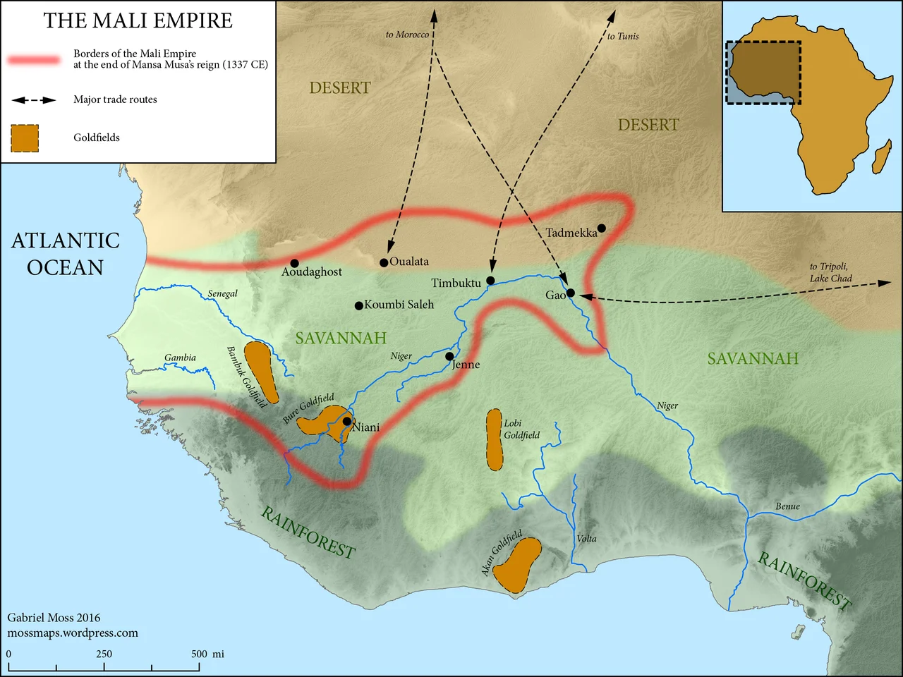
When a Catalan mapmaker sat down in 1375 to draw the wealth of the world, he placed at the center of West Africa a seated king holding a single nugget of gold the size of his head. That king was Mansa Musa, emperor of Mali, and the inscription beside him called him "the greatest noble lord of these parts for the abundance of the gold which is collected in his lands." The capital from which he ruled is widely believed to have stood here, on the west bank of the Sankarani River, in a corner of eastern Guinea where rocky peaks rise over the edge of the forest. Today Niani is a village. For three centuries, by many accounts, it was the heart of one of the wealthiest empires the world has known.
The City of the Mansa
Niani sat where the trade routes crossed. One road ran north, the Manding-sila, the Mande route; another ran south, the Sarakolle-sila. Through this junction moved gold from the forest goldfields, along with kola nuts, palm oil, and ivory carried up from the treeline at the village's edge. The Mansa kept great forges here, and a garrison of the imperial army. Wealth on this scale needed making as much as guarding: this was a working capital, a place of smiths and soldiers and caravans, not merely a throne. Some scholars hold that Niani became the capital in the early twelfth century, after an older seat called Dioliba was abandoned, and that it remained Mali's center as the empire swelled to span much of West Africa.
An Architect from Andalusia
Mansa Musa returned from his legendary pilgrimage to Mecca having spent so lavishly along the way that, the chronicles say, he disrupted the price of gold in Cairo for years. Among those he brought home was Ishak al-Tuedjin, an architect from Al-Andalus, in Muslim Spain. At Niani, al-Tuedjin raised an audience chamber for the emperor: square, crowned with a cupola, finished in plaster and decorated, in the words of one account, "with arabesques in dazzling colours." The North African historian Ibn Khaldun, writing in the fourteenth century, called it "an admirable monument." The Arab scholar al-Umari described a city of beaten-earth brick, with ceilings of beams and reeds shaped like vaulted arches or a camel's hump, and a cluster of royal palaces ringed by a circular wall.
What the Spades Found
When the Mali Empire faded in the 1600s, Niani faded with it, shrinking back into a small town. The site lay quiet until the 1920s, when excavations by Vidal and Gaillard first identified it. Guinean-Polish missions followed in 1965 and 1968 and revealed something larger than a single town: a dense, dispersed settlement, the royal core surrounded by a scatter of hamlets where the trade clans lived apart by craft, the smiths in one place, the fishermen in another. Archaeologists traced the foundations of stone houses, the mihrab of a mosque, and the walls that once enclosed the royal town. The earth at this latitude is unkind to mud brick, and the buildings al-Umari admired needed endless repair even when the empire still stood.
The Debate Beneath the Soil
Niani's claim is strong but not settled. The medieval Arab geographers and the Mande oral tradition point here, and the excavated walls and mosque lend weight. Yet historians still argue. Some propose that Mali had no single fixed capital, that the court moved, that other sites such as Kangaba played their part in the imperial story. The exact ground on which Mansa Musa held court remains, in the most honest telling, a question. What is certain is that an empire of extraordinary wealth and reach existed, that it left descriptions and ruins and a place name that endures, and that the search for its center has drawn scholars to this riverbank for a hundred years. The village keeps its secret with quiet dignity.
From the Air
Niani lies at 11.380°N, 8.384°W, on the west bank of the Sankarani River in extreme eastern Guinea, Kankan Region. The river and the surrounding rocky peaks at the forest's edge are the key visual references. Nearest significant airfield is Siguiri (GUSI) to the north in the Bure goldfield region; Kankan (GUXN) lies to the west. Best viewed from low altitude in the dry-season clear air; the Sankarani is navigable year-round and threads a green corridor through the savanna.
Nearby Stories
- Sélingué Dam 5.4 km away
- Bougouni 29 km away
- Siguiri 42 km away
- Niagassola 87 km away
- Kenedougou Kingdom 95 km away
- Morila Gold Mine 97 km away
- Samorian State 133 km away
- Battle of the Sama Forest 186 km away