.jpg)
Nundroo, South Australia
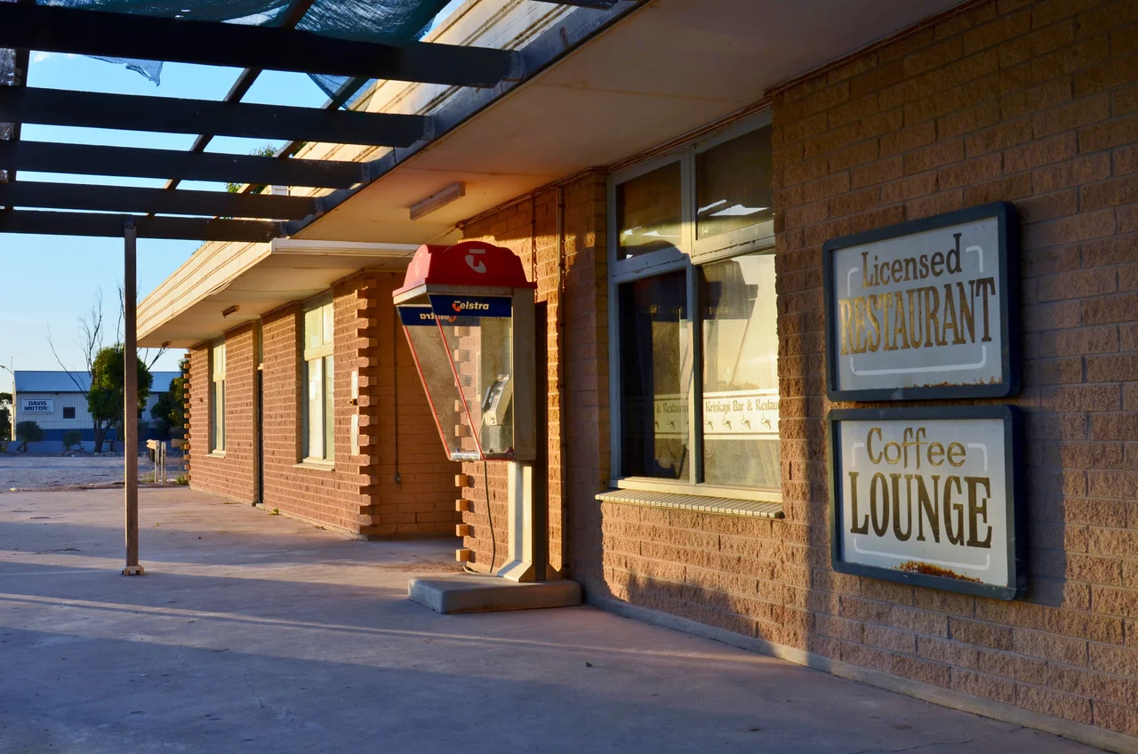
Fill the tank at Nundroo, because the next stretch will test your nerve. This single roadhouse, more than a thousand kilometres west of Adelaide, sits at a kind of frontier - the last reliable fuel stop before the Eyre Highway shrugs off the wheat paddocks and strikes out across the treeless Nullarbor toward Western Australia. There is no town here in the usual sense. There is a hotel-motel, a bowser, a few buildings braced against the wind, and an enormous quiet that begins the moment you switch off the engine.
Where the Map Empties Out
Nundroo's significance is geographic before it is anything else. It marks the western edge of dependable settlement on the far west coast of South Australia, the point where the agricultural country thins toward Yalata and Fowlers Bay and the great blank of the Nullarbor opens ahead. Drivers crossing the continent know the name the way sailors once knew a final harbour. The roadhouse has long served as a transient stop for travellers bound for Eucla on the state border, and for the scattered communities nearby - Coorabie, Bookabie, Fowlers Bay, Koonibba - and the larger town of Ceduna back east. Out here, distances are measured in fuel ranges and the gaps between roadhouses, and Nundroo is one of the markers that make the crossing possible.
Sheep on a Hard Country
Graziers brought sheep into this country in the 1860s, betting that the mallee scrub and low rainfall could be made to pay. By the 1870s the Nundroo run had been folded into the vast Yalata and Fowlers Bay sheep stations - holdings so large they were counted not in paddocks but in hundreds of square kilometres. Aboriginal shepherds did much of the work of keeping watch over the flocks across that immense ground, their knowledge of the land essential to running stock where fences were few and water scarce. In the following decade the great runs were broken up as the original pastoral leases expired, and the land was opened to grain farming. Sheep and wheat have anchored the local economy ever since, a thin agricultural skin stretched over a famously unforgiving landscape.
A Roadhouse in the Quiet
The Nundroo Hotel Motel opened in 1957, and with the roadhouse it became the practical heart of the locality - not a main street, but a waypoint. For travellers, a stop here is its own small ceremony: the relief of cold drinks and hot food, the ritual checking of tyres and water, the long look west before committing to the road ahead. The night sky over Nundroo is the kind that city dwellers forget exists, unsmudged by light, the Milky Way thrown across the dark like spilled flour. People do not come to Nundroo to arrive. They come because it stands between where they were and where they are going, and on the Nullarbor that is reason enough to be glad it is there.
A Link in a Lonely Chain
To understand Nundroo, picture the corridor it belongs to. The Eyre Highway is the only sealed road linking the eastern and western halves of Australia across the bottom of the continent, and along its loneliest reaches the roadhouses are strung out like beads, each one a lifeline measured against the range of a fuel tank. Nundroo sits roughly 78 kilometres west of Penong and about 51 kilometres east of the next stop toward Yalata, deep in the run where the spacing between services starts to matter in a way it never does in town. Mechanics here have rescued more than one traveller who underestimated the emptiness. The roadhouse trades in the most basic and most welcome commodities of the outback - fuel, water, food, and the simple reassurance that someone is here at all - and that humble role has kept this single dot on the map alive for the better part of a century.
From the Air
Nundroo lies at approximately 31.79 degrees south, 132.22 degrees east, on the Eyre Highway in the far west of South Australia, roughly 150 km west of Ceduna. From the air the highway itself is the main landmark - a single ribbon of bitumen running east-west through pale agricultural country that fades to mallee and saltbush toward the Nullarbor. The nearest sealed airstrip with services is Ceduna Airport (YCDU), to the east; Forrest (YFRT) lies far to the west across the plain. Expect long stretches with no settlement, excellent visibility in dry conditions, and few visual references beyond the road, scattered station tracks, and the distant glint of the Great Australian Bight to the south.
Nearby Stories
- Lake MacDonnell 12 km away
- Great Australian Bight Marine Park 43 km away
- Koonibba Test Range 56 km away
- Jacinth-Ambrosia Mine 65 km away
- Point Bell Conservation Park 77 km away
- Murrawijinie Cave 92 km away
- Tarcoola railway station 180 km away
- Great Australian Bight 205 km away