.jpg)
Operation MacArthur
Highway 14 ran north to south through the middle of the Central Highlands like a spine, connecting Pleiku to Kontum and continuing to Dak To near the Laotian border. For the US 4th Infantry Division, defending every district and provincial capital along this road was the mission. For PAVN General Hoang Minh Thao's B3 Front, cutting that road — or at minimum making it too dangerous to use — was the goal. Operation MacArthur, which began on 12 October 1967 and ran for fifteen months, was the sustained American effort to make Highway 14 hold.
The B3 Front
General Hoang Minh Thao's command was formidable. The B3 Front controlled all main-force North Vietnamese units across Kontum, Pleiku, and Darlac provinces — a swath of the Central Highlands that encompassed some of the most contested terrain of the entire war. His principal striking force, the 1st Division under Colonel Nguyen Huu An, comprised three battle-tested regiments: the 32nd, the 66th, and the 174th. Three additional independent regiments extended his reach across the region, and the 40th PAVN Artillery Regiment provided long-range firepower with 122mm rockets and 120mm mortars.
Supplies and replacements flowed down the southern end of the Ho Chi Minh Trail from bases along the Cambodian border. This logistics network was the engine that sustained North Vietnamese operations across the highlands for years. The 4th Infantry Division could disrupt it, damage it, force it to detour — but cutting it entirely proved beyond American capacity throughout the operation.
Dak To: The November Crisis
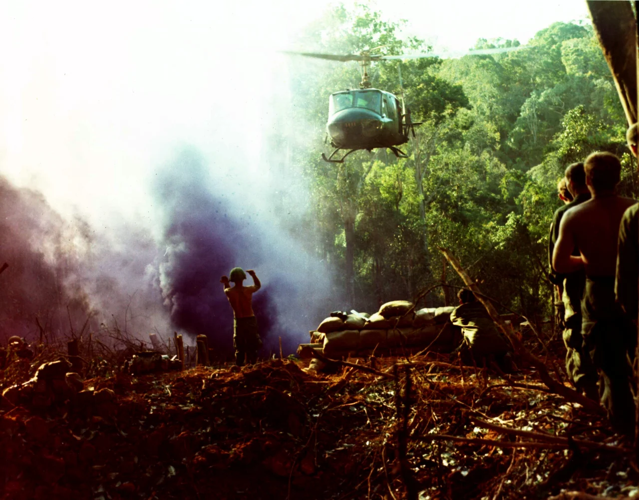
The early phase of Operation MacArthur produced its most intense combat at Dak To, in the far north of Kontum Province, where the fighting raged from 3 to 23 November 1967. The Battle of Dak To — the clash that came to define the operation in American memory — saw the 4th Infantry Division and the 173rd Airborne Brigade engage North Vietnamese forces across a series of jungle ridges. Firebases 1 and 6 near Dak To took rocket and recoilless rifle fire. The fighting was close, brutal, and costly on both sides.
Before the November battles fully developed, the operation had already seen significant contact. On 20 January 1968, two companies from the 1st Brigade received 75mm recoilless rifle fire fifteen kilometers west of Dak To. Through February and March, engagements continued: helicopter gunships hunting enemy patrols, ground units ambushed on patrol, convoys struck on Highway 14. Each engagement produced its tally of dead and wounded, its count of enemy weapons captured. By the end of May, cumulative losses since the operation's start stood at 690 Americans killed and over 4,700 North Vietnamese dead by body count.
The Long Middle
After the battle of Dak To subsided in late November 1967, Operation MacArthur settled into the exhausting rhythm that characterized most of the Vietnam War's sustained operations: patrols, ambushes, cache finds, convoy protection. On 5 May 1968, the PAVN 174th Regiment ambushed a convoy on Highway 14 eight miles south of Kontum. ARVN armor, mechanized infantry, Vietnamese Rangers, and Civilian Irregular Defense Group troops converged on the ambush site. By 14:30, the North Vietnamese had broken contact, leaving 121 dead. Twelve Americans died.
On 4 June another convoy to Dak To was struck. The ARVN 3rd Armored Cavalry Regiment drove off the attackers; the convoy was hit again, four miles further on, and Division units had to reinforce before the road could be cleared. These were not dramatic battles — they were the grinding daily cost of trying to control terrain where the enemy could mass forces, strike, and withdraw faster than American forces could respond.
Deeper Into the Highlands
As the operation stretched into late 1968, the fight spread across a broader geographic canvas. In August, an air cavalry unit engaged a sizable North Vietnamese force twenty-six miles east-northeast of Ban Me Thuot. In October, helicopter gunships caught a PAVN unit leaving a village near Pleiku; air cavalry troops landed in pursuit and found themselves in a sustained fight that lasted until nearly seven in the evening. An OH-6 Cayuse light observation helicopter was shot down. The North Vietnamese withdrew after dark, leaving 37 dead.
In December, a weapons cache found in caves southeast of Pleiku told a story of sustained preparation: seven rifles, 97 RPG-2 grenades, 72 mortar rounds, and a full ton of rice. Someone had been planning to stay a long time. Operation MacArthur formally concluded on 31 January 1969, replaced by Operation Binh Tay-MacArthur, which continued the mission. Fifteen months of operations had cost the 4th Infantry Division and its attached units heavily. The Ho Chi Minh Trail kept running. Highway 14 kept running too.
From the Air
Operation MacArthur's area of operations centers on approximately 14.378°N, 107.725°E in Kon Tum Province, with the action spreading across a broad swath from Dak To in the north (14.65°N) to Ban Me Thuot in the south and Pleiku to the southwest. Highway 14 — now National Route 14 — is visible as a north-south road through the highland terrain. Pleiku Airport (VVPK) provides the nearest scheduled air service, roughly 30 km to the south-southwest. The Cambodian border lies approximately 80 km to the west. At 12,000–18,000 feet, the full extent of the Central Highlands plateau and its river valleys are visible; Dak To and its surrounding ridges are identifiable in the far north of the operational area.
Nearby Stories
- Măng Đen 1.6 km away
- Đắk Tô Base Camp 8.2 km away
- Kon Ka Kinh National Park 9.2 km away
- Plei Djereng Camp 16 km away
- Virachey National Park 25 km away
- Camp Radcliff 40 km away
- Banlung 43 km away
- 2018 Laos Dam Collapse 83 km away