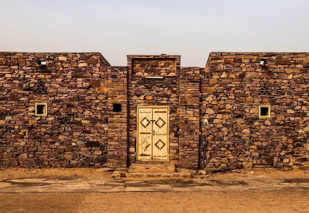

Ouadane
The old town of Ouadane is a ruin, and yet it refuses to fall. Its stone houses, stacked up the side of the Adrar escarpment, stand roofless and abandoned, horseshoe arches still arcing over rooms no one has entered in generations. Below, a small modern village clusters outside the ancient gate. Five hundred years ago this was the most important town in the Adrar - the only one with a wall around it - a place Portuguese merchants schemed to control and Moroccan armies marched across the desert to seize. They came for salt and gold. What remains is stone, silence, and one of the strangest landmarks on Earth just over the horizon.
On the Salt and Gold Road
Ouadane lived and died by the trans-Saharan trade. Caravans hauled slabs of salt from the mines at Idjil, roughly 240 kilometers to the northwest, and the town grew rich as an entrepot - a place where goods were gathered, taxed, and traded onward. Its deeper fortune may have come from gold. In the 11th century the Arab geographer al-Bakri described a route carrying gold north during the era of the Ghana Empire, and historians have long argued over whether that road ran through Ouadane or skirted the escarpment to the east. Either way, the town sat astride a commerce that connected the goldfields of West Africa to the markets of the Mediterranean, ninety-three kilometers northeast of its sister city Chinguetti.
Fought Over by Empires
Outsiders noticed Ouadane's wealth. The first written record of the town comes from 15th-century Portuguese accounts; the chronicler Gomes Eanes de Zurara called it the most important town of the Adrar and the only walled one. In 1487 the Portuguese went further, building a trading post here in a bid to tap the desert flow of gold, salt, and enslaved people - though the venture seems to have been short-lived. In the 16th century the Moroccans pressed their own claim, launching military expeditions to occupy Ouadane in 1543-44 and again in 1584. Their wider campaign to seize the Saharan trade culminated in 1591 at the Battle of Tondibi, where Moroccan victory shattered the Songhai Empire to the south. Through it all, estimates put Ouadane's population in the low thousands - a small place that great powers nonetheless considered worth fighting for.
What the Ruins Remember
Climb through the old town and its history is legible in stone. The upper section, Tegherbeyat, is almost certainly the oldest; it once held a mosque, but nothing of it survives. The lower town, which grew as the settlement expanded, contains a mosque probably built in the 15th century. Some of its horseshoe arches still stand, and patches of clay plaster cling to the walls, suggesting the building was not abandoned until sometime in the 19th century. The structure was modest but carefully made: a terrace once supported by five rows of arches, an external mihrab at the eastern end, a courtyard for prayer in the brutal heat. To walk among these walls is to read the autobiography of a town in the language of stone and shadow.
The Eye of the Sahara
Ouadane holds one last distinction: it is the closest town to the Richat Structure, the vast bullseye of concentric rings - some forty kilometers across - that astronauts use as a landmark and that early orbital crews mistook for an impact crater. It is now understood to be a deeply eroded geological dome, the Sahara's most famous feature seen from space. There is a fitting symmetry in this. For a thousand years Ouadane was a fixed point that travelers steered toward across a trackless desert; now it sits beside the one mark on this landscape visible from orbit. The caravans are long gone, the salt road silent, but the town still keeps its watch at the edge of the great Eye of the Sahara.
From the Air
Ouadane lies at 20.93°N, 11.62°W on the southern edge of the Adrar Plateau, about 93 km northeast of Chinguetti; the practical air gateway is Atar Airport (GQPA) to the southwest. The single most dramatic feature in the area is the Richat Structure (the Eye of the Sahara), a roughly 40-km concentric ring formation a short distance northeast - unmistakable from altitude and one of the most recognizable landmarks on the continent from the air. The old town itself reads as a mass of ruined stone stepping up the escarpment, with the small modern village beside it. Clear, dry conditions give the best visibility; dust events can obscure the entire plateau.
Nearby Stories
- Jbilet Winselwan Meteorite 13 km away
- Chinguetti Mosque 32 km away
- Chinguetti 61 km away
- Mauritania Railway 77 km away
- Empire of Great Fulo 85 km away
- Tourine Ambush 129 km away
- Tagant Plateau 254 km away