.jpg)
Panoche Hills: California's Last Desert Refuge
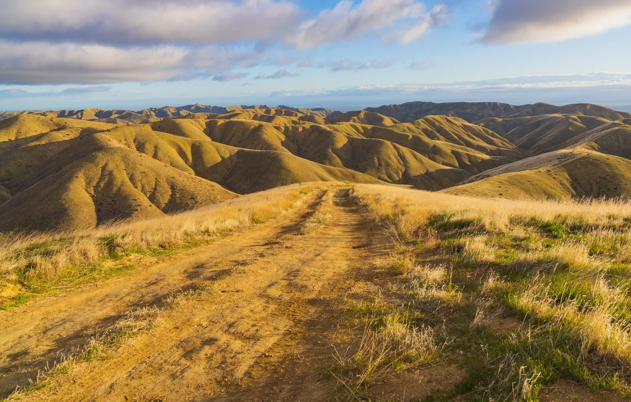
Somewhere between the agricultural grid of the San Joaquin Valley and the fog-draped ridges of the Diablo Range, the land breaks apart. Gullies of cream and rust-colored sediment score the hillsides. The soil is bare, alkaline, cracked. Nothing about the Panoche Hills looks like the California of postcards, and that is precisely the point. This wrinkled landscape in western Fresno County is one of the last intact fragments of the San Joaquin Desert, an ecosystem that once stretched across the valley floor and now survives only in scattered pockets too dry, too remote, or too rugged for the plow. What remains is a biologist's treasure chest and a paleontologist's playground, managed by the Bureau of Land Management and the California Department of Fish and Wildlife across more than 25,000 acres of public land.
Fossils of an Ancient Seafloor
Sixty-five million years ago, the Panoche Hills lay beneath a shallow ocean. Cold seeps - cracks in the seafloor where mineral-rich fluids leaked upward - supported colonies of organisms that thrived not on sunlight but on chemical energy, much like the hydrothermal vent communities found today in the deep Pacific. Those Paleocene-era seeps left behind carbonate mounds now exposed by erosion, their fossilized tubes and shells visible in the badlands' crumbling walls. Marine fossils here include mosasaurs, plesiosaurs, and sea turtles from the Cretaceous layers beneath. The geology tells a story of radical transformation: from ocean floor to mountain range, lifted and folded by the same tectonic forces that built the Coast Ranges. Rockhounds come for the fossils and the colorful mineral deposits; geologists come because few places on Earth expose cold-seep chemistry from this era so clearly.
The Valley Dragon's Last Stand
Conservation biologists know the Panoche Hills as one of three core areas in California essential for the survival of the blunt-nosed leopard lizard, a stout, handsomely blotched reptile sometimes called the valley dragon. Once found from Tracy to the Tehachapi Mountains, the species has retreated southward as agriculture consumed its habitat. Today, the Panoche Hills mark the northern edge of its range. The U.S. Fish and Wildlife Service has gone so far as to temporarily close BLM roads during certain seasons to protect the lizards and the scientific studies tracking their recovery. They share the hills with another imperiled predator: the San Joaquin kit fox, North America's smallest canid, whose oversized ears and nocturnal habits make it a ghost of the desert grasslands. The kit fox, the leopard lizard, and the giant kangaroo rat all depend on this same shrinking patch of arid ground - a triangle of survival that makes Panoche one of the most consequential conservation landscapes in the state.
Hot Water, Cold Wind
At the foot of the hills, just across Little Panoche Road, steam rises from Mercey Hot Springs. The mineral-laden water surfaces here thanks to the same fractured geology that once channeled seawater through ancient rock. Visitors soak in outdoor tubs while looking out at the badlands - a juxtaposition of comfort and wildness that captures the Panoche experience. The hills themselves receive fewer than ten inches of rain per year, placing them firmly in desert classification despite sitting barely an hour's drive from the irrigated fields of the valley floor. From mid-April to mid-October, fire-season restrictions close the BLM land to motorized vehicles. The restriction serves double duty: it reduces wildfire ignition risk and gives the desert wildlife an uninterrupted breeding season. For those willing to walk, the hills in spring bloom with wildflowers - brief, vivid, and gone within weeks.
A View From Above
From the air, the Panoche Hills appear as a rumpled tan quilt laid between the geometric green of irrigated farmland to the east and the darker chaparral of the Diablo Range to the west. The contrast is stark: straight-line agriculture yielding abruptly to erosion-carved chaos. Dry washes trace pale lines through the badlands, converging toward Panoche Creek and eventually the valley floor. The Tumey Hills and Griswold Hills roll off to the north and south, forming a corridor of public land that wildlife moves through largely unseen. On clear days, the Sierra Nevada rises as a white wall to the east, a reminder that this dry pocket exists in the rain shadow of two mountain ranges. It is a landscape easy to overlook and difficult to forget once seen - a place where California's deep past and its ecological future occupy the same crumbling ground.
From the Air
Located at 36.64N, 120.73W in western Fresno County, California, within the Inner Coast Ranges. The Panoche Hills appear as tan, eroded badlands between the green agricultural San Joaquin Valley to the east and the darker Diablo Range to the west. Elevation ranges roughly 800-2,800 feet. Nearest airports include Fresno Yosemite International (FAT) approximately 60 miles east and San Jose International (SJC) about 85 miles northwest. New Jerusalem Airport (1Q4) is a small field closer to the area. Dry conditions prevail most of the year with excellent visibility; spring may bring brief green-up.
Nearby Stories
- The San Joaquin Valley: America's Grocery Aisle, Hidden in Plain Sight 5 km away
- The Forgotten Rush 23 km away
- Los Banos Wildlife Area 24 km away
- Salinas and Steinbeck Country 32 km away
- Rancho San Juan Bautista 55 km away
- Bixby Bridge 55 km away
- Hearst Castle 86 km away
- Carrizo Plain: California's Secret Serengeti 142 km away