Peninsular Ranges
Draw a line from the Santa Ana Mountains south of Los Angeles all the way to Cabo San Lucas at the very tip of Baja California — about 1,500 kilometers — and you have traced the Peninsular Ranges. They are not separate mountain ranges so much as one continuous chain, a single geologic entity that the international border interrupted but did not divide. Looking down from altitude, the spine of these mountains is unmistakable: a wall of ridge and peak running north-south, with Pacific slopes to the west and desert dropping away to the east, a backbone dividing two radically different worlds.
One Batholith, Two Countries
The rocks that form the Peninsular Ranges share their origin with the Sierra Nevada. Both are dominated by Mesozoic granitic rocks — the deeply buried remnants of ancient magma chambers — and both are part of the same colossal batholith, a mass of granite that formed millions of years ago when the Pacific plate dove beneath North America. The key difference is what happened afterward. The Peninsular Ranges sit on the Salinian Block, a section of crust that broke free from the North American plate as the San Andreas Fault and the Gulf of California came into existence, carrying these mountains slowly northwestward while Baja pulled away from mainland Mexico. The mountains are still moving.
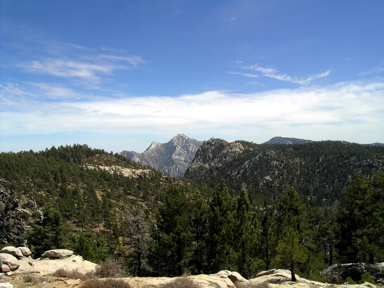
Wet West, Dry East
Standing on a high ridge in the Peninsular Ranges, you can sometimes see both sides at once: moisture-laden Pacific air building clouds over the western slopes, and brown desert baking in the rain shadow to the east. The western flanks of the northern ranges support California chaparral and oak woodlands, with coniferous forests on the higher ground. Cleveland National Forest covers much of the Southern California section. Palomar Mountain, home to the famous Palomar Observatory, rises within the Peninsular Ranges in San Diego County. East of the main ridge, conditions change abruptly. The Sonoran Desert begins, stretching across southeastern California and northeastern Baja California. Anza-Borrego Desert State Park, one of the largest state parks in the contiguous United States, occupies this rain shadow. In spring, Colorado Desert wildflowers bloom across it in startling profusion.
Sky Islands of Baja
As the ranges push south into Baja California, they become something stranger. The Sierra de Juárez and the Sierra de San Pedro Mártir host isolated forests of tamarack pine, sugar pine, white fir, and California incense cedar — trees more typical of the Sierra Nevada, thriving here on high plateaus surrounded by desert. These are sky islands: ecological refuges cut off from similar habitats by hundreds of miles of lowland. They harbor rare and endemic species found nowhere else. The San Pedro Mártir peaks host the Observatorio Astronómico Nacional, taking advantage of some of the clearest, driest skies in North America. The observatory sits above the clouds that sometimes blanket the desert below.
The Isolated South
At the southern end of the peninsula, the ranges take a final biogeographic turn. The Sierra de la Laguna in Baja California Sur was once an island, physically separated from the northern peninsula by the sea. It evolved in relative isolation, developing flora and fauna with strong affinities to southern Mexico and Central America rather than to the Baja desert to the north. Three distinct ecoregions occupy this southernmost range: Sierra de la Laguna dry forests, pine-oak forests, and San Lucan xeric scrub. The result is a peninsula where you can travel from Mediterranean chaparral through Sonoran Desert through sky island conifer forest to subtropical dry forest — a journey of thousands of kilometers of ecological time compressed into a single road.
From the Air
The Peninsular Ranges run from approximately 33.5°N (Santa Ana Mountains) to 22.9°N (Sierra de la Laguna). The central spine is most clearly visible in the San Diego–Baja California region between 32°N and 31°N. Palomar Mountain (33.35°N, 116.86°W) is a prominent landmark in the northern section. Maximum elevations reach approximately 3,100 m (10,154 ft) at Picacho del Diablo in Baja California. Nearest major airports include San Diego International (KSAN) to the west and San Felipe International (MMSF) to the east.
Nearby Stories
- Puertecitos 19 km away
- San Lorenzo Marine Archipelago National Park 161 km away
- Cedros Island 175 km away
- 2012 Boeing 727 Crash Experiment 239 km away
- Laguna Salada 268 km away
- Guadalupe Island Biosphere Reserve 295 km away
- Gulf of California 310 km away
- Battle of Stanwix Station 311 km away